Directions to Corby Cube with public transportation
The following transport lines have routes that pass near Corby Cube
How to get to Corby Cube by bus?
Click on the bus route to see step by step directions with maps, line arrival times and updated time schedules.
How to get to Corby Cube by train?
Click on the train route to see step by step directions with maps, line arrival times and updated time schedules.
Bus stops near Corby Cube
- Elizabeth Street, Corby, 4 min walk,
- George Street, Corby, 4 min walk,
- Leighton Road, Hazel Leys, 6 min walk,
Bus routes to Corby Cube
- 2C, Kettering - Corby,
- 14, Thrapston - Corby,
- 15, Kettering - Corby,
- 19, Ise Lodge - Corby,
- 20, Corby - Great Oakley,
- 2, Corby,
- 3, Welland Vale,
- X4, Peterborough,
- WWE, Stoke Albany,
- 1, Beanfield,
- 4, Earlstrees Industry,
- X4, Corby,
What are the nearest stations to Corby Cube?
The nearest stations to Corby Cube are:
- Elizabeth Street, Corby is 268 meters away, 4 min walk.
- George Street, Corby is 287 meters away, 4 min walk.
- Leighton Road, Hazel Leys is 455 meters away, 6 min walk.
Which bus line stops near Corby Cube?
X4
Which train line stops near Corby Cube?
EAST MIDLANDS RAILWAY
What’s the nearest bus stop to Corby Cube?
The nearest bus stops to Corby Cube are Elizabeth Street, Corby and George Street, Corby. The closest one is a 4 min walk away.
What time is the first bus to Corby Cube?
The X4 is the first bus that goes to Corby Cube. It stops nearby at 08:17.
What time is the last bus to Corby Cube?
The X4 is the last bus that goes to Corby Cube. It stops nearby at 22:26.
See Corby Cube on the map
Public Transportation to Corby Cube
Wondering how to get to Corby Cube, United Kingdom? Moovit helps you find the best way to get to Corby Cube with step-by-step directions from the nearest public transit station.
Moovit provides free maps and live directions to help you navigate through your city. View schedules, routes, timetables, and find out how long does it take to get to Corby Cube in real time.
Looking for the nearest stop or station to Corby Cube? Check out this list of stops closest to your destination: Elizabeth Street; George Street; Leighton Road.
Bus: X4, 2C, 14, 15, 19, 20, 2, 3, WWE, 1, 4.Train: EAST MIDLANDS RAILWAY.
Want to see if there’s another route that gets you there at an earlier time? Moovit helps you find alternative routes or times. Get directions from and directions to Corby Cube easily from the Moovit App or Website.
We make riding to Corby Cube easy, which is why over 1.5 million users, including users in Corby, trust Moovit as the best app for public transit. You don’t need to download an individual bus app or train app, Moovit is your all-in-one transit app that helps you find the best bus time or train time available.
For information on prices of bus and train, costs and ride fares to Corby Cube, please check the Moovit app.
Use the app to navigate to popular places including to the airport, hospital, stadium, grocery store, mall, coffee shop, school, college, and university.
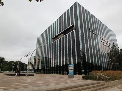
Corby Cube Address: George Street Roundabout street in Corby
Attractions near Corby Cube
George Street,Corby Bus Stop A.,The Cube Bus Stops,Corby, George Street (Stop A),Corby East Midlands International Pool (International Swimming Pool),Corby East Midlands International Pool,George Street (Stop A),Mcdonald's,Primark,Fat Panda Vape Shop,Paletto Lounge-Corby,Coral Bookmakers,Basra Newsagent,Cube,Hector's,A. Levy & Son Limited,Focussed Publications,Circa District,Ravenflo Plumbing & Heating,Oracle Ideas,ShipleysHow to get to popular attractions in Corby with public transportation
Doddington, Lincoln,Planet Ice, Peterborough,Park Farm Shopping Centre, Derby,Rolls-Royce Wilmore Road Gate 5a, Derby,St. Mary's Hospital, Kettering,Kesteven & Grantham Girls School, South Kesteven,Bramcote Crematorium, Broxtowe,Hmp Gartree, Harborough,Royal Derby Hospital, Amber Valley,Corby Railway Station (COR), Corby,Priory Hospital Nottingham, Nottingham,Victoria Park, Leicester, Leicester,PE7 8gx, Peterborough,Littleover, Derby,NHS Walk In Centre, Nottingham,Forest Recreation Ground, Nottingham,Trent Vineyard Church, Nottingham,Hallaton, Harborough,Mansfield Road Sherwood, Nottingham,Tesco, North East LincolnshireGet around East Midlands by public transport!
Travelling around East Midlands has never been so easy. See step by step directions as you travel to any attraction, street or major public transport station. View bus and train timetables, arrival times, service alerts and detailed routes on a map, so you know exactly how to get to anywhere in East Midlands.
When travelling to any destination around East Midlands use Moovit's Live Directions with Get Off Notifications to know exactly where and how far to walk, how long to wait for your line , and how many stops are left. Moovit will alert you when it’s time to get off — no need to constantly re-check whether yours is the next stop.
Wondering how to use public transport in East Midlands or how to pay for public transport in East Midlands? Moovit public transport app can help you navigate your way with public transport easily, and at minimum cost. It includes public transport fees, ticket prices, and costs. Looking for a map of East Midlands public transport lines? Moovit public transport app shows all public transport maps in East Midlands with all Bus, Train and Light rail routes and stops on an interactive map.
East Midlands has 3 transport type(s), including: Bus, Train and Light rail, operated by several transport agencies, including National Rail, Ashbourne Community Transport, Delaine Buses, Arriva Midlands, Centrebus, Our Centre, Hulleys of Baslow, D & G Bus, Stagecoach East Midlands, North Lincolnshire Council, Roberts Coaches, Lawson's of Corby, Hawkes Coaches, East Yorkshire, Soar Valley Community Bus