Directions to Mount Vernon Place (Baltimore) with public transportation
The following transit lines have routes that pass near Mount Vernon Place
How to get to Mount Vernon Place by bus?
Click on the bus route to see step by step directions with maps, line arrival times and updated time schedules.
How to get to Mount Vernon Place by metro?
Click on the metro route to see step by step directions with maps, line arrival times and updated time schedules.
Bus stops near Mount Vernon Place in Baltimore
- Washington Monument, 1 min walk,
- Centre St & Charles St Eb Ns, 2 min walk,
- Charles St & Hamilton St, 4 min walk,
- Calvert St & Centre St Nb, 6 min walk,
Light Rail stations near Mount Vernon Place in Baltimore
- Cultural Center, 10 min walk,
Metro stations near Mount Vernon Place in Baltimore
- State Center Metro, 15 min walk,
Bus lines to Mount Vernon Place in Baltimore
- CITYLINK GREEN, Downtown - Towson,
- CITYLINK SILVER, Curtis Bay - Hopkins/Morgan State,
- 51, Towson - Downtown,
- 95, Downtown - Roland Park,
- 103, Downtown - Cromwell Bridge,
- 410, Churchville - Baltimore,
- PURPLE ROUTE, Purple Route,
- 702, Mount Vernon,
- CITYLINK PINK, Cedonia,
- 411, 411/2 Hopkins Hospital,
- 56, White Marsh,
- 120, Downtown,
What are the closest stations to Mount Vernon Place?
The closest stations to Mount Vernon Place are:
- Washington Monument is 30 yards away, 1 min walk.
- Centre St & Charles St Eb Ns is 131 yards away, 2 min walk.
- Charles St & Hamilton St is 226 yards away, 4 min walk.
- Calvert St & Centre St Nb is 410 yards away, 6 min walk.
- Cultural Center is 822 yards away, 10 min walk.
- State Center Metro is 1234 yards away, 15 min walk.
Which bus lines stop near Mount Vernon Place?
These bus lines stop near Mount Vernon Place: 95, CITYLINK BLUE, CITYLINK GREEN, CITYLINK PINK, CITYLINK SILVER, PURPLE ROUTE.
Which metro line stops near Mount Vernon Place?
METRO
What’s the nearest light rail station to Mount Vernon Place in Baltimore?
The nearest light rail station to Mount Vernon Place in Baltimore is Cultural Center. It’s a 10 min walk away.
What’s the nearest metro station to Mount Vernon Place in Baltimore?
The nearest metro station to Mount Vernon Place in Baltimore is State Center Metro. It’s a 15 min walk away.
What’s the nearest bus stop to Mount Vernon Place in Baltimore?
The nearest bus stop to Mount Vernon Place in Baltimore is Washington Monument. It’s a 1 min walk away.
What time is the first light rail to Mount Vernon Place in Baltimore?
The LIGHT RAIL is the first light rail that goes to Mount Vernon Place in Baltimore. It stops nearby at 3:54 AM.
What time is the last light rail to Mount Vernon Place in Baltimore?
The LIGHT RAIL is the last light rail that goes to Mount Vernon Place in Baltimore. It stops nearby at 1:26 AM.
What time is the first metro to Mount Vernon Place in Baltimore?
The METRO is the first metro that goes to Mount Vernon Place in Baltimore. It stops nearby at 5:07 AM.
What time is the last metro to Mount Vernon Place in Baltimore?
The METRO is the last metro that goes to Mount Vernon Place in Baltimore. It stops nearby at 12:23 AM.
What time is the first bus to Mount Vernon Place in Baltimore?
The CITYLINK PINK is the first bus that goes to Mount Vernon Place in Baltimore. It stops nearby at 3:02 AM.
What time is the last bus to Mount Vernon Place in Baltimore?
The CITYLINK SILVER is the last bus that goes to Mount Vernon Place in Baltimore. It stops nearby at 3:18 AM.
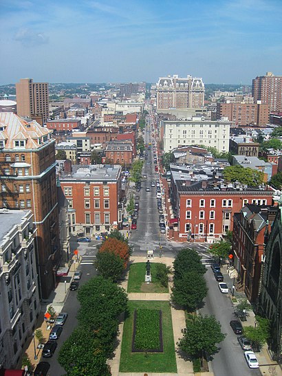
See Mount Vernon Place, Baltimore, on the map
Public Transit to Mount Vernon Place in Baltimore
Wondering how to get to Mount Vernon Place in Baltimore, United States? Moovit helps you find the best way to get to Mount Vernon Place with step-by-step directions from the nearest public transit station.
Moovit provides free maps and live directions to help you navigate through your city. View schedules, routes, timetables, and find out how long does it take to get to Mount Vernon Place in real time.
Looking for the nearest stop or station to Mount Vernon Place? Check out this list of stops closest to your destination: Washington Monument; Centre St & Charles St Eb Ns; Charles St & Hamilton St; Calvert St & Centre St Nb; Cultural Center; State Center Metro.
Bus: 95, CITYLINK BLUE, CITYLINK GREEN, CITYLINK PINK, CITYLINK SILVER, PURPLE ROUTE, 51, 103, 411, 56, 120.Metro: METRO.
Want to see if there’s another route that gets you there at an earlier time? Moovit helps you find alternative routes or times. Get directions from and directions to Mount Vernon Place easily from the Moovit App or Website.
We make riding to Mount Vernon Place easy, which is why over 1.5 million users, including users in Baltimore, trust Moovit as the best app for public transit. You don’t need to download an individual bus app or train app, Moovit is your all-in-one transit app that helps you find the best bus time or train time available.
For information on prices of bus and metro, costs and ride fares to Mount Vernon Place, please check the Moovit app.
Use the app to navigate to popular places including to the airport, hospital, stadium, grocery store, mall, coffee shop, school, college, and university.
Mount Vernon Place Address: Mt Vernon Pl & Washington Pl street in Baltimore
Attractions near Mount Vernon Place
Charm City Circulator Purple Route - Washington Monument - #307,Mt Vernon Pl N Charles St,Mount Vernon Square,The George Peabody Library,Peabody Symphony Orchestra,Martin Bresnick: Composer,M Dougherty Design,Our Past Productions,The Walters Art Museum,Miriam A. Friedberg Concert Hall,Make Beautiful Cha,Academic Affairs | Peabody Conservatory, JHU,Maryland Capital,Idfive,El Patron,Mt Vernon Hotel,Banyan Hill Publishing,Home Free Iop Midtown,Johns Hopkins Shuttle Bus,Dr. Marc Micozzi's Insiders' CuresHow to get to popular attractions in Baltimore with public transit
Fda White Oak Campus, Montgomery County,Park Potomac Place, Montgomery County,Dunkin Donuts, Washington,Student Services Center (SSRV) - CCBC Essex, Baltimore County,National City Christian Church, Washington,Tysons-Pimmit Regional Library, Fairfax County,Franklin High School, Baltimore County,DCity Smokehouse, Washington,Crispus Attucks Park, Washington,Oxon Hill High School, Prince George's County,I-66 Exit 67: Dulles Toll Road (VA-267), Fairfax County,Dirty Habit, Washington,Watkins Elementary School, Washington,Sully Station, Fairfax County,PRTC Transit Center, Prince William County,CVS/pharmacy, Washington,Gate #8 - U.S. Naval Academy, Anne Arundel County,Residence Inn Tysons Corner, Fairfax County,Cherry Hill Light Rail Station, Baltimore,Brent Elementary School, WashingtonGet around Washington, D.C. - Baltimore, MD by public transit!
Traveling around Washington, D.C. - Baltimore, MD has never been so easy. See step by step directions as you travel to any attraction, street or major public transit station. View bus and train schedules, arrival times, service alerts and detailed routes on a map, so you know exactly how to get to anywhere in Washington, D.C. - Baltimore, MD.
When traveling to any destination around Washington, D.C. - Baltimore, MD use Moovit's Live Directions with Get Off Notifications to know exactly where and how far to walk, how long to wait for your line, and how many stops are left. Moovit will alert you when it's time to get off — no need to constantly re-check whether yours is the next stop.
Wondering how to use public transit in Washington, D.C. - Baltimore, MD or how to pay for public transit in Washington, D.C. - Baltimore, MD? Moovit public transit app can help you navigate your way with public transit easily, and at minimum cost. It includes public transit fees, ticket prices, and costs. Looking for a map of Washington, D.C. - Baltimore, MD public transit lines? Moovit public transit app shows all public transit maps in Washington, D.C. - Baltimore, MD with all Bus, Train, Metro, Light Rail and Ferry routes and stops on an interactive map.
Washington, D.C. - Baltimore, MD has 5 transit type(s), including: Bus, Train, Metro, Light Rail and Ferry, operated by several transit agencies, including WMATA, Montgomery County Ride On, Montgomery County MD Ride On, Fairfax Connector, TheBus, PRTC, DC Circulator, DASH - Alexandria, Arlington Transit (ART), DC Streetcar, RTA of Central Maryland, FRED, MDOT MTA, Marc, Virginia Railway Express (VRE)