Directions to Steep Hill (Lincoln) with public transport
The following transport lines have routes that pass near Steep Hill
How to get to Steep Hill by bus?
Click on the bus route to see step by step directions with maps, line arrival times and updated time schedules.
How to get to Steep Hill by train?
Click on the train route to see step by step directions with maps, line arrival times and updated time schedules.
Bus stops near Steep Hill in Lincoln
- Bailgate Methodist Church, Lincoln, 2 min walk,
- Lincoln Hotel, Lincoln, 6 min walk,
- Constitutional Club, Lincoln, 7 min walk,
- Stonebow Centre, Lincoln, 7 min walk,
- College Of Art, Lincoln, 7 min walk,
- New Life Church, Lincoln, 9 min walk,
- West Parade, Lincoln, 9 min walk,
- Winnowsty Lane, Lincoln, 10 min walk,
Train stations near Steep Hill in Lincoln
- Lincoln Central, 20 min walk,
Bus lines to Steep Hill in Lincoln
- WR, Lincoln Walk & Ride,
- CT1, Lincoln Cathedral - Lincoln Cathedral,
- 3C, Lincoln - Fiskerton,
- RC4A, Sleaford - Riseholme College,
- 7, Lincoln - Ermine Estate,
- 8, Lincoln - Ermine Estate,
- 10, Lincoln - Welton Green,
- 11A, Lincoln - Waitrose - Scothern,
- 12, Lincoln - Welton Green,
- 12A, Lincoln - Welton Green,
- 17, Lincoln - Ermine Estate,
- 44, Lincoln - Nettleham,
- 103, Kirton in Lindsey - Lincoln Bus Station,
- 162, Waddingham - Lincoln,
- 354, Gainsborough - Lincoln,
- 510, Lincoln - Welton,
- 548, LSST - Reepham,
- 18, Lincoln,
- 43, Market Rasen,
- 77, Lincoln,
What are the nearest stations to Steep Hill?
The nearest stations to Steep Hill are:
- Bailgate Methodist Church, Lincoln is 107 meters away, 2 min walk.
- Lincoln Hotel, Lincoln is 417 meters away, 6 min walk.
- Constitutional Club, Lincoln is 453 meters away, 7 min walk.
- Stonebow Centre, Lincoln is 462 meters away, 7 min walk.
- College Of Art, Lincoln is 471 meters away, 7 min walk.
- New Life Church, Lincoln is 634 meters away, 9 min walk.
- West Parade, Lincoln is 659 meters away, 9 min walk.
- Winnowsty Lane, Lincoln is 755 meters away, 10 min walk.
- Lincoln Central is 1547 meters away, 20 min walk.
Which bus lines stop near Steep Hill?
These bus lines stop near Steep Hill: 12, 16, 48.
Which train lines stop near Steep Hill?
These train lines stop near Steep Hill: EAST MIDLANDS RAILWAY, NORTHERN.
What’s the nearest train station to Steep Hill in Lincoln?
The nearest train station to Steep Hill in Lincoln is Lincoln Central. It’s a 20 min walk away.
What’s the nearest bus stop to Steep Hill in Lincoln?
The nearest bus stop to Steep Hill in Lincoln is Bailgate Methodist Church, Lincoln. It’s a 2 min walk away.
What time is the first train to Steep Hill in Lincoln?
The EAST MIDLANDS RAILWAY is the first train that goes to Steep Hill in Lincoln. It stops nearby at 08:35.
What time is the last train to Steep Hill in Lincoln?
The EAST MIDLANDS RAILWAY is the last train that goes to Steep Hill in Lincoln. It stops nearby at 23:51.
What time is the first bus to Steep Hill in Lincoln?
The 18 is the first bus that goes to Steep Hill in Lincoln. It stops nearby at 07:12.
What time is the last bus to Steep Hill in Lincoln?
The 18 is the last bus that goes to Steep Hill in Lincoln. It stops nearby at 19:52.
See Steep Hill, Lincoln, on the map
Public Transit to Steep Hill in Lincoln
Wondering how to get to Steep Hill in Lincoln, United Kingdom? Moovit helps you find the best way to get to Steep Hill with step-by-step directions from the nearest public transit station.
Moovit provides free maps and live directions to help you navigate through your city. View schedules, routes, timetables, and find out how long does it take to get to Steep Hill in real time.
Looking for the nearest stop or station to Steep Hill? Check out this list of stops closest to your destination: Bailgate Methodist Church; Lincoln Hotel; Constitutional Club; Stonebow Centre; College Of Art; New Life Church; West Parade; Winnowsty Lane; Lincoln Central.
Bus: 12, 16, 48, WR, CT1, 3C, RC4A, 7, 8, 10, 18, 43, 77.Train: EAST MIDLANDS RAILWAY, NORTHERN, LONDON NORTH EASTERN RAILWAY.
Want to see if there’s another route that gets you there at an earlier time? Moovit helps you find alternative routes or times. Get directions from and directions to Steep Hill easily from the Moovit App or Website.
We make riding to Steep Hill easy, which is why over 1.5 million users, including users in Lincoln, trust Moovit as the best app for public transit. You don’t need to download an individual bus app or train app, Moovit is your all-in-one transit app that helps you find the best bus time or train time available.
For information on prices of train and bus, costs and ride fares to Steep Hill, please check the Moovit app.
Use the app to navigate to popular places including to the airport, hospital, stadium, grocery store, mall, coffee shop, school, college, and university.
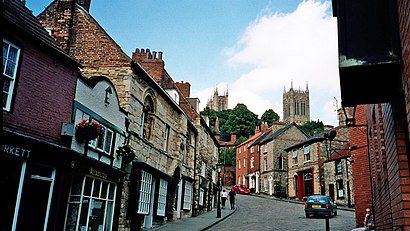
Steep Hill Address: Steep Hill street in Lincoln
Attractions near Steep Hill
The Crooked House,The Old Palace Lodge,Cathedral,Castle Square,Lincoln Crown Court Witness Service,Lincoln Crown Court,Cafe Zoot,Margaret's Tea Rooms,Lincoln Cathedral,Lincoln Castle,Lincoln Escorts by Essential,Eilidh Fridlin,Environmental Management Consultants,Gino's Restaurant ,Epernay Seafood Restaurant,Thailand No. 1 (Thailand Restaurants Limited),Lincoln Register Office,Lincoln Cathedral Visitor Centre & Cafe,Cloister Refectory,La Trattoria Da VincenzoHow to get to popular attractions in Lincoln with public transportation
Bretby Crematorium, South Derbyshire,NG7 1GX, Nottingham,Hmrc Enquiry Centre, Nottingham,Nettleham Road, Lincoln,Amazon Peterborough - Euk5, Peterborough,Trent Vineyard Church, Nottingham,Odeon Cinema, Derby,Wilford Hill Crematorium, Rushcliffe,Rushden Lakes Retail Park, East Northamptonshire,Brackmills Industrial Estate, Northampton,East Of England Showground, Peterborough,Passport Office, Peterborough,Thoresby Hall Hotel & Spa, Newark And Sherwood,Yarborough Leisure Centre, Lincoln,HM Prison Peterborough, Peterborough,Derby Station Pride Park Car Park, Derby,Brimington Crematorium, Chesterfield,Kegworth, North West Leicestershire,Argos Wincanton, Kettering,BMW Pineham, Swan Valley Business Park, NorthamptonGet around East Midlands by public transport!
Travelling around East Midlands has never been so easy. See step by step directions as you travel to any attraction, street or major public transport station. View bus and train timetables, arrival times, service alerts and detailed routes on a map, so you know exactly how to get to anywhere in East Midlands.
When travelling to any destination around East Midlands use Moovit's Live Directions with Get Off Notifications to know exactly where and how far to walk, how long to wait for your line , and how many stops are left. Moovit will alert you when it’s time to get off — no need to constantly re-check whether yours is the next stop.
Wondering how to use public transport in East Midlands or how to pay for public transport in East Midlands? Moovit public transport app can help you navigate your way with public transport easily, and at minimum cost. It includes public transport fees, ticket prices, and costs. Looking for a map of East Midlands public transport lines? Moovit public transport app shows all public transport maps in East Midlands with all Bus, Train and Light rail routes and stops on an interactive map.
East Midlands has 3 transport type(s), including: Bus, Train and Light rail, operated by several transport agencies, including National Rail, Ashbourne Community Transport, Delaine Buses, Arriva Midlands, Centrebus, Our Centre, Hulleys of Baslow, D & G Bus, Stagecoach East Midlands, North Lincolnshire Council, Roberts Coaches, Hawkes Coaches, Lawson's of Corby, East Yorkshire, Soar Valley Community Bus