Directions to Northampton Railway Station with public transportation
The following transport lines have routes that pass near Northampton Railway Station
How to get to Northampton Railway Station by bus?
Click on the bus route to see step by step directions with maps, line arrival times and updated time schedules.
How to get to Northampton Railway Station by train?
Click on the train route to see step by step directions with maps, line arrival times and updated time schedules.
Bus stops near Northampton Railway Station
- Northampton Bus Interchange, Northampton, 3 min walk,
- Rail Station Approach Road, Northampton, 3 min walk,
- Marefair, Northampton, 7 min walk,
Bus routes to Northampton Railway Station
- 14, Boughton,
- D2, Northampton - Daventry,
- D3, Northampton - Daventry,
- 7, Northampton - Moulton Park,
- 8, Blackthorn - Kings Heath,
- 9, Northampton - Northampton,
- 9A, Northampton - Northampton,
- 9B, Northampton General Hospital - Duston,
- 15, St Giles Park - Town Centre,
- 15A, St Giles Park - Town Centre,
- 18, UON Waterside Campus - Sixfields,
- 55, Northampton - Swan Valley,
- 87, Northampton - Brackley,
- 9C, New Duston,
- 3, Northampton - Camp Hill,
- X6, Milton Keynes - Northampton,
- 11, Grange Park - Northampton,
- 12A, Northampton - Northampton,
- 13, Northampton - Northampton,
- 88, Northampton - Silverstone,
What are the nearest stations to Northampton Railway Station?
The nearest stations to Northampton Railway Station are:
- Northampton Bus Interchange, Northampton is 94 meters away, 3 min walk.
- Rail Station Approach Road, Northampton is 153 meters away, 3 min walk.
- Marefair, Northampton is 472 meters away, 7 min walk.
Which bus lines stop near Northampton Railway Station?
These bus lines stop near Northampton Railway Station: 12A, 16, 7, X10, X4, X47.
Which train line stops near Northampton Railway Station?
WEST MIDLANDS RAILWAY
What’s the nearest bus stop to Northampton Railway Station?
The nearest bus stops to Northampton Railway Station are Northampton Bus Interchange, Northampton and Rail Station Approach Road, Northampton. The closest one is a 3 min walk away.
What time is the first bus to Northampton Railway Station?
The 7 is the first bus that goes to Northampton Railway Station. It stops nearby at 03:00.
What time is the last bus to Northampton Railway Station?
The 7 is the last bus that goes to Northampton Railway Station. It stops nearby at 03:02.
See Northampton Railway Station on the map
Public Transportation to Northampton Railway Station
Wondering how to get to Northampton Railway Station, United Kingdom? Moovit helps you find the best way to get to Northampton Railway Station with step-by-step directions from the nearest public transit station.
Moovit provides free maps and live directions to help you navigate through your city. View schedules, routes, timetables, and find out how long does it take to get to Northampton Railway Station in real time.
Looking for the nearest stop or station to Northampton Railway Station? Check out this list of stops closest to your destination: Northampton Bus Interchange; Rail Station Approach Road; Marefair.
Bus: 12A, 16, 7, X10, X4, X47, 14, D2, D3, 8, 9, 9C, 3, X6, 11, 13.Train: WEST MIDLANDS RAILWAY.
Want to see if there’s another route that gets you there at an earlier time? Moovit helps you find alternative routes or times. Get directions from and directions to Northampton Railway Station easily from the Moovit App or Website.
We make riding to Northampton Railway Station easy, which is why over 1.5 million users, including users in Northampton, trust Moovit as the best app for public transit. You don’t need to download an individual bus app or train app, Moovit is your all-in-one transit app that helps you find the best bus time or train time available.
For information on prices of bus and train, costs and ride fares to Northampton Railway Station, please check the Moovit app.
Use the app to navigate to popular places including to the airport, hospital, stadium, grocery store, mall, coffee shop, school, college, and university.
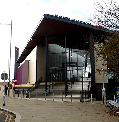
Northampton Railway Station Address: West Bridge street in Northampton
Attractions near Northampton Railway Station
Amazon Locker-Katarina,Oli's Barbershop,Enterprise Car & Van Hire - Northampton Station,Amazon Counter-Premier St James,Twelvetwentyfive,Uoffer 有录网-北安普顿店,Blue Recruitment Personnel Limited,Aden Health Care,University Of Northampton Innovation Centre,Northampton Innovation Centre,Innovation Centre,Baffin Technology Systems,Jump Media Group,Eco Kids Family Learning,Deafconnect,Icon Pods,North27 Limited,Mushroom Works,Rail Station Approach Road,Nene Auto RepaHow to get to popular attractions in Northampton with public transportation
Brampton, Chesterfield,Pilgrim Hospital, Boston,Rolls Royce Raynesway, Derby,Gypsum Close Recycling Centre, Leicester,Eden Hall Day Spa, Newark And Sherwood,Uppingham School, Rutland,Nn14 1ub, Kettering,Joseph Wright - Derby College, Derby,Little Stanion, Corby,Thorpe, Derbyshire Dales,Nottingham High School, Nottingham,Pirelli Stadium,Hilton East Midlands Airport (Derby Hilton), North West Leicestershire,Snake Pass,Charles Street, Leicester,The Nottingham, Melton,Mcarthur Glen Designer Outlet, Bolsover,Tansley Sunday Market & Carboot Sale, Derbyshire Dales,Matlock Bath Illuminations, Derbyshire Dales,Mercure Nottingham City Centre Hotel, NottinghamGet around East Midlands by public transport!
Travelling around East Midlands has never been so easy. See step by step directions as you travel to any attraction, street or major public transport station. View bus and train timetables, arrival times, service alerts and detailed routes on a map, so you know exactly how to get to anywhere in East Midlands.
When travelling to any destination around East Midlands use Moovit's Live Directions with Get Off Notifications to know exactly where and how far to walk, how long to wait for your line , and how many stops are left. Moovit will alert you when it’s time to get off — no need to constantly re-check whether yours is the next stop.
Wondering how to use public transport in East Midlands or how to pay for public transport in East Midlands? Moovit public transport app can help you navigate your way with public transport easily, and at minimum cost. It includes public transport fees, ticket prices, and costs. Looking for a map of East Midlands public transport lines? Moovit public transport app shows all public transport maps in East Midlands with all Bus, Train and Light rail routes and stops on an interactive map.
East Midlands has 3 transport type(s), including: Bus, Train and Light rail, operated by several transport agencies, including National Rail, Ashbourne Community Transport, Delaine Buses, Arriva Midlands, Centrebus, Our Centre, Hulleys of Baslow, D & G Bus, Stagecoach East Midlands, North Lincolnshire Council, Roberts Coaches, Lawson's of Corby, Hawkes Coaches, East Yorkshire, Soar Valley Community Bus