Directions to Fotheringhay Castle (East Northamptonshire) with public transport
The following transport lines have routes that pass near Fotheringhay Castle
How to get to Fotheringhay Castle by bus?
Click on the bus route to see step by step directions with maps, line arrival times and updated time schedules.
Bus stops near Fotheringhay Castle in East Northamptonshire
- Demand Responsive Area, Fotheringhay, 7 min walk,
Bus lines to Fotheringhay Castle in East Northamptonshire
- 4P, Peterborough,
- 4S, Stamford,
What are the nearest stations to Fotheringhay Castle?
The nearest stations to Fotheringhay Castle are:
- Demand Responsive Area, Fotheringhay is 491 meters away, 7 min walk.
Which bus line stops near Fotheringhay Castle?
X4
What’s the nearest bus stop to Fotheringhay Castle in East Northamptonshire?
The nearest bus stop to Fotheringhay Castle in East Northamptonshire is Demand Responsive Area, Fotheringhay. It’s a 7 min walk away.
See Fotheringhay Castle, East Northamptonshire, on the map
Public Transit to Fotheringhay Castle in East Northamptonshire
Wondering how to get to Fotheringhay Castle in East Northamptonshire, United Kingdom? Moovit helps you find the best way to get to Fotheringhay Castle with step-by-step directions from the nearest public transit station.
Moovit provides free maps and live directions to help you navigate through your city. View schedules, routes, timetables, and find out how long does it take to get to Fotheringhay Castle in real time.
Looking for the nearest stop or station to Fotheringhay Castle? Check out this list of stops closest to your destination: Demand Responsive Area.
Bus: X4, 4P, 4S.
Want to see if there’s another route that gets you there at an earlier time? Moovit helps you find alternative routes or times. Get directions from and directions to Fotheringhay Castle easily from the Moovit App or Website.
We make riding to Fotheringhay Castle easy, which is why over 1.5 million users, including users in East Northamptonshire, trust Moovit as the best app for public transit. You don’t need to download an individual bus app or train app, Moovit is your all-in-one transit app that helps you find the best bus time or train time available.
For information on prices of bus, costs and ride fares to Fotheringhay Castle, please check the Moovit app.
Use the app to navigate to popular places including to the airport, hospital, stadium, grocery store, mall, coffee shop, school, college, and university.
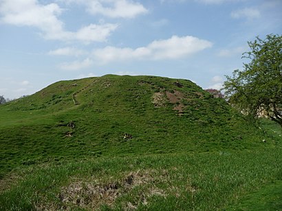
Fotheringhay Castle Address: 2 Castle Mound, Fotheringhay, Peterborough, Northamptonshire PE8 5HZ, UK street in East Northamptonshire
Attractions near Fotheringhay Castle
Fotheringhay,Fotheringhay Village Hall,Oundle Art GR,Jane Catherine,Elysia Skin Body Laser,Bluebell Lakes,GREGGS,SG Services at MFG Country Service Station,Barnwell Country Park,The Business Club,Elton Hall,Bosworth's Garden Centre,Halefield Farm and Stud,Cotterstock Hall,Murco,Tirconnell Properties,Peanut Butter Productions,Bluebell Lakes Reception,Cotterstock Angling Association,Mandaa PropertyHow to get to popular attractions in East Northamptonshire with public transportation
Wollaton Park, Nottingham,Derby College (The Roundhouse), Derby,Newark North Gate Railway Station (NNG), Newark And Sherwood,goose fair, Nottingham,Northampton College, Northampton,Leicester College, Leicester,Amazon-VEEI, Northampton,Hellidon Lakes Golf and Spa Hotel, Northampton,Wilkinson Street Tram Stop, Nottingham,Pirelli Stadium,Travelodge Nottingham EM Airport Donington Park M1, North West Leicestershire,X-Ray Department, Derby,Intu Derby, Derby,Uppingham, Rutland,Wellingborough Railway Station (WEL), Wellingborough,National Express Coach Station, Nottingham,Bourne Grammar School, South Kesteven,Woodside Wildlife & Falconry Park, West Lindsey,Hollywood Bowl, Peterborough,Attenborough University Film Theatre, LeicesterGet around East Midlands by public transport!
Travelling around East Midlands has never been so easy. See step by step directions as you travel to any attraction, street or major public transport station. View bus and train timetables, arrival times, service alerts and detailed routes on a map, so you know exactly how to get to anywhere in East Midlands.
When travelling to any destination around East Midlands use Moovit's Live Directions with Get Off Notifications to know exactly where and how far to walk, how long to wait for your line , and how many stops are left. Moovit will alert you when it’s time to get off — no need to constantly re-check whether yours is the next stop.
Wondering how to use public transport in East Midlands or how to pay for public transport in East Midlands? Moovit public transport app can help you navigate your way with public transport easily, and at minimum cost. It includes public transport fees, ticket prices, and costs. Looking for a map of East Midlands public transport lines? Moovit public transport app shows all public transport maps in East Midlands with all Bus, Train and Light rail routes and stops on an interactive map.
East Midlands has 3 transport type(s), including: Bus, Train and Light rail, operated by several transport agencies, including National Rail, Ashbourne Community Transport, Delaine Buses, Arriva Midlands, Centrebus, Our Centre, Hulleys of Baslow, D & G Bus, Stagecoach East Midlands, North Lincolnshire Council, Roberts Coaches, Hawkes Coaches, Lawson's of Corby, East Yorkshire, Soar Valley Community Bus