Directions to Little St. Mary's (Cambridge) with public transport
The following transport lines have routes that pass near Little St. Mary's
How to get to Little St. Mary's by bus?
Click on the bus route to see step by step directions with maps, line arrival times and updated time schedules.
How to get to Little St. Mary's by train?
Click on the train route to see step by step directions with maps, line arrival times and updated time schedules.
Bus stops near Little St. Mary's in Cambridge
- Pembroke Street, Cambridge, 1 min walk,
- Corpus Christi Col, Cambridge, 3 min walk,
- Fitzwilliam Museum, Cambridge, 4 min walk,
Bus lines to Little St. Mary's in Cambridge
- U1, Addenbrookes,
- U2, Girton,
- PR3, Cambridge,
- 199, Newnham,
- TOUR, Cambridge,
What are the nearest stations to Little St. Mary's?
The nearest stations to Little St. Mary's are:
- Pembroke Street, Cambridge is 17 meters away, 1 min walk.
- Corpus Christi Col, Cambridge is 167 meters away, 3 min walk.
- Fitzwilliam Museum, Cambridge is 260 meters away, 4 min walk.
Which bus lines stop near Little St. Mary's?
These bus lines stop near Little St. Mary's: 13A, 5, TRUMPINGTON PARK & RIDE, UNIVERSAL U.
Which train lines stop near Little St. Mary's?
These train lines stop near Little St. Mary's: GREAT NORTHERN, GREATER ANGLIA.
What’s the nearest bus stop to Little St. Mary's in Cambridge?
The nearest bus stop to Little St. Mary's in Cambridge is Pembroke Street, Cambridge. It’s a 1 min walk away.
See Little St. Mary's, Cambridge, on the map
Public Transit to Little St. Mary's in Cambridge
Wondering how to get to Little St. Mary's in Cambridge, United Kingdom? Moovit helps you find the best way to get to Little St. Mary's with step-by-step directions from the nearest public transit station.
Moovit provides free maps and live directions to help you navigate through your city. View schedules, routes, timetables, and find out how long does it take to get to Little St. Mary's in real time.
Looking for the nearest stop or station to Little St. Mary's? Check out this list of stops closest to your destination: Pembroke Street; Corpus Christi Col; Fitzwilliam Museum.
Bus: 13A, 5, TRUMPINGTON PARK & RIDE, UNIVERSAL U, U1, U2, PR3, 199, TOUR.Train: GREAT NORTHERN, GREATER ANGLIA.
Want to see if there’s another route that gets you there at an earlier time? Moovit helps you find alternative routes or times. Get directions from and directions to Little St. Mary's easily from the Moovit App or Website.
We make riding to Little St. Mary's easy, which is why over 1.5 million users, including users in Cambridge, trust Moovit as the best app for public transit. You don’t need to download an individual bus app or train app, Moovit is your all-in-one transit app that helps you find the best bus time or train time available.
For information on prices of bus and train, costs and ride fares to Little St. Mary's, please check the Moovit app.
Use the app to navigate to popular places including to the airport, hospital, stadium, grocery store, mall, coffee shop, school, college, and university.
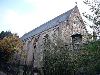
Little St. Mary's Address: Trumpington Rd street in Cambridge
Attractions near Little St. Mary's
Peterhouse,Cb2 1rf,Emmanuel United Reform Church,Little St Mary's Church,Pembroke Street, Cambridge,Cb2 1qg,Pembroke College,St Botolph C of E Church,The Fitzwilliam Museum Trust,Estate Management & Building Service,Syndicate Room,Little St Mary's Church (Church of England),Pembroke Old Library,Cb2 1rw,University of Cambridge Estate Management,Locksmith Cambridge,Oast House (Cambridge) Quaker Meeting,Pembroke College Buttery,The Little Rose Restaurant,Fare Shares CafeHow to get to popular attractions in Cambridge with public transportation
Milton Country Park, South Cambridgeshire,Cambridge Regional College (CRC), South Cambridgeshire,Wymondham, South Norfolk,Crown Point Maintenance Depot, Norwich,Cambridge Leisure, Cambridge,Cromer, North Norfolk,University Of East Anglia, Norwich,Holiday Inn Norwich City, Norwich,The Cricketers (Wetherspoon), Ipswich,David Lloyd, Ipswich,Sainsbury's, Suffolk Coastal,Cb1 3df, Cambridge,Godmanchester, Huntingdonshire,Hinchingbrooke Hospital, Huntingdonshire,Kings Lynn Railway Station (KLN), King'S Lynn And West Norfolk,UEA LCR, Norwich,Argos, St Edmundsbury,Nr4 7uy, South Norfolk,Cineworld, St Edmundsbury,Scudamore's Punting Cambridge Quayside, CambridgeGet around East Anglia by public transport!
Travelling around East Anglia has never been so easy. See step by step directions as you travel to any attraction, street or major public transport station. View bus and train timetables, arrival times, service alerts and detailed routes on a map, so you know exactly how to get to anywhere in East Anglia.
When travelling to any destination around East Anglia use Moovit's Live Directions with Get Off Notifications to know exactly where and how far to walk, how long to wait for your line , and how many stops are left. Moovit will alert you when it’s time to get off — no need to constantly re-check whether yours is the next stop.
Wondering how to use public transport in East Anglia or how to pay for public transport in East Anglia? Moovit public transport app can help you navigate your way with public transport easily, and at minimum cost. It includes public transport fees, ticket prices, and costs. Looking for a map of East Anglia public transport lines? Moovit public transport app shows all public transport maps in East Anglia with all Bus, Train and Ferry routes and stops on an interactive map.
East Anglia has 3 transport type(s), including: Bus, Train and Ferry, operated by several transport agencies, including National Rail, Ambassador Travel, Harwich Harbour Ferry, Stephensons of Essex, Villager Minibus Sharnbrook, The Voluntary Network, Dews Coaches, Lord's Travel, Felixstowe Ferry Boat Yard, Hadleigh Community Transport, Beestons, Fenland Association for Community Transport, First Norfolk & Suffolk, Mulleys Motorways, Halesworth Area Community Transport