Directions to 1st Year Geography Lab (Crawley) with public transport
The following transport lines have routes that pass near 1st Year Geography Lab
 Bus: 24, 950, 950X, 96, 995.
- Train: AIRPORT LINE, FREMANTLE LINE, 906.
- Ferry: FERRY ROUTE ELIZABETH QUAY JETTY - FERRY ROUTE MENDS ST JETTY.
How to get to 1st Year Geography Lab by bus?
Click on the bus route to see step by step directions with maps, line arrival times and updated time schedules.
From Welshpool Station, Welshpool
62 minFrom Mciver Carpark RPH, Perth
31 minFrom Bentley Hospital, Bentley
58 minFrom Westfield Booragoon, Booragoon
59 minFrom Bentley Plaza Shopping Centre, Bentley
62 minFrom Scarborough WA Australia, Scarborough
64 minFrom Loftus Recreation Centre, Leederville
37 minFrom Pan Pacific Perth, East Perth
31 minFrom Kardinya Park Shopping Centre, Kardinya
81 minFrom Boatshed Market, Cottesloe
28 min
How to get to 1st Year Geography Lab by train?
Click on the train route to see step by step directions with maps, line arrival times and updated time schedules.
Bus stops near 1st Year Geography Lab in Crawley
Train station near 1st Year Geography Lab in Crawley
- Karrakatta Stn, 32 min walk,VIEW
Ferry station near 1st Year Geography Lab in Crawley
- Ferry Route Elizabeth Quay Jetty, 59 min walk,VIEW
Bus lines to 1st Year Geography Lab in Crawley
- 998, Stirling Stn,VIEW
- 23, Claremont Stn,VIEW
- 103, Claremont Stn,VIEW
- 995, Elizabeth Quay Bus Stn,VIEW
- 999, Fremantle Stn,VIEW
- 97, Crawley,VIEW
- 950, Galleria Bus Stn,VIEW
- 950X, Qeii Medical Ctr,VIEW
- 24, Claremont Stn,VIEW
- 96, Leederville Stn,VIEW
- ELIZABETH QUAY BUS STN - HACKETT DR UWA BUSINESS SCHOOL CAT ID 123, Crawley,VIEW
What are the nearest stations to 1st Year Geography Lab?
The nearest stations to 1st Year Geography Lab are:
- Stirling Hwy Opposite University Of Wa is 13 meters away, 1 min walk.
- Stirling Hwy After Broadway is 65 meters away, 2 min walk.
- Mounts Bay Rd Before Winthrop Av is 289 meters away, 5 min walk.
- Hampden Rd Hampden Road South Cat Id 120 is 345 meters away, 5 min walk.
- Karrakatta Stn is 2417 meters away, 32 min walk.
- Ferry Route Elizabeth Quay Jetty is 4570 meters away, 59 min walk.
Which bus lines stop near 1st Year Geography Lab?
These bus lines stop near 1st Year Geography Lab: 24, 950, 950X, 96, 995, 998, 999, ELIZABETH QUAY BUS STN - HACKETT DR UWA BUSINESS SCHOOL CAT ID 123.
Which train lines stop near 1st Year Geography Lab?
These train lines stop near 1st Year Geography Lab: AIRPORT LINE, FREMANTLE LINE.
What’s the nearest bus station to 1st Year Geography Lab in Crawley?
The nearest bus station to 1st Year Geography Lab in Crawley is Stirling Hwy Opposite University Of Wa. It’s a 1 min walk away.
What time is the first train to 1st Year Geography Lab in Crawley?
The FREMANTLE LINE is the first train that goes to 1st Year Geography Lab in Crawley. It stops nearby at 05:30.
What time is the last train to 1st Year Geography Lab in Crawley?
The FREMANTLE LINE is the last train that goes to 1st Year Geography Lab in Crawley. It stops nearby at 00:29.
What time is the first bus to 1st Year Geography Lab in Crawley?
The 950 is the first bus that goes to 1st Year Geography Lab in Crawley. It stops nearby at 04:54.
What time is the last bus to 1st Year Geography Lab in Crawley?
The 950 is the last bus that goes to 1st Year Geography Lab in Crawley. It stops nearby at 00:59.
What time is the first ferry to 1st Year Geography Lab in Crawley?
The FERRY ROUTE ELIZABETH QUAY JETTY - FERRY ROUTE MENDS ST JETTY is the first ferry that goes to 1st Year Geography Lab in Crawley. It stops nearby at 06:30.
What time is the last ferry to 1st Year Geography Lab in Crawley?
The FERRY ROUTE ELIZABETH QUAY JETTY - FERRY ROUTE MENDS ST JETTY is the last ferry that goes to 1st Year Geography Lab in Crawley. It stops nearby at 22:25.
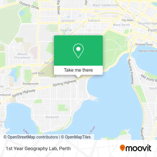
See 1st Year Geography Lab, Crawley, on the map
Public Transit to 1st Year Geography Lab in Crawley
Wondering how to get to 1st Year Geography Lab in Crawley? Moovit helps you find the best way to get to 1st Year Geography Lab with step-by-step directions from the nearest public transit station.
Moovit provides free maps and live directions to help you navigate through your city. View schedules, routes, timetables, and find out how long does it take to get to 1st Year Geography Lab in real time.
Looking for the nearest stop or station to 1st Year Geography Lab? Check out this list of stops closest to your destination: Stirling Hwy Opposite University Of Wa; Stirling Hwy After Broadway; Mounts Bay Rd Before Winthrop Av; Hampden Rd Hampden Road South Cat Id 120; Karrakatta Stn; Ferry Route Elizabeth Quay Jetty.
Bus: 24, 950, 950X, 96, 995, 998, 999, ELIZABETH QUAY BUS STN - HACKETT DR UWA BUSINESS SCHOOL CAT ID 123, 23, 103, 97.Train: AIRPORT LINE, FREMANTLE LINE, 906.Ferry: FERRY ROUTE ELIZABETH QUAY JETTY - FERRY ROUTE MENDS ST JETTY.
Want to see if there’s another route that gets you there at an earlier time? Moovit helps you find alternative routes or times. Get directions from and directions to 1st Year Geography Lab easily from the Moovit App or Website.
We make riding to 1st Year Geography Lab easy, which is why over 1.5 million users, including users in Crawley, trust Moovit as the best app for public transit. You don’t need to download an individual bus app or train app, Moovit is your all-in-one transit app that helps you find the best bus time or train time available.
For information on prices of bus and train, costs and ride fares to 1st Year Geography Lab, please check the Moovit app.
Use the app to navigate to popular places including to the airport, hospital, stadium, grocery store, mall, coffee shop, school, college, and university.
Location: Crawley, Perth
- Crawley Edge Boatshed,
- Trinity Residential College,
- AB Village Surgical and Sports Manufacturer,
- Gale Room,
- Kingswood Court,
- Uwa Out of School Care,
- Focus Building Company,
- Frank Prowse Hi Fi,
- Woolnough Lecture Theatre,
- Broadway Building,
- St Catherine's College, UWA,
- Uwa Consulting and Expert Opinion Services,
- Artlaab,
- Broadway,
- Broadway Fair Health Foods,
- Ma Kin-Thai Street Eats,
- Gentilli Lecture Theatre - Geology Building,
- University Of Western Australia Nedlands Campus,
- Canning Bridge Superwa,
- Caltex
Places Near 1st Year Geography Lab (Crawley)
- Pelicaan Investment Ho, Bellevue,
- IKEA, Innaloo,
- Karrinyup Shopping Centre, Karrinyup,
- Blue Boat House,
- Watertown, Perth,
- Rac Arena, Perth,
- Langley Park, Perth,
- McCallum Park, Victoria Park,
- DFO, Perth Airport,
- Westfield Carousel, Cannington,
- Mount Hospital, Perth,
- Perth Convention Exhibition Centre, Perth,
- Sir Charles Gairdner Hospital, Nedlands,
- Yankee Mart, Baldivis,
- Royal Perth Hospital, Perth,
- Crown Perth Casino, Burswood,
- Aqwa Aquarium, Hillarys,
- Optus Stadium, Burswood,
- Fiona Stanley Hospital, Murdoch,
- Scitech, West Perth
How to get to popular places in Perth with public transport
Get around Crawley by public transport!
Travelling around Crawley has never been so easy. See step by step directions as you travel to any attraction, street or major public transport station. View bus and train timetables, arrival times, service alerts and detailed routes on a map, so you know exactly how to get to anywhere in Crawley.
When travelling to any destination around Crawley use Moovit's Live Directions with Get Off Notifications to know exactly where and how far to walk, how long to wait for your line , and how many stops are left. Moovit will alert you when it’s time to get off — no need to constantly re-check whether yours is the next stop.
Wondering how to use public transport in Crawley or how to pay for public transport in Crawley? Moovit public transport app can help you navigate your way with public transport easily, and at minimum cost. It includes public transport fees, ticket prices, and costs. Looking for a map of Crawley public transport lines? Moovit public transport app shows all public transport maps in Crawley with all Bus, Train and Ferry routes and stops on an interactive map.
Perth has 3 transport type(s), including: Bus, Train and Ferry, operated by several transport agencies, including Transperth Rail, Transwa, Transperth Ferry, Transperth, TransBusselton, TransAlbany, TransGoldfields, TransEsperance, TransGeraldton, TransCarnarvon, TransHedland, TransKarratha, TransBunbury, Mandurah Bus Charter and TransBroome