Directions to APB (Perth) with public transport
The following transport lines have routes that pass near APB
 Bus: 27, 28, 51, 930, 935.
- Train: AIRPORT LINE, ARMADALE LINE, FREMANTLE LINE, THORNLIE-COCKBURN LINE, MANDURAH LINE.
- Ferry: FERRY ROUTE ELIZABETH QUAY JETTY - FERRY ROUTE MENDS ST JETTY.
How to get to APB by bus?
Click on the bus route to see step by step directions with maps, line arrival times and updated time schedules.
From Thi Nguyen & Minh Hoan, Cottesloe
51 minFrom Challenge Stadium, Mount Claremont
50 minFrom Irwin Barracks, Karrakatta
49 minFrom Queens Park, Queens Park
59 minFrom Centrelink Cannington, Cannington
51 minFrom Mt Claremont, City Beach
56 minFrom Nedlands, Nedlands
26 minFrom St. Hilda's Anglican School for Girls, Mosman Park
63 minFrom Taxi Rank - Perth Domestic Airport, Perth Airport
60 minFrom DFO, Perth Airport
60 min
How to get to APB by train?
Click on the train route to see step by step directions with maps, line arrival times and updated time schedules.
From Thi Nguyen & Minh Hoan, Cottesloe
33 minFrom Irwin Barracks, Karrakatta
37 minFrom Queens Park, Queens Park
34 minFrom Centrelink Cannington, Cannington
44 minFrom St. Hilda's Anglican School for Girls, Mosman Park
48 minFrom Taxi Rank - Perth Domestic Airport, Perth Airport
40 minFrom DFO, Perth Airport
38 min
Bus stops near APB in Perth
Ferry station near APB in Perth
- Ferry Route Elizabeth Quay Jetty, 11 min walk,VIEW
Bus lines to APB in Perth
- PERTH RED CAT, Hale St / Waca,VIEW
- PERTH YELLOW CAT, Claisebrook Stn,VIEW
- 30, Manning,VIEW
- 31, Salter Point,VIEW
- 910, Fremantle Stn,VIEW
- PERTH BLUE CAT, Elizabeth Quay Bus Stn,VIEW
- 15, Glendalough Stn,VIEW
- 19, Perth Busport,VIEW
- 28, Claremont Stn,VIEW
- 34, Cannington Stn,VIEW
- 38, Cloverdale,VIEW
- 51, Perth Busport,VIEW
- 67, Mirrabooka Bus Stn,VIEW
- 68, Mirrabooka Bus Stn,VIEW
- 81, City Beach,VIEW
- 82, City Beach,VIEW
- 83, Churchlands Senior High School,VIEW
- 84, City Beach (Hale Rd),VIEW
- 85, Glendalough Stn,VIEW
- 220, Armadale Senior High School,VIEW
What are the nearest stations to APB?
The nearest stations to APB are:
- Murray St Raine Square Cat Id 99 is 20 meters away, 1 min walk.
- Wellington St Yagan Square Cat Id 59 is 240 meters away, 4 min walk.
- Milligan St After Murray St is 266 meters away, 4 min walk.
- Elizabeth Quay Stn is 453 meters away, 6 min walk.
- Perth Busport is 467 meters away, 7 min walk.
- Perth Stn is 471 meters away, 7 min walk.
- St Georges Tce Stand 2 - After Milligan St is 512 meters away, 7 min walk.
- St Georges Tce Stand 32 - Cat Id 21 is 534 meters away, 7 min walk.
- Ferry Route Elizabeth Quay Jetty is 799 meters away, 11 min walk.
Which bus lines stop near APB?
These bus lines stop near APB: 27, 28, 51, 930, 935, 940, 950.
Which train lines stop near APB?
These train lines stop near APB: AIRPORT LINE, ARMADALE LINE, FREMANTLE LINE, THORNLIE-COCKBURN LINE.
What’s the nearest train station to APB in Perth?
The nearest train station to APB in Perth is Elizabeth Quay Stn. It’s a 6 min walk away.
What’s the nearest bus station to APB in Perth?
The nearest bus station to APB in Perth is Murray St Raine Square Cat Id 99. It’s a 1 min walk away.
What’s the nearest ferry station to APB in Perth?
The nearest ferry station to APB in Perth is Ferry Route Elizabeth Quay Jetty. It’s a 11 min walk away.
What time is the first train to APB in Perth?
The ARMADALE LINE is the first train that goes to APB in Perth. It stops nearby at 05:03.
What time is the last train to APB in Perth?
The FREMANTLE LINE is the last train that goes to APB in Perth. It stops nearby at 00:38.
What time is the first bus to APB in Perth?
The 935 is the first bus that goes to APB in Perth. It stops nearby at 04:51.
What time is the last bus to APB in Perth?
The 386 is the last bus that goes to APB in Perth. It stops nearby at 00:37.
What time is the first ferry to APB in Perth?
The FERRY ROUTE ELIZABETH QUAY JETTY - FERRY ROUTE MENDS ST JETTY is the first ferry that goes to APB in Perth. It stops nearby at 06:30.
What time is the last ferry to APB in Perth?
The FERRY ROUTE ELIZABETH QUAY JETTY - FERRY ROUTE MENDS ST JETTY is the last ferry that goes to APB in Perth. It stops nearby at 22:25.
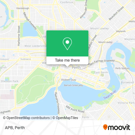
See APB, Perth, on the map
Public Transit to APB in Perth
Wondering how to get to APB in Perth? Moovit helps you find the best way to get to APB with step-by-step directions from the nearest public transit station.
Moovit provides free maps and live directions to help you navigate through your city. View schedules, routes, timetables, and find out how long does it take to get to APB in real time.
Looking for the nearest stop or station to APB? Check out this list of stops closest to your destination: Murray St Raine Square Cat Id 99; Wellington St Yagan Square Cat Id 59; Milligan St After Murray St; Elizabeth Quay Stn; Perth Busport; Perth Stn; St Georges Tce Stand 2 - After Milligan St; St Georges Tce Stand 32 - Cat Id 21; Ferry Route Elizabeth Quay Jetty.
Bus: 27, 28, 51, 930, 935, 940, 950, PERTH RED CAT, PERTH YELLOW CAT, 30, 31, 910.Train: AIRPORT LINE, ARMADALE LINE, FREMANTLE LINE, THORNLIE-COCKBURN LINE, MANDURAH LINE, YANCHEP LINE, ELLENBROOK LINE, MIDLAND LINE.Ferry: FERRY ROUTE ELIZABETH QUAY JETTY - FERRY ROUTE MENDS ST JETTY.
Want to see if there’s another route that gets you there at an earlier time? Moovit helps you find alternative routes or times. Get directions from and directions to APB easily from the Moovit App or Website.
We make riding to APB easy, which is why over 1.5 million users, including users in Perth, trust Moovit as the best app for public transit. You don’t need to download an individual bus app or train app, Moovit is your all-in-one transit app that helps you find the best bus time or train time available.
For information on prices of bus and train, costs and ride fares to APB, please check the Moovit app.
Use the app to navigate to popular places including to the airport, hospital, stadium, grocery store, mall, coffee shop, school, college, and university.
Location: Perth
- FESA Fire Safety Education Centre & Museum,
- Strandbags Pty Limited,
- Carillon Health The Good Life Store,
- JeansWest,
- Perth International Medical Centre,
- Shiels Jewellers,
- Perth School Advisory centre,
- Good Sammy,
- Red CAT Stop 23 (Raine Square),
- The Generous Squire,
- Miss Mi Perth,
- NOVOTEL Perth Murray Street,
- Perth Hobby Centre,
- King Street Arts Centre,
- Abbey Imports,
- Durty Nelly's Irish Pub,
- Fuch,
- 609 Wellington St Parking,
- Wild Gear,
- Tiffany & Co.
Places Near APB (Perth)
- Sir Charles Gairdner Hospital, Nedlands,
- Royal Perth Hospital, Perth,
- Aqwa Aquarium, Hillarys,
- Mount Hospital, Perth,
- Blue Boat House,
- Rac Arena, Perth,
- Yankee Mart, Baldivis,
- Pelicaan Investment Ho, Bellevue,
- McCallum Park, Victoria Park,
- Scitech, West Perth,
- Optus Stadium, Burswood,
- DFO, Perth Airport,
- Crown Perth Casino, Burswood,
- Watertown, Perth,
- Fiona Stanley Hospital, Murdoch,
- Langley Park, Perth,
- Westfield Carousel, Cannington,
- IKEA, Innaloo,
- Karrinyup Shopping Centre, Karrinyup,
- Perth Convention Exhibition Centre, Perth
How to get to popular places in Perth with public transport
Get around Perth by public transport!
Travelling around Perth has never been so easy. See step by step directions as you travel to any attraction, street or major public transport station. View bus and train timetables, arrival times, service alerts and detailed routes on a map, so you know exactly how to get to anywhere in Perth.
When travelling to any destination around Perth use Moovit's Live Directions with Get Off Notifications to know exactly where and how far to walk, how long to wait for your line , and how many stops are left. Moovit will alert you when it’s time to get off — no need to constantly re-check whether yours is the next stop.
Wondering how to use public transport in Perth or how to pay for public transport in Perth? Moovit public transport app can help you navigate your way with public transport easily, and at minimum cost. It includes public transport fees, ticket prices, and costs. Looking for a map of Perth public transport lines? Moovit public transport app shows all public transport maps in Perth with all Bus, Train and Ferry routes and stops on an interactive map.
Perth has 3 transport type(s), including: Bus, Train and Ferry, operated by several transport agencies, including Transperth Rail, Transwa, Transperth Ferry, Transperth, TransBusselton, TransAlbany, TransGoldfields, TransEsperance, TransGeraldton, TransCarnarvon, TransHedland, TransKarratha, TransBunbury, Mandurah Bus Charter and TransBroome