Directions to Absolute Sleep (West Perth) with public transport
The following transport lines have routes that pass near Absolute Sleep
How to get to Absolute Sleep by bus?
Click on the bus route to see step by step directions with maps, line arrival times and updated time schedules.
From Booragoon, Booragoon
59 minFrom Tech Revo Group Pty, Innaloo
64 minFrom A A al M & J al M, Morley
67 minFrom KDC Holdings, Karrinyup
75 minFrom Kewdale, Kewdale
55 minFrom Abernethy road, Belmont
53 minFrom Bentley Hospital, Bentley
61 minFrom Tech Revo Group Pty, Booragoon
56 minFrom Rivervale, Rivervale
42 minFrom Dianella, Dianella
51 min
How to get to Absolute Sleep by train?
Click on the train route to see step by step directions with maps, line arrival times and updated time schedules.
Bus stops near Absolute Sleep in West Perth
Train stations near Absolute Sleep in West Perth
Ferry station near Absolute Sleep in West Perth
- Ferry Route Elizabeth Quay Jetty, 32 min walk,VIEW
Bus lines to Absolute Sleep in West Perth
What are the nearest stations to Absolute Sleep?
The nearest stations to Absolute Sleep are:
- Ord St Ord Street Cat Id 94 is 182 meters away, 3 min walk.
- Colin St Colin Street South Cat Id 33 is 299 meters away, 5 min walk.
- Kings Park Rd Outram Street Cat Id 141 is 321 meters away, 5 min walk.
- Thomas St After Richardson St is 419 meters away, 6 min walk.
- Murray St Perth Modern Cat Id 63 is 457 meters away, 7 min walk.
- Perth Underground Stn is 2097 meters away, 28 min walk.
- Perth Stn is 2143 meters away, 28 min walk.
- Ferry Route Elizabeth Quay Jetty is 2435 meters away, 32 min walk.
Which bus lines stop near Absolute Sleep?
These bus lines stop near Absolute Sleep: 103, 96, ELIZABETH QUAY BUS STN - HACKETT DR UWA BUSINESS SCHOOL CAT ID 123, PERTH GREEN CAT, PERTH RED CAT.
Which train lines stop near Absolute Sleep?
These train lines stop near Absolute Sleep: AIRPORT LINE, FREMANTLE LINE, YANCHEP LINE.
What’s the nearest train station to Absolute Sleep in West Perth?
The nearest train stations to Absolute Sleep in West Perth are Perth Underground Stn and Perth Stn. The closest one is a 28 min walk away.
What’s the nearest bus station to Absolute Sleep in West Perth?
The nearest bus station to Absolute Sleep in West Perth is Ord St Ord Street Cat Id 94. It’s a 3 min walk away.
What time is the first train to Absolute Sleep in West Perth?
The ARMADALE LINE is the first train that goes to Absolute Sleep in West Perth. It stops nearby at 05:03.
What time is the last train to Absolute Sleep in West Perth?
The FREMANTLE LINE is the last train that goes to Absolute Sleep in West Perth. It stops nearby at 00:38.
What time is the first bus to Absolute Sleep in West Perth?
The ELIZABETH QUAY BUS STN - HACKETT DR UWA BUSINESS SCHOOL CAT ID 123 is the first bus that goes to Absolute Sleep in West Perth. It stops nearby at 05:12.
What time is the last bus to Absolute Sleep in West Perth?
The 24 is the last bus that goes to Absolute Sleep in West Perth. It stops nearby at 23:49.
What time is the first ferry to Absolute Sleep in West Perth?
The FERRY ROUTE ELIZABETH QUAY JETTY - FERRY ROUTE MENDS ST JETTY is the first ferry that goes to Absolute Sleep in West Perth. It stops nearby at 06:30.
What time is the last ferry to Absolute Sleep in West Perth?
The FERRY ROUTE ELIZABETH QUAY JETTY - FERRY ROUTE MENDS ST JETTY is the last ferry that goes to Absolute Sleep in West Perth. It stops nearby at 22:25.
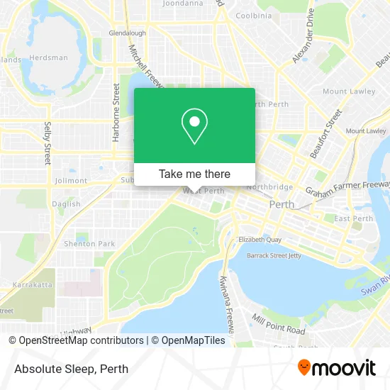
See Absolute Sleep, West Perth, on the map
Public Transit to Absolute Sleep in West Perth
Wondering how to get to Absolute Sleep in West Perth? Moovit helps you find the best way to get to Absolute Sleep with step-by-step directions from the nearest public transit station.
Moovit provides free maps and live directions to help you navigate through your city. View schedules, routes, timetables, and find out how long does it take to get to Absolute Sleep in real time.
Looking for the nearest stop or station to Absolute Sleep? Check out this list of stops closest to your destination: Ord St Ord Street Cat Id 94; Colin St Colin Street South Cat Id 33; Kings Park Rd Outram Street Cat Id 141; Thomas St After Richardson St; Murray St Perth Modern Cat Id 63; Perth Underground Stn; Perth Stn; Ferry Route Elizabeth Quay Jetty.
Bus: 103, 96, ELIZABETH QUAY BUS STN - HACKETT DR UWA BUSINESS SCHOOL CAT ID 123, PERTH GREEN CAT, PERTH RED CAT, 24, 27.Train: AIRPORT LINE, FREMANTLE LINE, YANCHEP LINE, MANDURAH LINE, ARMADALE LINE, ELLENBROOK LINE, MIDLAND LINE.Ferry: FERRY ROUTE ELIZABETH QUAY JETTY - FERRY ROUTE MENDS ST JETTY.
Want to see if there’s another route that gets you there at an earlier time? Moovit helps you find alternative routes or times. Get directions from and directions to Absolute Sleep easily from the Moovit App or Website.
We make riding to Absolute Sleep easy, which is why over 1.5 million users, including users in West Perth, trust Moovit as the best app for public transit. You don’t need to download an individual bus app or train app, Moovit is your all-in-one transit app that helps you find the best bus time or train time available.
For information on prices of bus and train, costs and ride fares to Absolute Sleep, please check the Moovit app.
Use the app to navigate to popular places including to the airport, hospital, stadium, grocery store, mall, coffee shop, school, college, and university.
Absolute Sleep Address: Outram St 34 West Perth, 6005 Perth street in West Perth
- Outram Small Luxury Hotel The,
- RAMADA-Perth the Outram,
- Club Wyndham-Perth,
- Outram Street,
- Club Wyndham Perth The Outram,
- 42 Ord Street,
- Perth Eye Hospital,
- 24 Richardson Street,
- Blackstone Minerals Limited,
- Roy Hill -HPPL,
- Simon McGrath - Mortgage Australia,
- Ord Street,
- SKG Radiology,
- 14 Ventnor Avenue,
- Ord Street Digital,
- Italian Consulate Of Perth,
- Optus Head Office,
- Mayfair Lane,
- Lifechoice Clinic,
- Stanley College
Places Near Absolute Sleep (West Perth)
- Yankee Mart, Baldivis,
- Rac Arena, Perth,
- Perth Convention Exhibition Centre, Perth,
- Blue Boat House,
- Scitech, West Perth,
- Langley Park, Perth,
- Pelicaan Investment Ho, Bellevue,
- McCallum Park, Victoria Park,
- Sir Charles Gairdner Hospital, Nedlands,
- Mount Hospital, Perth,
- Optus Stadium, Burswood,
- Aqwa Aquarium, Hillarys,
- Fiona Stanley Hospital, Murdoch,
- DFO, Perth Airport,
- Crown Perth Casino, Burswood,
- Westfield Carousel, Cannington,
- Karrinyup Shopping Centre, Karrinyup,
- IKEA, Innaloo,
- Watertown, Perth,
- Royal Perth Hospital, Perth
How to get to popular places in Perth with public transport
Get around West Perth by public transport!
Travelling around West Perth has never been so easy. See step by step directions as you travel to any attraction, street or major public transport station. View bus and train timetables, arrival times, service alerts and detailed routes on a map, so you know exactly how to get to anywhere in West Perth.
When travelling to any destination around West Perth use Moovit's Live Directions with Get Off Notifications to know exactly where and how far to walk, how long to wait for your line , and how many stops are left. Moovit will alert you when it’s time to get off — no need to constantly re-check whether yours is the next stop.
Wondering how to use public transport in West Perth or how to pay for public transport in West Perth? Moovit public transport app can help you navigate your way with public transport easily, and at minimum cost. It includes public transport fees, ticket prices, and costs. Looking for a map of West Perth public transport lines? Moovit public transport app shows all public transport maps in West Perth with all Bus, Train and Ferry routes and stops on an interactive map.
Perth has 3 transport type(s), including: Bus, Train and Ferry, operated by several transport agencies, including Transperth Rail, Transwa, Transperth Ferry, Transperth, TransBusselton, TransAlbany, TransGoldfields, TransEsperance, TransGeraldton, TransCarnarvon, TransHedland, TransKarratha, TransBunbury, Mandurah Bus Charter and TransBroome