Ainley Top stop - Monday schedule
| Line | Direction | Time |
|---|---|---|
| X1 | Halifax Bus Station | 05:11 |
| 501 | Halifax Bus Station | 05:40 |
| X1 | Halifax Bus Station | 06:11 |
| 501 | Halifax Bus Station | 06:44 |
| X1 | Halifax Bus Station | 06:51 |
| 501 | Halifax Bus Station | 07:09 |
| X1 | Halifax Bus Station | 07:12 |
| 501 | Halifax Bus Station | 07:29 |
| X1 | Halifax Bus Station | 07:33 |
| 501 | Halifax Bus Station | 07:49 |
| X1 | Halifax Bus Station | 07:50 |
| 501 | Halifax Bus Station | 08:04 |
| X1 | Halifax Bus Station | 08:05 |
| 501 | Halifax Bus Station | 08:19 |
| X1 | Halifax Bus Station | 08:22 |
| X1 | Halifax Bus Station | 08:38 |
| 501 | Halifax Bus Station | 08:40 |
| X1 | Halifax Bus Station | 08:53 |
| 501 | Halifax Bus Station | 08:55 |
| X1 | Halifax Bus Station | 09:09 |
| 501 | Halifax Bus Station | 09:10 |
| X1 | Halifax Bus Station | 09:24 |
| 501 | Halifax Bus Station | 09:25 |
| 501 | Halifax Bus Station | 09:36 |
| X1 | Halifax Bus Station | 09:37 |
Directions to Ainley Top stop (Halifax) with public transport
The following transport lines have routes that pass near Ainley Top
How to get to Ainley Top stop by bus?
Click on the bus route to see step by step directions with maps, line arrival times and updated time schedules.
Bus stops near Ainley Top stop in Halifax
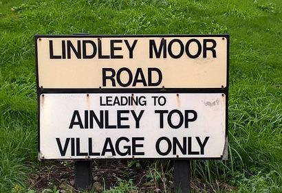
- Lindley Moor Rd Crest Road, 3 min walk,
- Ainley Top, 3 min walk,
- Cedar Court Hotel, 5 min walk,
Bus lines to Ainley Top stop in Halifax
- 343, Huddersfield Busstn,
- X1, Huddersfield Busstn,
- 501, Huddersfield Busstn,
- NC8, Salendine Nook,
- NC9, Salendine Nook,
What are the nearest stations to Ainley Top?
The nearest stations to Ainley Top are:
- Lindley Moor Rd Crest Road is 171 meters away, 3 min walk.
- Ainley Top is 228 meters away, 3 min walk.
- Cedar Court Hotel is 385 meters away, 5 min walk.
Which bus lines stop near Ainley Top?
These bus lines stop near Ainley Top: 501, X1.
What’s the nearest bus stop to Ainley Top in Halifax?
The nearest bus stops to Ainley Top in Halifax are Lindley Moor Rd Crest Road and Ainley Top. The closest one is a 3 min walk away.
What time is the first bus to Ainley Top in Halifax?
The 501 is the first bus that goes to Ainley Top in Halifax. It stops nearby at 04:34.
What time is the last bus to Ainley Top in Halifax?
The 501 is the last bus that goes to Ainley Top in Halifax. It stops nearby at 23:35.
See Ainley Top stop, Halifax, on the map
Public transport to Ainley Top stop (ID: 45022169) in Halifax
Looking for directions to Ainley Top in Halifax, United Kingdom?
Download the Moovit App to find the current schedule and step-by-step directions for Bus routes that pass through Ainley Top.
Looking for the nearest stops closest to Ainley Top ? Check out this list of closest stops to your destination: Lindley Moor Rd Crest Road; Ainley Top; Cedar Court Hotel.
Bus: 501, X1, 343, NC8, NC9.
We make riding on public transit to Ainley Top easy, which is why over 1.5 million users, including users in Halifax trust Moovit as the best app for public transit.
Use the app to navigate to popular places including to the airport, hospital, stadium, grocery store, mall, coffee shop, school, college, and university.
Ainley Top stop’s code is 45022169
The first line to this stop is X1, at 05:11, and the last line is X1 at 00:09.
This stop serves First Halifax’s lines
Popular routes from Ainley Top stop, Halifax
Popular public transport stations in Halifax
Get around Halifax by public transport!
Travelling around Halifax has never been so easy. See step by step directions as you travel to any attraction, street or major public transport station. View bus and train timetables, arrival times, service alerts and detailed routes on a map, so you know exactly how to get to anywhere in Halifax.
When travelling to any destination around Halifax use Moovit's Live Directions with Get Off Notifications to know exactly where and how far to walk, how long to wait for your line , and how many stops are left. Moovit will alert you when it’s time to get off — no need to constantly re-check whether yours is the next stop.
Wondering how to use public transport in Halifax or how to pay for public transport in Halifax? Moovit public transport app can help you navigate your way with public transport easily, and at minimum cost. It includes public transport fees, ticket prices, and costs. Looking for a map of Halifax public transport lines? Moovit public transport app shows all public transport maps in Halifax with all Bus, Train and Light rail routes and stops on an interactive map.
Yorkshire has 3 transport type(s), including: Bus, Train and Light rail, operated by several transport agencies, including National Rail, South Yorkshire Future Tram, Stevenson's Travel, North Yorkshire County Council, Hulleys of Baslow, TLC Travel, R & S Watersons, The Keighley Bus Company, Stagecoach Yorkshire, Goole Go Far, Jacksons of Silsden Ltd, First Bradford, Hodgsons, Sheffield Community Transport and Station Coaches