How to get to Amazon Locker-Azza by bus?
Click on the bus route to see step by step directions with maps, line arrival times and updated time schedules.
From Broad Lane, Coventry, Earlsdon
80 minFrom President Kennedy School, Coventry, Holbrook
110 minFrom Coundon Court Secondary School, Bablake
105 minFrom CV6 6GE, Longford
111 minFrom CV2 2DX, Henley
82 minFrom Nuffield Health Warwickshire Hospital – Leamington Spa, Leamington Milverton
129 minFrom Canley Garden Crematorium and Cemetery, Wainbody
93 minFrom Norman Place Rd, Coventry, Sherbourne
91 minFrom The Greyhound Inn, Longford
104 minFrom The Warwickshire Golf & Country Club, Cubbington & Leek Wootton
168 min
Bus stop near Amazon Locker-Azza in Dunsmore
- Blacksmiths Arms, 4 min walk,VIEW
Bus lines to Amazon Locker-Azza in Dunsmore
What are the nearest stations to Amazon Locker-Azza?
The nearest stations to Amazon Locker-Azza are:
- Blacksmiths Arms is 211 meters away, 4 min walk.
Which bus lines stop near Amazon Locker-Azza?
These bus lines stop near Amazon Locker-Azza: 21, 25, 86.
What’s the nearest bus station to Amazon Locker-Azza in Dunsmore?
The nearest bus station to Amazon Locker-Azza in Dunsmore is Blacksmiths Arms. It’s a 4 min walk away.
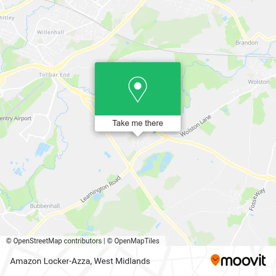
See Amazon Locker-Azza, Dunsmore, on the map
Public Transit to Amazon Locker-Azza in Dunsmore
Wondering how to get to Amazon Locker-Azza in Dunsmore? Moovit helps you find the best way to get to Amazon Locker-Azza with step-by-step directions from the nearest public transit station.
Moovit provides free maps and live directions to help you navigate through your city. View schedules, routes, timetables, and find out how long does it take to get to Amazon Locker-Azza in real time.
Looking for the nearest stop or station to Amazon Locker-Azza? Check out this list of stops closest to your destination: Blacksmiths Arms.
Bus: 21, 25, 86, CAT5, 25A, 25X, 69.
Want to see if there’s another route that gets you there at an earlier time? Moovit helps you find alternative routes or times. Get directions from and directions to Amazon Locker-Azza easily from the Moovit App or Website.
We make riding to Amazon Locker-Azza easy, which is why over 1.5 million users, including users in Dunsmore, trust Moovit as the best app for public transit. You don’t need to download an individual bus app or train app, Moovit is your all-in-one transit app that helps you find the best bus time or train time available.
For information on prices of bus, costs and ride fares to Amazon Locker-Azza, please check the Moovit app.
Use the app to navigate to popular places including to the airport, hospital, stadium, grocery store, mall, coffee shop, school, college, and university.
Amazon Locker-Azza Address: 64 High Street Ryton on Dunsmore Coventry CV8 3 street in Dunsmore
- Retrotechuk,
- Co-operative food,
- Sisu Customs,
- Kestra,
- Lynette Hawkin,
- NSCR Consultancy,
- RP Services,
- KCM Consultancy Services,
- Martin Griffin,
- Specialist Spray & Filter,
- Wade128,
- CV8 3FL,
- Central Galaxy Coventry Trampoline Club,
- Ryton on Dunsmore Leamington Road,
- Walters Ehs Services,
- Herb,
- Habbits Contracting,
- Ryton-On-Dunsmore,
- Advanced Total Supplies,
- Our 4 Wa
Places Near Amazon Locker-Azza (Dunsmore)
- Travelodge Birmingham Airport Hotel Birmingham, Bickenhill,
- Crown Wharf Retail Park, St. Matthew's,
- Royal Orthopaedic Hospital, Northfield,
- Lilleshall Hall National Sports Centre, Telford,
- Waseley Hills Crematorium, Frankley Great Park,
- Bournville Staff Shop (Cadbury World), Bournville & Cotteridge,
- Moseley, Moseley,
- Birmingham And Midland Eye Centre, Soho & Jewellery Quarter,
- Heritage Building (Queen Elizabeth Hospital), Edgbaston,
- Stratford Road, Sparkhill,
- Bickerstaff Endoscopy Unit (PRH), Apley Castle,
- IKEA Wednesbury, Oldbury,
- One Stop Shopping Centre, Perry Barr,
- Sandwell General Hospital, West Bromwich Central,
- Tally Ho Police Training, Birmingham, Edgbaston,
- Birmingham Dental Hospital, Edgbaston,
- Boundary Mill Stores, Bentley And Darlaston North,
- Fort Shopping Centre, Birmingham, Pype Hayes,
- The Merry Hill Centre, Brierley Hill,
- Sandwell General Hospital, West Bromwich Central
How to get to popular places in West Midlands with public transport
Get around Dunsmore by public transport!
Travelling around Dunsmore has never been so easy. See step by step directions as you travel to any attraction, street or major public transport station. View bus and train timetables, arrival times, service alerts and detailed routes on a map, so you know exactly how to get to anywhere in Dunsmore.
When travelling to any destination around Dunsmore use Moovit's Live Directions with Get Off Notifications to know exactly where and how far to walk, how long to wait for your line , and how many stops are left. Moovit will alert you when it’s time to get off — no need to constantly re-check whether yours is the next stop.
Wondering how to use public transport in Dunsmore or how to pay for public transport in Dunsmore? Moovit public transport app can help you navigate your way with public transport easily, and at minimum cost. It includes public transport fees, ticket prices, and costs. Looking for a map of Dunsmore public transport lines? Moovit public transport app shows all public transport maps in Dunsmore with all Bus, Train and Light rail routes and stops on an interactive map.
West Midlands has 3 transport type(s), including: Bus, Train and Light rail, operated by several transport agencies, including National Express West Midlands, National Express Coventry, National Express, Diamond Bus, Arriva Midlands, Stagecoach Midlands, West Midlands Metro, Stagecoach West, Stagecoach South Wales, First Potteries, First Worcestershire, LandFlight, trentbarton, D & G Bus and Flexibus