Directions to Australian Fire Control (Kelmscott) with public transport
The following transport lines have routes that pass near Australian Fire Control
 Bus: 220, 244, 519, ARMADALE LINE, 907.
- Train: ARMADALE LINE.
How to get to Australian Fire Control by bus?
Click on the bus route to see step by step directions with maps, line arrival times and updated time schedules.
From The Last Local Canning Vale, Canning Vale
80 minFrom ZLR*Cannington, Gosnells
52 minFrom Livingston Marketplace, Canning Vale
77 minFrom Sikh Temple Perth, Canning Vale
80 minFrom Australian Islamic College, Thornlie, Thornlie
64 minFrom Maddington Station, Maddington
38 minFrom Thornlie Square Shopping Centre, Thornlie
62 minFrom Huntingdale, Huntingdale
78 minFrom Nicholson Road Station Site, Canning Vale
79 min
How to get to Australian Fire Control by train?
Click on the train route to see step by step directions with maps, line arrival times and updated time schedules.
Bus stops near Australian Fire Control in Kelmscott
Bus lines to Australian Fire Control in Kelmscott
What are the nearest stations to Australian Fire Control?
The nearest stations to Australian Fire Control are:
- Sherwood Stn is 420 meters away, 6 min walk.
- Williams Rd After Champion Dr is 616 meters away, 9 min walk.
- Seville Dr After Champion Dr is 1196 meters away, 16 min walk.
- Albany Hwy After Galliers Av is 1405 meters away, 19 min walk.
Which bus lines stop near Australian Fire Control?
These bus lines stop near Australian Fire Control: 220, 244, 519.
Which train line stops near Australian Fire Control?
ARMADALE LINE (Byford Stn)
What’s the nearest bus station to Australian Fire Control in Kelmscott?
The nearest bus station to Australian Fire Control in Kelmscott is Sherwood Stn. It’s a 6 min walk away.
What time is the first train to Australian Fire Control in Kelmscott?
The ARMADALE LINE is the first train that goes to Australian Fire Control in Kelmscott. It stops nearby at 05:00.
What time is the last train to Australian Fire Control in Kelmscott?
The ARMADALE LINE is the last train that goes to Australian Fire Control in Kelmscott. It stops nearby at 00:47.
What time is the first bus to Australian Fire Control in Kelmscott?
The 220 is the first bus that goes to Australian Fire Control in Kelmscott. It stops nearby at 04:03.
What time is the last bus to Australian Fire Control in Kelmscott?
The 220 is the last bus that goes to Australian Fire Control in Kelmscott. It stops nearby at 19:33.
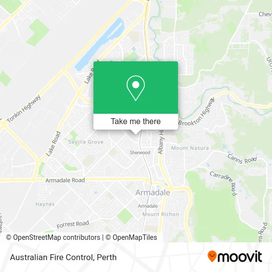
See Australian Fire Control, Kelmscott, on the map
Public Transit to Australian Fire Control in Kelmscott
Wondering how to get to Australian Fire Control in Kelmscott? Moovit helps you find the best way to get to Australian Fire Control with step-by-step directions from the nearest public transit station.
Moovit provides free maps and live directions to help you navigate through your city. View schedules, routes, timetables, and find out how long does it take to get to Australian Fire Control in real time.
Looking for the nearest stop or station to Australian Fire Control? Check out this list of stops closest to your destination: Sherwood Stn; Williams Rd After Champion Dr; Seville Dr After Champion Dr; Albany Hwy After Galliers Av.
Bus: 220, 244, 519, ARMADALE LINE, 907, 243, 219.Train: ARMADALE LINE.
Want to see if there’s another route that gets you there at an earlier time? Moovit helps you find alternative routes or times. Get directions from and directions to Australian Fire Control easily from the Moovit App or Website.
We make riding to Australian Fire Control easy, which is why over 1.5 million users, including users in Kelmscott, trust Moovit as the best app for public transit. You don’t need to download an individual bus app or train app, Moovit is your all-in-one transit app that helps you find the best bus time or train time available.
For information on prices of train and bus, costs and ride fares to Australian Fire Control, please check the Moovit app.
Use the app to navigate to popular places including to the airport, hospital, stadium, grocery store, mall, coffee shop, school, college, and university.
Australian Fire Control Address: 71 Brant Rd Kelmscott WA 6111 street in Kelmscott
- House of Low,
- Pro Detailing Solutions,
- Ceramic Coating Perth,
- Australian Offroad,
- DJT Automotive,
- Australian Wheel Clamp,
- Jarrah Outdoor Furniture Perth Wa,
- Complete Drilling Services,
- Precision Cabinet Makers,
- Kelmscott Ten Pin Bowl,
- Western Union,
- Sunset Coast Patios & Decking,
- Carolines Miniatures Manual,
- Indian Restaurant Village,
- Aadept Mechanical Services,
- Heritage Christian Church,
- champion drive,
- Total Health,
- Earworx,
- Harcourts Focus
Places Near Australian Fire Control (Kelmscott)
- McCallum Park, Victoria Park,
- Westfield Carousel, Cannington,
- Blue Boat House,
- Perth Convention Exhibition Centre, Perth,
- Scitech, West Perth,
- Langley Park, Perth,
- Karrinyup Shopping Centre, Karrinyup,
- Rac Arena, Perth,
- DFO, Perth Airport,
- Aqwa Aquarium, Hillarys,
- IKEA, Innaloo,
- Pelicaan Investment Ho, Bellevue,
- Watertown, Perth,
- Sir Charles Gairdner Hospital, Nedlands,
- Fiona Stanley Hospital, Murdoch,
- Yankee Mart, Baldivis,
- Mount Hospital, Perth,
- Optus Stadium, Burswood,
- Royal Perth Hospital, Perth,
- Crown Perth Casino, Burswood
How to get to popular places in Perth with public transport
Get around Kelmscott by public transport!
Travelling around Kelmscott has never been so easy. See step by step directions as you travel to any attraction, street or major public transport station. View bus and train timetables, arrival times, service alerts and detailed routes on a map, so you know exactly how to get to anywhere in Kelmscott.
When travelling to any destination around Kelmscott use Moovit's Live Directions with Get Off Notifications to know exactly where and how far to walk, how long to wait for your line , and how many stops are left. Moovit will alert you when it’s time to get off — no need to constantly re-check whether yours is the next stop.
Wondering how to use public transport in Kelmscott or how to pay for public transport in Kelmscott? Moovit public transport app can help you navigate your way with public transport easily, and at minimum cost. It includes public transport fees, ticket prices, and costs. Looking for a map of Kelmscott public transport lines? Moovit public transport app shows all public transport maps in Kelmscott with all Bus, Train and Ferry routes and stops on an interactive map.
Perth has 3 transport type(s), including: Bus, Train and Ferry, operated by several transport agencies, including Transperth Rail, Transwa, Transperth Ferry, Transperth, TransBusselton, TransAlbany, TransGoldfields, TransEsperance, TransGeraldton, TransCarnarvon, TransHedland, TransKarratha, TransBunbury, Mandurah Bus Charter and TransBroome