Bond Street station - Monday schedule
| Line | Direction | Time |
|---|---|---|
| ELIZABETH | Abbey Wood | 05:48 |
| ELIZABETH | Heathrow Terminal 5 | 05:50 |
| ELIZABETH | Heathrow Terminal 4 | 05:50 |
| ELIZABETH | Abbey Wood | 05:52 |
| ELIZABETH | Shenfield | 05:55 |
| ELIZABETH | Paddington | 05:55 |
| ELIZABETH | Abbey Wood | 05:59 |
| ELIZABETH | Heathrow Terminal 5 | 06:00 |
| ELIZABETH | Shenfield | 06:03 |
| ELIZABETH | Heathrow Terminal 4 | 06:05 |
| ELIZABETH | Abbey Wood | 06:07 |
| ELIZABETH | Paddington | 06:10 |
| ELIZABETH | Shenfield | 06:10 |
| ELIZABETH | Abbey Wood | 06:13 |
| ELIZABETH | Paddington | 06:15 |
| ELIZABETH | Shenfield | 06:16 |
| ELIZABETH | Shenfield | 06:19 |
| ELIZABETH | Heathrow Terminal 4 | 06:20 |
| ELIZABETH | Abbey Wood | 06:22 |
| ELIZABETH | Paddington | 06:24 |
| ELIZABETH | Shenfield | 06:26 |
| ELIZABETH | Reading | 06:28 |
| ELIZABETH | Abbey Wood | 06:29 |
| ELIZABETH | Heathrow Terminal 5 | 06:32 |
| ELIZABETH | Shenfield | 06:33 |
Directions to Bond Street (Mayfair) with public transport
The following transport lines have routes that pass near Bond Street
How to get to Bond Street by bus?
Click on the bus route to see step by step directions with maps, line arrival times and updated time schedules.
How to get to Bond Street by train?
Click on the train route to see step by step directions with maps, line arrival times and updated time schedules.
How to get to Bond Street by Tube?
Click on the Tube route to see step by step directions with maps, line arrival times and updated time schedules.
Bus stops near Bond Street in Mayfair
- Selfridges (BC), 3 min walk,
- Orchard Street / Selfridges (BZ), 6 min walk,
- Holles Street (OG), 6 min walk,
- Portman Street / Selfridges, Marble Arch, 8 min walk,
- Portman Street / Selfridges (M), 8 min walk,
- Oxford Circus Station (RC), 8 min walk,
- Oxford Circus Station (RG), 8 min walk,
- Oxford Circus Stn / Margaret Street (RF), 8 min walk,
Tube stations near Bond Street in Mayfair
- Oxford Circus, 7 min walk,
- Bond Street, 12 min walk,
- Green Park, 14 min walk,
Bus lines to Bond Street in Mayfair
- 7, Oxford Circus - East Acton,
- N7, Oxford Circus - Northolt,
- 94, Piccadilly Circus - Acton Green,
- 98, Holborn - Willesden, Bus Garage,
- N98, Holborn - Stanmore Station,
- N113, Trafalgar Square - Edgware,
- N137, Oxford Circus - Crystal Palace,
- 139, Waterloo - Golders Green,
- N207, Holborn - Uxbridge,
- 390, Victoria - Archway,
- 2, West Norwood,
- N2, Crystal Palace,
- 13, Victoria,
- 74, Putney, High Street,
- N74, Baker Street Station,
- 113, Edgware,
- 189, Brent Cross, Shopping Centre,
- 274, Lancaster Gate,
- N8, Oxford Circus - Hainault, The Lowe,
- N25, Ilford - Oxford Circus,
What are the nearest stations to Bond Street?
The nearest stations to Bond Street are:
- Selfridges (BC) is 210 meters away, 3 min walk.
- Orchard Street / Selfridges (BZ) is 394 meters away, 6 min walk.
- Holles Street (OG) is 439 meters away, 6 min walk.
- Oxford Circus is 515 meters away, 7 min walk.
- Portman Street / Selfridges, Marble Arch is 556 meters away, 8 min walk.
- Portman Street / Selfridges (M) is 558 meters away, 8 min walk.
- Oxford Circus Station (RC) is 566 meters away, 8 min walk.
- Oxford Circus Station (RG) is 587 meters away, 8 min walk.
- Oxford Circus Stn / Margaret Street (RF) is 603 meters away, 8 min walk.
- Bond Street is 877 meters away, 12 min walk.
- Green Park is 1050 meters away, 14 min walk.
Which bus lines stop near Bond Street?
These bus lines stop near Bond Street: 159, 390, 55, 98.
Which train line stops near Bond Street?
ELIZABETH
Which Tube lines stop near Bond Street?
These Tube lines stop near Bond Street: CENTRAL, JUBILEE, VICTORIA.
What’s the nearest Tube station to Bond Street in Mayfair?
The nearest Tube station to Bond Street in Mayfair is Oxford Circus. It’s a 7 min walk away.
What’s the nearest bus stop to Bond Street in Mayfair?
The nearest bus stop to Bond Street in Mayfair is Selfridges (BC). It’s a 3 min walk away.
What time is the first Tube to Bond Street in Mayfair?
The VICTORIA is the first Tube that goes to Bond Street in Mayfair. It stops nearby at 03:17.
What time is the last Tube to Bond Street in Mayfair?
The VICTORIA is the last Tube that goes to Bond Street in Mayfair. It stops nearby at 00:39.
What time is the first bus to Bond Street in Mayfair?
The N207 is the first bus that goes to Bond Street in Mayfair. It stops nearby at 03:00.
What time is the last bus to Bond Street in Mayfair?
The N15 is the last bus that goes to Bond Street in Mayfair. It stops nearby at 04:21.
See Bond Street, Mayfair, on the map
Public transport to Bond Street station in Mayfair
Looking for directions to Bond Street in Mayfair, United Kingdom?
Download the Moovit App to find the current schedule and step-by-step directions for Tube, Bus or Train routes that pass through Bond Street.
Looking for the nearest stops closest to Bond Street ? Check out this list of closest stops to your destination: Selfridges (BC); Orchard Street / Selfridges (BZ); Holles Street (OG); Oxford Circus; Portman Street / Selfridges; Portman Street / Selfridges (M); Oxford Circus Station (RC); Oxford Circus Station (RG); Oxford Circus Stn / Margaret Street (RF); Bond Street; Green Park.
Bus: 159, 390, 55, 98, 7, N7, 94, N98, 2, N2, 13, 74, N74, N8, N25, N55, 73.Train: ELIZABETH.Tube: CENTRAL, JUBILEE, VICTORIA, BAKERLOO, PICCADILLY.
We make riding on public transit to Bond Street easy, which is why over 1.5 million users, including users in Mayfair trust Moovit as the best app for public transit.
Use the app to navigate to popular places including to the airport, hospital, stadium, grocery store, mall, coffee shop, school, college, and university.
The station has the following entrances: Bond Street Station
The first line to this station is ELIZABETH, at 05:48, and the last line is ELIZABETH at 00:32.
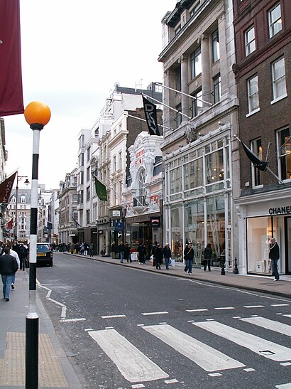
28 South Molton Street, London, England, United Kingdom
This station serves Transport for London’s lines
Bus stops near Bond Street
Popular public transport stations in Mayfair
Get around London by public transport!
Travelling around London has never been so easy. See step by step directions as you travel to any attraction, street or major public transport station. View bus and train timetables, arrival times, service alerts and detailed routes on a map, so you know exactly how to get to anywhere in London.
When travelling to any destination around London use Moovit's Live Directions with Get Off Notifications to know exactly where and how far to walk, how long to wait for your line , and how many stops are left. Moovit will alert you when it’s time to get off — no need to constantly re-check whether yours is the next stop.
Wondering how to use public transport in London or how to pay for public transport in London? Moovit public transport app can help you navigate your way with public transport easily, and at minimum cost. It includes public transport fees, ticket prices, and costs. Looking for a map of London public transport lines? Moovit public transport app shows all public transport maps in London with all Bus, Train, Tube, Tramlink, River Bus and DLR routes and stops on an interactive map.
London has 6 transport type(s), including: Bus, Train, Tube, Tramlink, River Bus and DLR, operated by several transport agencies, including London Underground, London Buses, Transport for London, London Tramlink, National Rail, Bluestar, Berry's Coaches, Oxford Bus Company, Stagecoach West, Community First Wessex, Cresta Coaches, D & P Boat Hire, First Portsmouth, Fareham & Gosport, FYTbus, IFS Cloud Cable Car