Directions to Britannia Royal Naval College (Dartmouth) with public transport
The following transport lines have routes that pass near Britannia Royal Naval College
 Bus: 92, 93, 90.
- Ferry: DARTMOUTH LOWER FERRY, DARTMOUTH HIGHER FERRY.
How to get to Britannia Royal Naval College by bus?
Click on the bus route to see step by step directions with maps, line arrival times and updated time schedules.
Bus stops near Britannia Royal Naval College in Dartmouth
- Coronation Park, 3 min walk,
- Mayor's Avenue, 8 min walk,
Ferry stations near Britannia Royal Naval College in Dartmouth
- Dartmouth Naval College Ferry Terminal, 9 min walk,
- Dartmouth North Embankment Ferry Terminal, 15 min walk,
Bus lines to Britannia Royal Naval College in Dartmouth
- 92, Totnes Opposite Royal Seven Stars Hotel,
- 93, Dartmouth Pontoon,
- 90, Dartmouth P&R,
What are the nearest stations to Britannia Royal Naval College?
The nearest stations to Britannia Royal Naval College are:
- Coronation Park is 208 meters away, 3 min walk.
- Mayor's Avenue is 571 meters away, 8 min walk.
- Dartmouth Naval College Ferry Terminal is 641 meters away, 9 min walk.
- Dartmouth North Embankment Ferry Terminal is 1093 meters away, 15 min walk.
Which bus line stops near Britannia Royal Naval College?
92 (Dartmouth Pontoon)
Which ferry line stops near Britannia Royal Naval College?
DARTMOUTH LOWER FERRY (Kingswear)
What’s the nearest bus station to Britannia Royal Naval College in Dartmouth?
The nearest bus station to Britannia Royal Naval College in Dartmouth is Coronation Park. It’s a 3 min walk away.
What’s the nearest ferry station to Britannia Royal Naval College in Dartmouth?
The nearest ferry station to Britannia Royal Naval College in Dartmouth is Dartmouth Naval College Ferry Terminal. It’s a 9 min walk away.
What time is the first bus to Britannia Royal Naval College in Dartmouth?
The 92 is the first bus that goes to Britannia Royal Naval College in Dartmouth. It stops nearby at 06:05.
What time is the last bus to Britannia Royal Naval College in Dartmouth?
The 90 is the last bus that goes to Britannia Royal Naval College in Dartmouth. It stops nearby at 23:36.
What time is the first ferry to Britannia Royal Naval College in Dartmouth?
The DARTMOUTH HIGHER FERRY is the first ferry that goes to Britannia Royal Naval College in Dartmouth. It stops nearby at 06:30.
What time is the last ferry to Britannia Royal Naval College in Dartmouth?
The DARTMOUTH LOWER FERRY is the last ferry that goes to Britannia Royal Naval College in Dartmouth. It stops nearby at 23:20.
See Britannia Royal Naval College, Dartmouth, on the map
Public Transit to Britannia Royal Naval College in Dartmouth
Wondering how to get to Britannia Royal Naval College in Dartmouth? Moovit helps you find the best way to get to Britannia Royal Naval College with step-by-step directions from the nearest public transit station.
Moovit provides free maps and live directions to help you navigate through your city. View schedules, routes, timetables, and find out how long does it take to get to Britannia Royal Naval College in real time.
Looking for the nearest stop or station to Britannia Royal Naval College? Check out this list of stops closest to your destination: Coronation Park; Mayor's Avenue; Dartmouth Naval College Ferry Terminal; Dartmouth North Embankment Ferry Terminal.
Bus: 92, 93, 90.Ferry: DARTMOUTH LOWER FERRY, DARTMOUTH HIGHER FERRY.
Want to see if there’s another route that gets you there at an earlier time? Moovit helps you find alternative routes or times. Get directions from and directions to Britannia Royal Naval College easily from the Moovit App or Website.
We make riding to Britannia Royal Naval College easy, which is why over 1.5 million users, including users in Dartmouth, trust Moovit as the best app for public transit. You don’t need to download an individual bus app or train app, Moovit is your all-in-one transit app that helps you find the best bus time or train time available.
For information on prices of bus, ferry and train, costs and ride fares to Britannia Royal Naval College, please check the Moovit app.
Use the app to navigate to popular places including to the airport, hospital, stadium, grocery store, mall, coffee shop, school, college, and university.
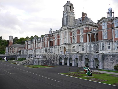
Britannia Royal Naval College Address: Flagstaff Road street in Dartmouth
- Cardtronics,
- The Dartmouth-Kingswear Floating Bridge Company Limited,
- Dart Marina Hotel & Spa,
- The Floating Bridge,
- Mainstay Yacht Maintenance,
- Dartmouth Police Station,
- Greenway Ferry (Greenway & Dittisham Ferry),
- Dartmouth Pontoon,
- Dartmouth,
- Dartmouth North Embankment Ferry Terminal (Quay), Dartmouth,
- Simply Sweets,
- Wildlifeartneilpatey .,
- Number Seven Marinecraft and Storage,
- Dartmouth Passenger Ferry,
- Dartmouth Allotments,
- Will Franks Dartmouth,
- Dart Haven Marina,
- The Fleet Care Home,
- Noss-on-Dart Marina,
- Dartmouth Maso
Places Near Britannia Royal Naval College (Dartmouth)
- The Willows, Torquay,
- Hinkley Point C, Stogursey,
- Dunkertons Cider, Charlton Kings,
- Harbour View Crematorium, Funeral Home & Burial Ground, Bournemouth,
- Great Western Hospital, Liddington,
- Royal Devon & Exeter Hospital, Exeter,
- Nhs Nightingale Hospital, Exeter,
- Royal Eye Infirmary, Plymouth,
- St. Michael's Hospital, Bristol,
- Dock Gate 4 - Passenger Cruise Terminal, Southampton,
- Royal United Hospital, Bath,
- Center Parcs-Longleat Forest, Corsley,
- Ikea, Bristol,
- Hpc Junction 23 Park & Ride, Puriton,
- Southmead Hospital, Bristol,
- Cossham Hospital, Bristol, Bristol,
- The Mall at Cribbs Causeway, Almondsbury,
- Bristol Royal Infirmary, Bristol,
- 1 Bussex Square, Westonzoyland,
- IKEA Exeter, Exeter
How to get to popular places in South West with public transport
Get around Dartmouth by public transport!
Travelling around Dartmouth has never been so easy. See step by step directions as you travel to any attraction, street or major public transport station. View bus and train timetables, arrival times, service alerts and detailed routes on a map, so you know exactly how to get to anywhere in Dartmouth.
When travelling to any destination around Dartmouth use Moovit's Live Directions with Get Off Notifications to know exactly where and how far to walk, how long to wait for your line , and how many stops are left. Moovit will alert you when it’s time to get off — no need to constantly re-check whether yours is the next stop.
Wondering how to use public transport in Dartmouth or how to pay for public transport in Dartmouth? Moovit public transport app can help you navigate your way with public transport easily, and at minimum cost. It includes public transport fees, ticket prices, and costs. Looking for a map of Dartmouth public transport lines? Moovit public transport app shows all public transport maps in Dartmouth with all Bus, Train and Ferry routes and stops on an interactive map.
South West has 3 transport type(s), including: Bus, Train and Ferry, operated by several transport agencies, including National Rail, Stagecoach South, Padstow Harbour Commissioners, Royal Buses, Yeos Contracts, Bennetts, MD Coaches, Newport Bus, First Bristol, Bath & the West, First Kernow, St Mawes Ferry, First Wessex, Dorset & South Somerset, Isles of Scilly Steamship Co, Stagecoach South West and Stagecoach West