How to get to CLS Tech by bus?
Click on the bus route to see step by step directions with maps, line arrival times and updated time schedules.
From Mandurah Railway Station, Mandurah
23 minFrom Atrium Hotel Mandurah, Mandurah
41 minFrom Mandurah Baptist College, Lakelands
81 minFrom Singleton WA Australia, Singleton
84 minFrom Mandurah Catholic College, Dudley Park
50 minFrom Austin Cove Baptist College, West Pinjarra
119 minFrom Lakelands Shopping Centre, Lakelands
68 minFrom Mandurah Visitor Centre, Mandurah
51 minFrom Secret Harbour, Secret Harbour
106 minFrom Dolphin Quay Shops, Mandurah
47 min
Bus stops near CLS Tech in Halls Head
What are the nearest stations to CLS Tech?
The nearest stations to CLS Tech are:
- Old Coast Rd Before Seascapes Bvd is 541 meters away, 7 min walk.
- Peelwood Pde After Sugarwood Tce is 546 meters away, 7 min walk.
Which bus lines stop near CLS Tech?
These bus lines stop near CLS Tech: 592, 593.
What’s the nearest bus station to CLS Tech in Halls Head?
The nearest bus stations to CLS Tech in Halls Head are Old Coast Rd Before Seascapes Bvd and Peelwood Pde After Sugarwood Tce. The closest one is a 7 min walk away.
What time is the first bus to CLS Tech in Halls Head?
The 594 is the first bus that goes to CLS Tech in Halls Head. It stops nearby at 05:07.
What time is the last bus to CLS Tech in Halls Head?
The 594 is the last bus that goes to CLS Tech in Halls Head. It stops nearby at 21:04.
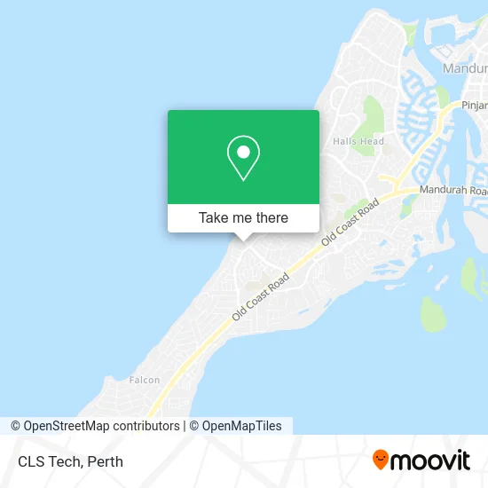
See CLS Tech, Halls Head, on the map
Public Transit to CLS Tech in Halls Head
Wondering how to get to CLS Tech in Halls Head? Moovit helps you find the best way to get to CLS Tech with step-by-step directions from the nearest public transit station.
Moovit provides free maps and live directions to help you navigate through your city. View schedules, routes, timetables, and find out how long does it take to get to CLS Tech in real time.
Looking for the nearest stop or station to CLS Tech? Check out this list of stops closest to your destination: Old Coast Rd Before Seascapes Bvd; Peelwood Pde After Sugarwood Tce.
Bus: 592, 593, 594.
Want to see if there’s another route that gets you there at an earlier time? Moovit helps you find alternative routes or times. Get directions from and directions to CLS Tech easily from the Moovit App or Website.
We make riding to CLS Tech easy, which is why over 1.5 million users, including users in Halls Head, trust Moovit as the best app for public transit. You don’t need to download an individual bus app or train app, Moovit is your all-in-one transit app that helps you find the best bus time or train time available.
For information on prices of bus and train, costs and ride fares to CLS Tech, please check the Moovit app.
Use the app to navigate to popular places including to the airport, hospital, stadium, grocery store, mall, coffee shop, school, college, and university.
CLS Tech Address: Boardwalk Blvd Halls Head WA 6210 street in Halls Head
- Cashcard,
- Spill the Beans at Seascapes,
- Pizza-Gelato,
- Boho by the Sea,
- Seascapes Fish & Chips,
- Seascapes Apartments,
- Veronika Sajova Photography,
- Harcourts Mandurah,
- Microfinish 4 Painting,
- Geographe Landscapes,
- Wellness for Work,
- Beach House at Seascapes,
- Harcourts Mandurah,
- Driveritchie Driving School Mandurah Driving les,
- The Little Soccer Co,
- Nail Artistry by Matilda,
- Simons Carpentry and Building Services,
- Tree Park,
- Harcourts Mandurah,
- Camith Store
Places Near CLS Tech (Halls Head)
- Fiona Stanley Hospital, Murdoch,
- Perth Convention Exhibition Centre, Perth,
- Rac Arena, Perth,
- Optus Stadium, Burswood,
- Yankee Mart, Baldivis,
- Blue Boat House,
- Royal Perth Hospital, Perth,
- Westfield Carousel, Cannington,
- Mount Hospital, Perth,
- Crown Perth Casino, Burswood,
- Sir Charles Gairdner Hospital, Nedlands,
- DFO, Perth Airport,
- Scitech, West Perth,
- Karrinyup Shopping Centre, Karrinyup,
- McCallum Park, Victoria Park,
- Pelicaan Investment Ho, Bellevue,
- Hillarys Boat Harbour,
- Aqwa Aquarium, Hillarys,
- Langley Park, Perth,
- IKEA, Innaloo
How to get to popular places in Perth with public transport
Get around Halls Head by public transport!
Travelling around Halls Head has never been so easy. See step by step directions as you travel to any attraction, street or major public transport station. View bus and train timetables, arrival times, service alerts and detailed routes on a map, so you know exactly how to get to anywhere in Halls Head.
When travelling to any destination around Halls Head use Moovit's Live Directions with Get Off Notifications to know exactly where and how far to walk, how long to wait for your line , and how many stops are left. Moovit will alert you when it’s time to get off — no need to constantly re-check whether yours is the next stop.
Wondering how to use public transport in Halls Head or how to pay for public transport in Halls Head? Moovit public transport app can help you navigate your way with public transport easily, and at minimum cost. It includes public transport fees, ticket prices, and costs. Looking for a map of Halls Head public transport lines? Moovit public transport app shows all public transport maps in Halls Head with all Bus, Train and Ferry routes and stops on an interactive map.
Perth has 3 transport type(s), including: Bus, Train and Ferry, operated by several transport agencies, including Transperth Rail, Transwa, Transperth Ferry, Transperth, TransBusselton, TransAlbany, TransGoldfields, TransEsperance, TransGeraldton, TransCarnarvon, TransHedland, TransKarratha, TransBunbury, Mandurah Bus Charter and TransBroome