Directions to Cardiff Central Police Station with public transportation
The following transport lines have routes that pass near Cardiff Central Police Station
How to get to Cardiff Central Police Station by bus?
Click on the bus route to see step by step directions with maps, line arrival times and updated time schedules.
How to get to Cardiff Central Police Station by train?
Click on the train route to see step by step directions with maps, line arrival times and updated time schedules.
Bus stations near Cardiff Central Police Station
- Law Courts Stop Rj, Cathays Park, 3 min walk,
- Greyfriars Road Gh, Cardiff, 5 min walk,
- Greyfriars Road Stop Gn, Cardiff, 6 min walk,
- Kingsway Ga, Cardiff Castle, 6 min walk,
- Kingsway Gb, Cardiff Castle, 6 min walk,
- Cathays, 11 min walk,
Train stations near Cardiff Central Police Station
- Cardiff Central, 33 min walk,
Bus routes to Cardiff Central Police Station
- SKY, Cardiff City Centre - Cardiff Bay,
- X, Cardiff - Senghenydd,
- T4, Merthyr Tydfil - Cardiff,
- T14, Merthyr Tydfil - Cardiff,
- 21, Cardiff City Centre - Pantmawr,
- 23, Cardiff City Centre - Pantmawr,
- 25, Cardiff City Centre - Llandaff North (Circular) via Llandaff,
- 26, Cardiff - Blackwood,
- 27, Cardiff - Cardiff via Gabalfa Flyover, Templeton Avenue, Excalibur Drive,
- X30, Newport - Cardiff via University Hospital (Heath),
- X32, Maerdy - Cardiff,
- 35, Cardiff City Centre - Gabalfa via North Road,
- 61, Aberdare - Cardiff,
- 132, Maerdy - Cardiff,
- 136, Cardiff City Centre - Creigiau via Whitchurch,
- 400, Gwaunmiskin - Cardiff,
- X3, Cardiff,
- 9, Heath Hospital - Cardiff Sports Village,
- 11, Cardiff City Centre - Pengam Green via Splott, Tremorfa,
- 28, Cardiff City Centre - Thornhill via Albany Road, Roath Park Lake, Lakeside,
What are the nearest stations to Cardiff Central Police Station?
The nearest stations to Cardiff Central Police Station are:
- Law Courts Stop Rj, Cathays Park is 169 meters away, 3 min walk.
- Greyfriars Road Gh, Cardiff is 342 meters away, 5 min walk.
- Greyfriars Road Stop Gn, Cardiff is 388 meters away, 6 min walk.
- Kingsway Ga, Cardiff Castle is 396 meters away, 6 min walk.
- Kingsway Gb, Cardiff Castle is 411 meters away, 6 min walk.
- Cathays is 790 meters away, 11 min walk.
- Cardiff Central is 2503 meters away, 33 min walk.
Which bus lines stop near Cardiff Central Police Station?
These bus lines stop near Cardiff Central Police Station: 122, 17, 26, 30, 44, 58, 63, 94, 96.
Which train line stops near Cardiff Central Police Station?
TRANSPORT FOR WALES
What’s the nearest bus stop to Cardiff Central Police Station?
The nearest bus stop to Cardiff Central Police Station is Law Courts Stop Rj, Cathays Park. It’s a 3 min walk away.
What time is the first train to Cardiff Central Police Station?
The TRANSPORT FOR WALES is the first train that goes to Cardiff Central Police Station. It stops nearby at 07:44.
What time is the last train to Cardiff Central Police Station?
The TRANSPORT FOR WALES is the last train that goes to Cardiff Central Police Station. It stops nearby at 00:31.
What time is the first bus to Cardiff Central Police Station?
The 57 is the first bus that goes to Cardiff Central Police Station. It stops nearby at 05:49.
What time is the last bus to Cardiff Central Police Station?
The TRANSPORT FOR WALES is the last bus that goes to Cardiff Central Police Station. It stops nearby at 01:17.
See Cardiff Central Police Station on the map
Public Transportation to Cardiff Central Police Station
Wondering how to get to Cardiff Central Police Station, United Kingdom? Moovit helps you find the best way to get to Cardiff Central Police Station with step-by-step directions from the nearest public transit station.
Moovit provides free maps and live directions to help you navigate through your city. View schedules, routes, timetables, and find out how long does it take to get to Cardiff Central Police Station in real time.
Looking for the nearest stop or station to Cardiff Central Police Station? Check out this list of stops closest to your destination: Law Courts Stop Rj; Greyfriars Road Gh; Greyfriars Road Stop Gn; Kingsway Ga; Kingsway Gb; Cathays; Cardiff Central.
Bus: 122, 17, 26, 30, 44, 58, 63, 94, 96, SKY, X, T4, T14, 21, X3, 9, 11, 28, 29, 24, 95.Train: TRANSPORT FOR WALES, CROSSCOUNTRY, GREAT WESTERN RAILWAY.
Want to see if there’s another route that gets you there at an earlier time? Moovit helps you find alternative routes or times. Get directions from and directions to Cardiff Central Police Station easily from the Moovit App or Website.
We make riding to Cardiff Central Police Station easy, which is why over 1.5 million users, including users in Cardiff, trust Moovit as the best app for public transit. You don’t need to download an individual bus app or train app, Moovit is your all-in-one transit app that helps you find the best bus time or train time available.
For information on prices of bus and train, costs and ride fares to Cardiff Central Police Station, please check the Moovit app.
Use the app to navigate to popular places including to the airport, hospital, stadium, grocery store, mall, coffee shop, school, college, and university.
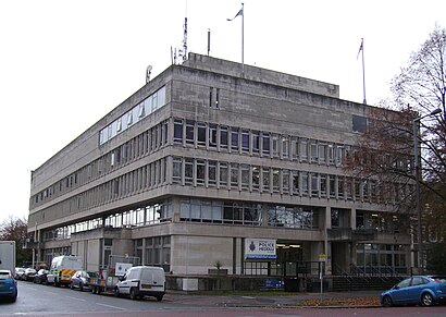
Cardiff Central Police Station Address: King Edward VII Avenue street in Cardiff
Attractions near Cardiff Central Police Station
Winter Wonderland Ice Rink,Raoul Wallenberg Memorial,Glamorgan Building,Cardiff University - Glamorgan Building,Cardiff Crown Court,Cathays Park Law Courts Stop RJ,Castle Mews,National Museum,CF10 3ND,Cardiff Collection,Admiral,Cathays Park,Cardiff Lawn Tennis Club,Cardiff School of Journalism (JOMEC),Cardiff City Hall,Cardiff University Bute Building,Bute Park - Castle North Gate Entrance,400E Beddau/Cardiff,Kingsway Bus Stop,Cardiff Civic CentreHow to get to popular attractions in Cardiff with public transportation
Ibis Budget, Cardiff,Cardiff Gate Retail Park, Cardiff,Bangor Railway Station (BNG), Gwynedd,Castle Bingo, Rhondda Cynon Taf,Hadfield Road, Cardiff,Memory Lane Cakes, Cardiff,Office for National Statistics, Newport,Walnut Tree Farm Park, Newport,Queen Elizabeth High School, Carmarthenshire,Corwen, Conwy,Bute Park, Cardiff,Fabian Way, Swansea,Dolgellau, Gwynedd,The Grange, Caerphilly,Whitmore High School, The Vale Of Glamorgan,Abereiddy, Pembrokeshire,Penrhyn Bay Community Centre, Conwy,Clyne Gardens, Swansea,Broughton Shopping Park,Gower College - Tycoch Campus, SwanseaGet around Wales by public transport!
Travelling around Wales has never been so easy. See step by step directions as you travel to any attraction, street or major public transport station. View bus and train timetables, arrival times, service alerts and detailed routes on a map, so you know exactly how to get to anywhere in Wales.
When travelling to any destination around Wales use Moovit's Live Directions with Get Off Notifications to know exactly where and how far to walk, how long to wait for your line , and how many stops are left. Moovit will alert you when it’s time to get off — no need to constantly re-check whether yours is the next stop.
Wondering how to use public transport in Wales or how to pay for public transport in Wales? Moovit public transport app can help you navigate your way with public transport easily, and at minimum cost. It includes public transport fees, ticket prices, and costs. Looking for a map of Wales public transport lines? Moovit public transport app shows all public transport maps in Wales with all Bus and Train routes and stops on an interactive map.
Wales has 2 transport type(s), including: Bus and Train, operated by several transport agencies, including National Rail, O R Jones, M & H Coaches, Peyton Travel, Gwynfor Coaches, Nefyn, Edwards Coaches, Cardiff Bus, Pembrokeshire County Council, Crickhowell Taxis, Village & Valleys Travel, South Wales Transport, Forge Travel, Sarah Bell, Phil Anslow Travel