Castle Steps, Inverness stop - Saturday schedule
| Line | Direction | Time |
|---|---|---|
| 302 | Foyers | 08:11 |
| 302 | Foyers | 12:27 |
| 302 | Foyers | 17:49 |
Directions to Castle Steps, Inverness stop with public transport
The following transport lines have routes that pass near Castle Steps, Inverness
 Bus: 10, 112, 17, X99, 302.
- Train: SCOTRAIL, CALEDONIAN SLEEPER, LONDON NORTH EASTERN RAILWAY.
How to get to Castle Steps, Inverness stop by bus?
Click on the bus route to see step by step directions with maps, line arrival times and updated time schedules.
How to get to Castle Steps, Inverness stop by train?
Click on the train route to see step by step directions with maps, line arrival times and updated time schedules.
Bus stops near Castle Steps, Inverness stop
- Castle Road, Inverness, 1 min walk,
- Bridge Street, Inverness, 2 min walk,
- Town House, Inverness, 2 min walk,
- King Street, Inverness, 3 min walk,
- Union Street, Inverness, 4 min walk,
- St Josephs School, Inverness, 5 min walk,
- Queensgate, Inverness, 5 min walk,
- Abbey National, Inverness, 6 min walk,
Train stations near Castle Steps, Inverness station
- Inverness, 7 min walk,
Bus lines to Castle Steps, Inverness stop
- 302, Foyers,
- 7, Inverness - Holm,
- 16, Torvean - Holm,
- 14, Whitebridge - Inverness,
- 14A, Inverness - Whitebridge,
- 107, Culduthel - Inverness,
- 2, Inverness [Craig Dunain] - Woodside Village,
- 8, Inverness Academy Street - Dalneigh Limetree Avenue,
- 17, Inverness [Bus Station] - Drumnadrochit,
- 106, Inverness (Circular),
- 307, Inverness - Beauly,
- 307A, Inverness - Kiltarlity,
- 312, Inverness,
- E6, Inverness - Thurso,
- E7, Bridge of Don - Inverness,
- E8, Inverness - Glasgow,
- E9, Edinburgh - Inverness,
- E14, Inverness - Oban,
- E14, Fort William - Inverness,
- 112, Culloden Moor,
What are the nearest stations to Castle Steps, Inverness?
The nearest stations to Castle Steps, Inverness are:
- Castle Road, Inverness is 38 meters away, 1 min walk.
- Bridge Street, Inverness is 88 meters away, 2 min walk.
- Town House, Inverness is 109 meters away, 2 min walk.
- King Street, Inverness is 210 meters away, 3 min walk.
- Union Street, Inverness is 260 meters away, 4 min walk.
- St Josephs School, Inverness is 350 meters away, 5 min walk.
- Queensgate, Inverness is 366 meters away, 5 min walk.
- Abbey National, Inverness is 400 meters away, 6 min walk.
- Inverness is 501 meters away, 7 min walk.
Which bus lines stop near Castle Steps, Inverness?
These bus lines stop near Castle Steps, Inverness: 10, 112, 17, X99.
Which train line stops near Castle Steps, Inverness?
SCOTRAIL (Inverness)
What’s the nearest train station to Castle Steps, Inverness?
The nearest train station to Castle Steps, Inverness is Inverness. It’s a 7 min walk away.
What’s the nearest bus station to Castle Steps, Inverness?
The nearest bus station to Castle Steps, Inverness is Castle Road, Inverness. It’s a 1 min walk away.
What time is the first train to Castle Steps, Inverness?
The SCOTRAIL is the first train that goes to Castle Steps, Inverness. It stops nearby at 04:54.
What time is the last train to Castle Steps, Inverness?
The CALEDONIAN SLEEPER is the last train that goes to Castle Steps, Inverness. It stops nearby at 08:45.
What time is the first bus to Castle Steps, Inverness?
The E9 is the first bus that goes to Castle Steps, Inverness. It stops nearby at 03:17.
What time is the last bus to Castle Steps, Inverness?
The E9 is the last bus that goes to Castle Steps, Inverness. It stops nearby at 05:56.
Castle Steps, Inverness station
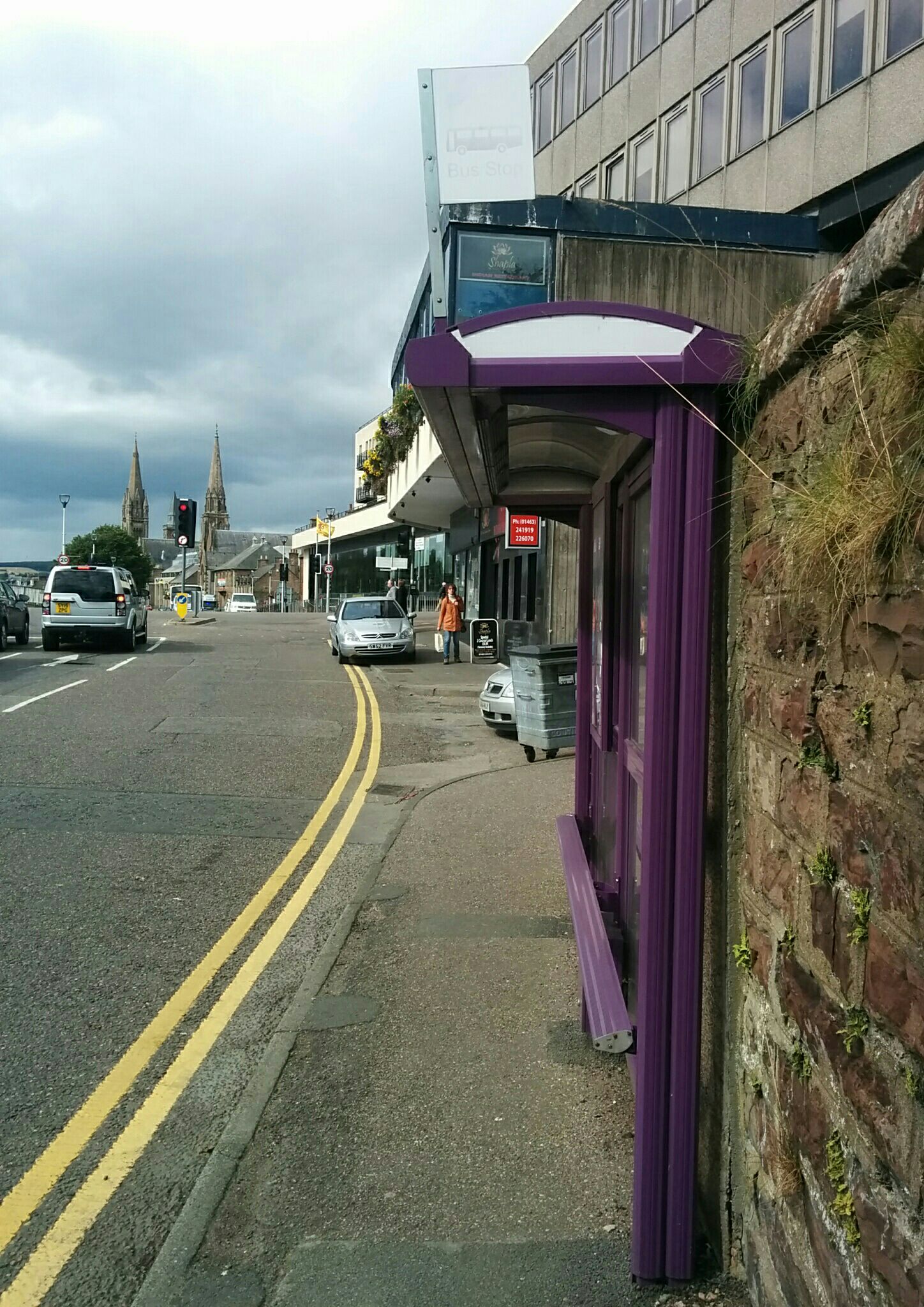 Taken by Gidy B.
See Castle Steps, Inverness stop on the map
Public transport to Castle Steps, Inverness stop (ID: 6700713967)
Looking for directions to Castle Steps, Inverness in Inverness, United Kingdom?
Download the Moovit App to find the current schedule and step-by-step directions for Bus or Train routes that pass through Castle Steps, Inverness.
Looking for the nearest stops closest to Castle Steps, Inverness ? Check out this list of closest stops to your destination: Castle Road; Bridge Street; Town House; King Street; Union Street; St Josephs School; Queensgate; Abbey National; Inverness.
Bus: 10, 112, 17, X99, 302, 7, 16, 14, 14A, 107, 2, 8, 106, 307, 312.Train: SCOTRAIL, CALEDONIAN SLEEPER, LONDON NORTH EASTERN RAILWAY.
We make riding on public transit to Castle Steps, Inverness easy, which is why over 1.5 million users, including users in Inverness trust Moovit as the best app for public transit.
Use the app to navigate to popular places including to the airport, hospital, stadium, grocery store, mall, coffee shop, school, college, and university.
Castle Steps, Inverness stop’s code is 6700713967
The first line to this stop is 302, at 08:11, and the last line is 302 at 17:49.
2 Castle Road, Inverness, Scotland, United Kingdom
This stop serves Highland Council’s lines
Popular routes from Castle Steps, Inverness stop
- To Queen Margaret University,
- To UWS Ayr Campus,
- To Oxgangs,
- To DJCAD, University of Dundee,
- To University Of Edinburgh - Easter Bush Campus,
- To Edinburgh Napier University - Sighthill Campus,
- To University Of Glasgow,
- To Robert Gordon University,
- To University Of Strathclyde,
- To Edinburgh Napier University - Craiglockhart Campus
- Castle Road, Inverness,
- Bridge Street, Inverness,
- Town House, Inverness,
- King Street, Inverness,
- Union Street, Inverness,
- St Josephs School, Inverness,
- Queensgate, Inverness,
- Abbey National, Inverness
Bus stops near Castle Steps, Inverness stop
- Inverness
Train station near Castle Steps, Inverness station
- Station, Dufftown,
- Kirkwall Orkney Ferry Terminal, Kirkwall,
- Barnhill,
- Renfield Street, Glasgow,
- Royal Infirmary, Edinburgh Royal Infirmary,
- Loch Lomond Golf Course, Luss,
- Tantallon Caravan Park, North Berwick,
- Douglas Street, Ayr,
- Meadowbank Stadium, Meadowbank,
- Dalhousie Street, Glasgow,
- Colintraive Ferry Terminal, Colintraive,
- High Street, Perth,
- Edinburgh Park Station (Edinburgh Trams), Edinburgh Park,
- West Mains Industrial Estate, Grangemouth,
- Meadow Place Road, Corstorphine,
- Stobhill Hospital, Springburn,
- Redcastle Square, Garthamlock,
- Kennacraig Ferry Terminal, Kennacraig,
- North Queensferry,
- Paisley Gilmour Street
Popular public transport stations in Inverness
Get around Inverness by public transport!
Travelling around Inverness has never been so easy. See step by step directions as you travel to any attraction, street or major public transport station. View bus and train timetables, arrival times, service alerts and detailed routes on a map, so you know exactly how to get to anywhere in Inverness.
When travelling to any destination around Inverness use Moovit's Live Directions with Get Off Notifications to know exactly where and how far to walk, how long to wait for your line , and how many stops are left. Moovit will alert you when it’s time to get off — no need to constantly re-check whether yours is the next stop.
Wondering how to use public transport in Inverness or how to pay for public transport in Inverness? Moovit public transport app can help you navigate your way with public transport easily, and at minimum cost. It includes public transport fees, ticket prices, and costs. Looking for a map of Inverness public transport lines? Moovit public transport app shows all public transport maps in Inverness with all Bus, Train, Light rail and Ferry routes and stops on an interactive map.
Scotland has 4 transport type(s), including: Bus, Train, Light rail and Ferry, operated by several transport agencies, including First Greater Glasgow, First Aberdeen, Lothian Buses, McGill's, Stagecoach East Scotland, Stagecoach Bluebird, Xplore Dundee, Community Transport Glasgow, Prentice Westwood, McCall's Coaches, J P Minibus, National Rail, R Robertson & Son, Burnbrae Garage and Ember