How to get to Chermside Library by bus?
Click on the bus route to see step by step directions with maps, line arrival times and updated time schedules.
How to get to Chermside Library by train?
Click on the train route to see step by step directions with maps, line arrival times and updated time schedules.
Bus stops near Chermside Library
- Hamilton Rd at Playfield Street, Stop 37a, 3 min walk,VIEW
- Hamilton Rd at Chermside Rsl, Stop 53, 3 min walk,VIEW
- Kingsmill St at Miller Street, 5 min walk,VIEW
- Chermside Shopping Centre Interchange F, 5 min walk,VIEW
- Chermside Shopping Centre Interchange E, 6 min walk,VIEW
- Chermside Interchange, 6 min walk,VIEW
Train stations near Chermside Library
Bus routes to Chermside Library
- 320, Chermside - City Via Wavell Heights,VIEW
- 322, Chermside - City Via Toombul,VIEW
- 334, Chermside - City Via Kedron,VIEW
- 336, Chermside Clockwise Loop,VIEW
- 354, Mitchelton - Chermside,VIEW
- 325, City, Queen St,VIEW
- 337, Chermside Interchange,VIEW
- 308, Toombul Interchange,VIEW
- 77, Eight Mile Plains Station,VIEW
- 335, Sandgate Station,VIEW
- 599, Carindale Interchange,VIEW
- 680, Redcliffe,VIEW
- 330, Bracken Ridge, Quinlan St,VIEW
- N339, Bracken Ridge, Barrett St,VIEW
- 340, Carseldine Station,VIEW
- 333, Chermside - Woolloongabba Via City,VIEW
- 338, City - Chermside,VIEW
- 353, Chermside - City Via Mcdowall,VIEW
- 358, Strathpine - Chermside,VIEW
- 598, Great Circle Line Anti-clockwise,VIEW
What are the nearest stations to Chermside Library?
The nearest stations to Chermside Library are:
- Hamilton Rd at Playfield Street, Stop 37a is 132 meters away, 3 min walk.
- Hamilton Rd at Chermside Rsl, Stop 53 is 147 meters away, 3 min walk.
- Kingsmill St at Miller Street is 291 meters away, 5 min walk.
- Chermside Shopping Centre Interchange F is 353 meters away, 5 min walk.
- Chermside Shopping Centre Interchange E is 379 meters away, 6 min walk.
- Chermside Interchange is 385 meters away, 6 min walk.
- Sunshine Station is 3107 meters away, 40 min walk.
- Nundah Station is 3810 meters away, 49 min walk.
Which bus lines stop near Chermside Library?
These bus lines stop near Chermside Library: 320, 330, 333, 340, 358, 77.
Which train line stops near Chermside Library?
SPRP (Kippa-Ring Station)
What’s the nearest bus station to Chermside Library?
The nearest bus stations to Chermside Library are Hamilton Rd at Playfield Street, Stop 37a and Hamilton Rd at Chermside Rsl, Stop 53. The closest one is a 3 min walk away.
What time is the first train to Chermside Library?
The RPSP is the first train that goes to Chermside Library. It stops nearby at 04:18.
What time is the last train to Chermside Library?
The SHBR is the last train that goes to Chermside Library. It stops nearby at 00:29.
What time is the first bus to Chermside Library?
The 333 is the first bus that goes to Chermside Library. It stops nearby at 05:00.
What time is the last bus to Chermside Library?
The 325 is the last bus that goes to Chermside Library. It stops nearby at 00:16.
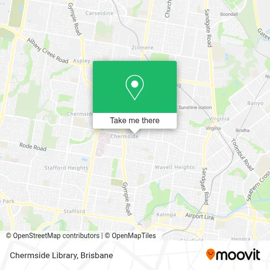
See Chermside Library on the map
Public Transportation to Chermside Library
Wondering how to get to Chermside Library? Moovit helps you find the best way to get to Chermside Library with step-by-step directions from the nearest public transit station.
Moovit provides free maps and live directions to help you navigate through your city. View schedules, routes, timetables, and find out how long does it take to get to Chermside Library in real time.
Looking for the nearest stop or station to Chermside Library? Check out this list of stops closest to your destination: Hamilton Rd at Playfield Street; Hamilton Rd at Chermside Rsl; Kingsmill St at Miller Street; Chermside Shopping Centre Interchange F; Chermside Shopping Centre Interchange E; Chermside Interchange; Sunshine Station; Nundah Station.
Bus: 320, 330, 333, 340, 358, 77, 322, 334, 336, 354, 325, 337, 308.Train: SPRP, BRCA, BRRP, CABR, RPBR, RPSP, BNSH, BRSH, CLSH, IPSH, SHBN.
Want to see if there’s another route that gets you there at an earlier time? Moovit helps you find alternative routes or times. Get directions from and directions to Chermside Library easily from the Moovit App or Website.
We make riding to Chermside Library easy, which is why over 1.5 million users, including users in Chermside, trust Moovit as the best app for public transit. You don’t need to download an individual bus app or train app, Moovit is your all-in-one transit app that helps you find the best bus time or train time available.
For information on prices of bus and train, costs and ride fares to Chermside Library, please check the Moovit app.
Use the app to navigate to popular places including to the airport, hospital, stadium, grocery store, mall, coffee shop, school, college, and university.
Chermside Library Address: Hamilton Road street in Chermside
- Kedron Wavell RSL Sub Branch,
- Stafford Heights Toastmasters,
- Sacha Drake Westfield Chermside,
- World Expo 88 Art Trail,
- Chermside Aquatic Centre,
- Kedron-Wavell Services Club,
- Foley Fitness,
- Westfield,
- Prince Charles Hospital,
- Chermside Day Hospital,
- Quest Chermside on Playfield Brisbane,
- Bob & Michael's Chemworld,
- Hanaromart Chermside,
- Napoleon Perdis,
- Smokemart & Giftbox,
- Happy Dough,
- ATMx Westfield Chermside 3,
- Black Pepper,
- Hairhouse,
- Br Halliday Medical
Places Near Chermside Library
- Queen Street Station Platform 3, City,
- Kangaroo Point, Kangaroo Point,
- The Star Gold Coast Hotel & Casino, Broadbeach,
- Queen Street Mall, City,
- The Gabba , Woolloongabba,
- The Triffid, Newstead,
- Prince Charles Hospital, Chermside,
- Royal Brisbane & Women's Hospital (RBWH), Herston,
- Pat Rafter Arena, Tennyson,
- Stars, Herston,
- Brisbane Showgrounds, Bowen Hills,
- QUT Gardens Point, City,
- Westfield Chermside, Chermside,
- Southport Sharks, Southport,
- St Andrew's Hospital, Spring Hill,
- Twelfth Night Theatre, Bowen Hills,
- Felons Brewing Co., Fortitude Valley,
- Casino, City,
- Greenslopes Private Hospital, Greenslopes,
- Brisbane Riverstage, City
How to get to popular places in Brisbane with public transport
Get around Chermside by public transport!
Travelling around Chermside has never been so easy. See step by step directions as you travel to any attraction, street or major public transport station. View bus and train timetables, arrival times, service alerts and detailed routes on a map, so you know exactly how to get to anywhere in Chermside.
When travelling to any destination around Chermside use Moovit's Live Directions with Get Off Notifications to know exactly where and how far to walk, how long to wait for your line , and how many stops are left. Moovit will alert you when it’s time to get off — no need to constantly re-check whether yours is the next stop.
Wondering how to use public transport in Chermside or how to pay for public transport in Chermside? Moovit public transport app can help you navigate your way with public transport easily, and at minimum cost. It includes public transport fees, ticket prices, and costs. Looking for a map of Chermside public transport lines? Moovit public transport app shows all public transport maps in Chermside with all Bus, Train, Light rail and Ferry routes and stops on an interactive map.
Brisbane has 4 transport type(s), including: Bus, Train, Light rail and Ferry, operated by several transport agencies, including TransLink SEQ, TransLink, Christensens Bus and Coach and North Stradbroke Island Buses