Directions to Colley Gate, Colley Gate (Cradley And Wollescote) with public transport
The following transport lines have routes that pass near Colley Gate, Colley Gate
 Bus: 9, X21, 002, 142, 142A.
- Train: WEST MIDLANDS RAILWAY, CHILTERN RAILWAYS.
How to get to Colley Gate, Colley Gate by bus?
Click on the bus route to see step by step directions with maps, line arrival times and updated time schedules.
From Hallam Street Hospital, West Bromwich Central
80 minFrom Leonard Deacon Lecture Theatre, Edgbaston
61 minFrom B69 3du, Oldbury
58 minFrom University Of Birmingham Vincent Drive Car Park, Edgbaston
61 minFrom M&S Longbridge, Rubery & Rednal
87 minFrom Guru Nanak Gurdwara Smethwick, Smethwick
58 minFrom Showcase Cinemas, Castle And Priory
57 minFrom St Paul's School For Girls, North Edgbaston
39 minFrom Hagley Road, Edgbaston
32 minFrom Gornalwood Crematorium, Gornal
65 min
How to get to Colley Gate, Colley Gate by train?
Click on the train route to see step by step directions with maps, line arrival times and updated time schedules.
Bus stops near Colley Gate, Colley Gate in Cradley And Wollescote
Train station near Colley Gate, Colley Gate in Cradley And Wollescote
- Stourbridge Junction, 11 min walk,VIEW
Bus lines to Colley Gate, Colley Gate in Cradley And Wollescote
What are the nearest stations to Colley Gate, Colley Gate?
The nearest stations to Colley Gate, Colley Gate are:
- Foredraft Street is 176 meters away, 3 min walk.
- Drews Holloway is 260 meters away, 4 min walk.
- Park Lane is 455 meters away, 7 min walk.
- Butchers Lane is 515 meters away, 7 min walk.
- Stourbridge Junction is 857 meters away, 11 min walk.
Which bus lines stop near Colley Gate, Colley Gate?
These bus lines stop near Colley Gate, Colley Gate: 9, X21.
Which train line stops near Colley Gate, Colley Gate?
WEST MIDLANDS RAILWAY (Worcester Foregate Street)
What’s the nearest train station to Colley Gate, Colley Gate in Cradley And Wollescote?
The nearest train station to Colley Gate, Colley Gate in Cradley And Wollescote is Stourbridge Junction. It’s a 11 min walk away.
What’s the nearest bus station to Colley Gate, Colley Gate in Cradley And Wollescote?
The nearest bus station to Colley Gate, Colley Gate in Cradley And Wollescote is Foredraft Street. It’s a 3 min walk away.
What time is the first train to Colley Gate, Colley Gate in Cradley And Wollescote?
The WEST MIDLANDS RAILWAY is the first train that goes to Colley Gate, Colley Gate in Cradley And Wollescote. It stops nearby at 09:40.
What time is the last train to Colley Gate, Colley Gate in Cradley And Wollescote?
The WEST MIDLANDS RAILWAY is the last train that goes to Colley Gate, Colley Gate in Cradley And Wollescote. It stops nearby at 23:22.
What time is the first bus to Colley Gate, Colley Gate in Cradley And Wollescote?
The 9 is the first bus that goes to Colley Gate, Colley Gate in Cradley And Wollescote. It stops nearby at 06:12.
What time is the last bus to Colley Gate, Colley Gate in Cradley And Wollescote?
The 9 is the last bus that goes to Colley Gate, Colley Gate in Cradley And Wollescote. It stops nearby at 01:56.
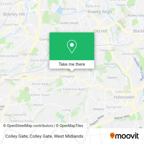
See Colley Gate, Colley Gate, Cradley And Wollescote, on the map
Public Transit to Colley Gate, Colley Gate in Cradley And Wollescote
Wondering how to get to Colley Gate, Colley Gate in Cradley And Wollescote? Moovit helps you find the best way to get to Colley Gate, Colley Gate with step-by-step directions from the nearest public transit station.
Moovit provides free maps and live directions to help you navigate through your city. View schedules, routes, timetables, and find out how long does it take to get to Colley Gate, Colley Gate in real time.
Looking for the nearest stop or station to Colley Gate, Colley Gate? Check out this list of stops closest to your destination: Foredraft Street; Drews Holloway; Park Lane; Butchers Lane; Stourbridge Junction.
Bus: 9, X21, 002, 142, 142A, 13, 18.Train: WEST MIDLANDS RAILWAY, CHILTERN RAILWAYS.
Want to see if there’s another route that gets you there at an earlier time? Moovit helps you find alternative routes or times. Get directions from and directions to Colley Gate, Colley Gate easily from the Moovit App or Website.
We make riding to Colley Gate, Colley Gate easy, which is why over 1.7 million users, including users in Cradley And Wollescote, trust Moovit as the best app for public transit. You don’t need to download an individual bus app or train app, Moovit is your all-in-one transit app that helps you find the best bus time or train time available.
For information on prices of bus and train, costs and ride fares to Colley Gate, Colley Gate, please check the Moovit app.
Use the app to navigate to popular places including to the airport, hospital, stadium, grocery store, mall, coffee shop, school, college, and university.
Colley Gate, Colley Gate Address: 10 Maple Tree Lane Halesowen Halesowen B63 2BN street in Cradley And Wollescote
- Laurels Crown Green Bowling Club,
- Colley Lane,
- Elms Health Centre,
- cradley sports and social club,
- Homer Hill Park,
- B63 2dq,
- Soccer Zone - Halesowen,
- Davries,
- Ramsey Healthcare UK,
- Banners Lane and Century,
- West Midlands Hospital Ramsay Health Care,
- Shirley Aquatics Limited,
- 49 Meres Road,
- Classic Physiques Gym,
- The Mary Stevens Hospi,
- CM Services (Collygate),
- Motor Fuel,
- Timbertree Estate, Cradley,
- Stonecraft Paving Centre,
- Cradley Town Fc
Places Near Colley Gate, Colley Gate (Cradley And Wollescote)
- Birmingham Dental Hospital, Edgbaston,
- Wolstanton Retail Park, Wolstanton,
- Heritage Building (Queen Elizabeth Hospital), Edgbaston,
- Birmingham And Midland Eye Centre, Soho & Jewellery Quarter,
- IKEA Wednesbury, Oldbury,
- Bickerstaff Endoscopy Unit (PRH), Apley Castle,
- One Stop Shopping Centre, Perry Barr,
- Studley Castle, Studley,
- Tally Ho Police Training, Birmingham, Edgbaston,
- Crown Wharf Retail Park, St. Matthew's,
- Fort Shopping Centre, Birmingham, Pype Hayes,
- Royal Orthopaedic Hospital, Northfield,
- Woodlands Cemetery And Crematorium, Coleshill North,
- Lilleshall Hall National Sports Centre, Telford,
- Boundary Mill Stores, Bentley And Darlaston North,
- IKEA Birmingham Central, Ladywood,
- Travelodge Birmingham Airport Hotel Birmingham, Bickenhill,
- Waseley Hills Crematorium, Frankley Great Park,
- Bournville Staff Shop (Cadbury World), Bournville & Cotteridge,
- The Merry Hill Centre, Brierley Hill
How to get to popular places in West Midlands with public transport
Get around Cradley And Wollescote by public transport!
Travelling around Cradley And Wollescote has never been so easy. See step by step directions as you travel to any attraction, street or major public transport station. View bus and train timetables, arrival times, service alerts and detailed routes on a map, so you know exactly how to get to anywhere in Cradley And Wollescote.
When travelling to any destination around Cradley And Wollescote use Moovit's Live Directions with Get Off Notifications to know exactly where and how far to walk, how long to wait for your line , and how many stops are left. Moovit will alert you when it’s time to get off — no need to constantly re-check whether yours is the next stop.
Wondering how to use public transport in Cradley And Wollescote or how to pay for public transport in Cradley And Wollescote? Moovit public transport app can help you navigate your way with public transport easily, and at minimum cost. It includes public transport fees, ticket prices, and costs. Looking for a map of Cradley And Wollescote public transport lines? Moovit public transport app shows all public transport maps in Cradley And Wollescote with all Bus, Train and Light rail routes and stops on an interactive map.
West Midlands has 3 transport type(s), including: Bus, Train and Light rail, operated by several transport agencies, including National Express West Midlands, National Express Coventry, National Express, Diamond Bus, Arriva Midlands, Stagecoach Midlands, West Midlands Metro, Stagecoach West, Stagecoach South Wales, First Potteries, First Worcestershire, LandFlight, trentbarton, D & G Bus and Flexibus