Directions to Corcom (Brookdale) with public transport
The following transport lines have routes that pass near Corcom
 Bus: 249, 250.
- Train: ARMADALE LINE.
How to get to Corcom by bus?
Click on the bus route to see step by step directions with maps, line arrival times and updated time schedules.
From Harrisdale Senior High School, Forrestdale
70 minFrom Southern River, Southern River
105 minFrom ZLR*Cannington, Gosnells
91 minFrom Huntingdale, Huntingdale
120 minFrom Cohunu Koala Park, Byford
60 minFrom Kelmscott Senior High School, Kelmscott
42 minFrom Kelmscott Station, Kelmscott
38 minFrom Jing Tu Temple Western Australia, Kelmscott
43 minFrom Southern River College, Gosnells
79 min
How to get to Corcom by train?
Click on the train route to see step by step directions with maps, line arrival times and updated time schedules.
Bus stops near Corcom in Brookdale
What are the nearest stations to Corcom?
The nearest stations to Corcom are:
- Wungong Rd Before Ninth Rd is 275 meters away, 4 min walk.
- Harber Dr After Ninth Rd is 595 meters away, 8 min walk.
Which bus lines stop near Corcom?
These bus lines stop near Corcom: 249, 250.
Which train line stops near Corcom?
ARMADALE LINE (Byford Stn)
What’s the nearest bus station to Corcom in Brookdale?
The nearest bus station to Corcom in Brookdale is Wungong Rd Before Ninth Rd. It’s a 4 min walk away.
What time is the first bus to Corcom in Brookdale?
The 250 is the first bus that goes to Corcom in Brookdale. It stops nearby at 04:57.
What time is the last bus to Corcom in Brookdale?
The 250 is the last bus that goes to Corcom in Brookdale. It stops nearby at 21:12.
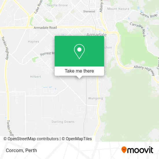
See Corcom, Brookdale, on the map
Public Transit to Corcom in Brookdale
Wondering how to get to Corcom in Brookdale? Moovit helps you find the best way to get to Corcom with step-by-step directions from the nearest public transit station.
Moovit provides free maps and live directions to help you navigate through your city. View schedules, routes, timetables, and find out how long does it take to get to Corcom in real time.
Looking for the nearest stop or station to Corcom? Check out this list of stops closest to your destination: Wungong Rd Before Ninth Rd; Harber Dr After Ninth Rd.
Bus: 249, 250.Train: ARMADALE LINE.
Want to see if there’s another route that gets you there at an earlier time? Moovit helps you find alternative routes or times. Get directions from and directions to Corcom easily from the Moovit App or Website.
We make riding to Corcom easy, which is why over 1.5 million users, including users in Brookdale, trust Moovit as the best app for public transit. You don’t need to download an individual bus app or train app, Moovit is your all-in-one transit app that helps you find the best bus time or train time available.
For information on prices of bus and train, costs and ride fares to Corcom, please check the Moovit app.
Use the app to navigate to popular places including to the airport, hospital, stadium, grocery store, mall, coffee shop, school, college, and university.
Corcom Address: 2 Munday Ave Brookdale WA 6112 street in Brookdale
- Living Well Massage for Women,
- Smitha Aneesh,
- Bpe Enterprise,
- Little Footprints Community Playgroup,
- Kathmandu,
- Rose Valley Cheese Company,
- Ideal Consultants,
- Sunlight Driving School,
- Armadale Concrete Tank,
- Brookdale Family Day Care,
- Armadale Thai Massage Remedial Massage,
- Walco (Aust),
- Pr Scrap Metals,
- Tyreright Armadale,
- Wungong Child Health Centre,
- Bayleys Boilermaking and Welding Services,
- Always Solar,
- A Better Bin Service,
- Footwork Podiatric Laboratory,
- Proshine Automotive Detailing
Places Near Corcom (Brookdale)
- Watertown, Perth,
- McCallum Park, Victoria Park,
- Mount Hospital, Perth,
- Yankee Mart, Baldivis,
- Westfield Carousel, Cannington,
- IKEA, Innaloo,
- Aqwa Aquarium, Hillarys,
- DFO, Perth Airport,
- Perth Convention Exhibition Centre, Perth,
- Blue Boat House,
- Rac Arena, Perth,
- Pelicaan Investment Ho, Bellevue,
- Optus Stadium, Burswood,
- Scitech, West Perth,
- Sir Charles Gairdner Hospital, Nedlands,
- Crown Perth Casino, Burswood,
- Royal Perth Hospital, Perth,
- Fiona Stanley Hospital, Murdoch,
- Langley Park, Perth,
- Karrinyup Shopping Centre, Karrinyup
How to get to popular places in Perth with public transport
Get around Brookdale by public transport!
Travelling around Brookdale has never been so easy. See step by step directions as you travel to any attraction, street or major public transport station. View bus and train timetables, arrival times, service alerts and detailed routes on a map, so you know exactly how to get to anywhere in Brookdale.
When travelling to any destination around Brookdale use Moovit's Live Directions with Get Off Notifications to know exactly where and how far to walk, how long to wait for your line , and how many stops are left. Moovit will alert you when it’s time to get off — no need to constantly re-check whether yours is the next stop.
Wondering how to use public transport in Brookdale or how to pay for public transport in Brookdale? Moovit public transport app can help you navigate your way with public transport easily, and at minimum cost. It includes public transport fees, ticket prices, and costs. Looking for a map of Brookdale public transport lines? Moovit public transport app shows all public transport maps in Brookdale with all Bus, Train and Ferry routes and stops on an interactive map.
Perth has 3 transport type(s), including: Bus, Train and Ferry, operated by several transport agencies, including Transperth Rail, Transwa, Transperth Ferry, Transperth, TransBusselton, TransAlbany, TransGoldfields, TransEsperance, TransGeraldton, TransCarnarvon, TransHedland, TransKarratha, TransBunbury, Mandurah Bus Charter and TransBroome