Directions to Cottesloe Cup with public transportation
The following transport lines have routes that pass near Cottesloe Cup
 Bus: 102, FREMANTLE LINE, 107, 906, 998.
- Train: FREMANTLE LINE.
How to get to Cottesloe Cup by bus?
Click on the bus route to see step by step directions with maps, line arrival times and updated time schedules.
How to get to Cottesloe Cup by train?
Click on the train route to see step by step directions with maps, line arrival times and updated time schedules.
Bus stops near Cottesloe Cup
Bus routes to Cottesloe Cup
What are the nearest stations to Cottesloe Cup?
The nearest stations to Cottesloe Cup are:
- Marine Pde Before Eileen St is 29 meters away, 1 min walk.
- Cottesloe Stn is 469 meters away, 7 min walk.
- Stirling Hwy Before Keane St is 1398 meters away, 18 min walk.
Which bus line stops near Cottesloe Cup?
102 (Claremont Stn)
Which train line stops near Cottesloe Cup?
FREMANTLE LINE (Perth Stn)
What’s the nearest bus station to Cottesloe Cup?
The nearest bus station to Cottesloe Cup is Marine Pde Before Eileen St. It’s a 1 min walk away.
What time is the first train to Cottesloe Cup?
The FREMANTLE LINE is the first train that goes to Cottesloe Cup. It stops nearby at 05:29.
What time is the last train to Cottesloe Cup?
The FREMANTLE LINE is the last train that goes to Cottesloe Cup. It stops nearby at 00:38.
What time is the first bus to Cottesloe Cup?
The 998 is the first bus that goes to Cottesloe Cup. It stops nearby at 05:26.
What time is the last bus to Cottesloe Cup?
The 998 is the last bus that goes to Cottesloe Cup. It stops nearby at 23:12.
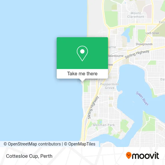
See Cottesloe Cup on the map
Public Transportation to Cottesloe Cup
Wondering how to get to Cottesloe Cup? Moovit helps you find the best way to get to Cottesloe Cup with step-by-step directions from the nearest public transit station.
Moovit provides free maps and live directions to help you navigate through your city. View schedules, routes, timetables, and find out how long does it take to get to Cottesloe Cup in real time.
Looking for the nearest stop or station to Cottesloe Cup? Check out this list of stops closest to your destination: Marine Pde Before Eileen St; Cottesloe Stn; Stirling Hwy Before Keane St.
Bus: 102, FREMANTLE LINE, 107, 906, 998.Train: FREMANTLE LINE.
Want to see if there’s another route that gets you there at an earlier time? Moovit helps you find alternative routes or times. Get directions from and directions to Cottesloe Cup easily from the Moovit App or Website.
We make riding to Cottesloe Cup easy, which is why over 1.5 million users, including users in Cottesloe, trust Moovit as the best app for public transit. You don’t need to download an individual bus app or train app, Moovit is your all-in-one transit app that helps you find the best bus time or train time available.
For information on prices of bus and train, costs and ride fares to Cottesloe Cup, please check the Moovit app.
Use the app to navigate to popular places including to the airport, hospital, stadium, grocery store, mall, coffee shop, school, college, and university.
Cottesloe Cup Address: 87 Marine Pde Cottesloe WA 6011 street in Cottesloe
- Arch Monument,
- Sun Dial,
- Beach,
- Sprout Pilates,
- Sculptures By The Sea - Cottesloe,
- Ebusiness Consultants,
- Indigo Oscar,
- Ol' Buoy,
- Indiana Tea House,
- Cottesloe Beach,
- North Cottesloe Dog Beach,
- Cottesloe Beach Hotel Perth,
- Cottesloe Beach Hotel,
- Town of Cottesloe - No.1 Car Park,
- Cottesloe Beach Club,
- Forrest Street Car Park,
- Overton Blue,
- Arcadia,
- John Street Cafe Cottesloe,
- Constantia
Places Near Cottesloe Cup
- Rac Arena, Perth,
- Royal Perth Hospital, Perth,
- Optus Stadium, Burswood,
- Perth Convention Exhibition Centre, Perth,
- Hillarys Boat Harbour,
- Fiona Stanley Hospital, Murdoch,
- Blue Boat House,
- Langley Park, Perth,
- Mount Hospital, Perth,
- Pelicaan Investment Ho, Bellevue,
- Crown Perth Casino, Burswood,
- Yankee Mart, Baldivis,
- Scitech, West Perth,
- McCallum Park, Victoria Park,
- Aqwa Aquarium, Hillarys,
- DFO, Perth Airport,
- Karrinyup Shopping Centre, Karrinyup,
- Westfield Carousel, Cannington,
- IKEA, Innaloo,
- Sir Charles Gairdner Hospital, Nedlands
How to get to popular places in Perth with public transport
Get around Cottesloe by public transport!
Travelling around Cottesloe has never been so easy. See step by step directions as you travel to any attraction, street or major public transport station. View bus and train timetables, arrival times, service alerts and detailed routes on a map, so you know exactly how to get to anywhere in Cottesloe.
When travelling to any destination around Cottesloe use Moovit's Live Directions with Get Off Notifications to know exactly where and how far to walk, how long to wait for your line , and how many stops are left. Moovit will alert you when it’s time to get off — no need to constantly re-check whether yours is the next stop.
Wondering how to use public transport in Cottesloe or how to pay for public transport in Cottesloe? Moovit public transport app can help you navigate your way with public transport easily, and at minimum cost. It includes public transport fees, ticket prices, and costs. Looking for a map of Cottesloe public transport lines? Moovit public transport app shows all public transport maps in Cottesloe with all Bus, Train and Ferry routes and stops on an interactive map.
Perth has 3 transport type(s), including: Bus, Train and Ferry, operated by several transport agencies, including Transperth Rail, Transwa, Transperth Ferry, Transperth, TransBusselton, TransAlbany, TransGoldfields, TransEsperance, TransGeraldton, TransCarnarvon, TransHedland, TransKarratha, TransBunbury, Mandurah Bus Charter and TransBroome