Directions to Cowley International College (St Helens) with public transport
The following transport lines have routes that pass near Cowley International College
How to get to Cowley International College by bus?
Click on the bus route to see step by step directions with maps, line arrival times and updated time schedules.
How to get to Cowley International College by train?
Click on the train route to see step by step directions with maps, line arrival times and updated time schedules.
Bus stops near Cowley International College in St Helens
- Eaton Road, 1 min walk,
- Rosebery Road, 5 min walk,
- Hammill Street, 5 min walk,
- Gamble Avenue, 6 min walk,
- Windle Hall Drive, 7 min walk,
Train station near Cowley International College in St Helens
- St Helens Central, 24 min walk,
Bus lines to Cowley International College in St Helens
- 787, Windle Hall Drive,
- 37, Church Street,
- 38, Church Street,
- 38A, Church Street,
- C39, Windle, East Lancashire Road,
- 743, Rainford,
- 743, Reeds Brow,
- 754, Rainford High School Internal Grounds,
- 794, Coronation Road,
- 152, St Helens Bridge St,
- 152, St Helens Town Centre,
- 743, Carmel College,
- 786, Rainford High School Internal Grounds,
- 706, Roper Street,
- 716, Elton Head Road,
- 726, Elton Head Road,
- 757, Desford Ave,
- 760, Cowley College,
- 760, Dalehead Place,
- 60, Windle,
What are the nearest stations to Cowley International College?
The nearest stations to Cowley International College are:
- Eaton Road is 40 meters away, 1 min walk.
- Rosebery Road is 322 meters away, 5 min walk.
- Hammill Street is 332 meters away, 5 min walk.
- Gamble Avenue is 380 meters away, 6 min walk.
- Windle Hall Drive is 485 meters away, 7 min walk.
- St Helens Central is 1855 meters away, 24 min walk.
Which bus lines stop near Cowley International College?
These bus lines stop near Cowley International College: 152, 289, 329, 37, 38.
Which train line stops near Cowley International College?
NORTHERN (Wigan North Western)
What’s the nearest train station to Cowley International College in St Helens?
The nearest train station to Cowley International College in St Helens is St Helens Central. It’s a 24 min walk away.
What’s the nearest bus station to Cowley International College in St Helens?
The nearest bus station to Cowley International College in St Helens is Eaton Road. It’s a 1 min walk away.
What time is the first train to Cowley International College in St Helens?
The NORTHERN is the first train that goes to Cowley International College in St Helens. It stops nearby at 05:51.
What time is the last train to Cowley International College in St Helens?
The NORTHERN is the last train that goes to Cowley International College in St Helens. It stops nearby at 23:44.
What time is the first bus to Cowley International College in St Helens?
The 38 is the first bus that goes to Cowley International College in St Helens. It stops nearby at 06:01.
What time is the last bus to Cowley International College in St Helens?
The 38A is the last bus that goes to Cowley International College in St Helens. It stops nearby at 23:45.
See Cowley International College, St Helens, on the map
Public Transit to Cowley International College in St Helens
Wondering how to get to Cowley International College in St Helens, United Kingdom? Moovit helps you find the best way to get to Cowley International College with step-by-step directions from the nearest public transit station.
Moovit provides free maps and live directions to help you navigate through your city. View schedules, routes, timetables, and find out how long does it take to get to Cowley International College in real time.
Looking for the nearest stop or station to Cowley International College? Check out this list of stops closest to your destination: Eaton Road; Rosebery Road; Hammill Street; Gamble Avenue; Windle Hall Drive; St Helens Central.
Bus: 152, 289, 329, 37, 38, 787, 743, 786, 38A, C39, 743, 706, 716, 726, 757, 760, 60, 60, 717.Train: NORTHERN, TRANSPENNINE EXPRESS.
Want to see if there’s another route that gets you there at an earlier time? Moovit helps you find alternative routes or times. Get directions from and directions to Cowley International College easily from the Moovit App or Website.
We make riding to Cowley International College easy, which is why over 1.5 million users, including users in St Helens, trust Moovit as the best app for public transit. You don’t need to download an individual bus app or train app, Moovit is your all-in-one transit app that helps you find the best bus time or train time available.
For information on prices of bus and train, costs and ride fares to Cowley International College, please check the Moovit app.
Use the app to navigate to popular places including to the airport, hospital, stadium, grocery store, mall, coffee shop, school, college, and university.
Cowley International College Address: Hard Lane Dentons Green St Helens WA10 6 street in St Helens
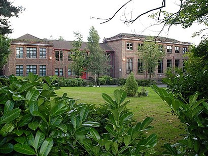
Cowley International College, formerly Cowley Language College and originally Cowley School, is an 11-18 secondary school located on Cowley Hill, in Windle, St Helens, Merseyside.Wiki
Places Near Cowley International College (St Helens)
How to get to popular places in North West with public transport
Get around St Helens by public transport!
Travelling around St Helens has never been so easy. See step by step directions as you travel to any attraction, street or major public transport station. View bus and train timetables, arrival times, service alerts and detailed routes on a map, so you know exactly how to get to anywhere in St Helens.
When travelling to any destination around St Helens use Moovit's Live Directions with Get Off Notifications to know exactly where and how far to walk, how long to wait for your line , and how many stops are left. Moovit will alert you when it’s time to get off — no need to constantly re-check whether yours is the next stop.
Wondering how to use public transport in St Helens or how to pay for public transport in St Helens? Moovit public transport app can help you navigate your way with public transport easily, and at minimum cost. It includes public transport fees, ticket prices, and costs. Looking for a map of St Helens public transport lines? Moovit public transport app shows all public transport maps in St Helens with all Bus, Train, Light rail and Ferry routes and stops on an interactive map.
North West has 4 transport type(s), including: Bus, Train, Light rail and Ferry, operated by several transport agencies, including Arriva North West, Stagecoach Merseyside and South Lancashire, Stagecoach Cumbria and North Lancashire, First Halifax, National Express, Warrington's Own Buses, First Potteries, Rosso, Blackpool Transport, The Blackburn Bus Company, The Burnley Bus Company, Vision Bus, National Rail, Huyton Travel and Stotts Tours