Directions to Crystal Pack (Cannington) with public transport
The following transport lines have routes that pass near Crystal Pack
 Bus: 222, 51, 930, ARMADALE LINE, THORNLIE-COCKBURN LINE.
- Train: ARMADALE LINE, THORNLIE-COCKBURN LINE.
How to get to Crystal Pack by bus?
Click on the bus route to see step by step directions with maps, line arrival times and updated time schedules.
From Murray Street, Perth
47 minFrom Maroomba Airlines, Perth Airport
77 minFrom Burswood Park, Burswood
43 minFrom James Street, Northbridge
52 minFrom Landgate, Perth
48 minFrom Adnate Art Series Hotel, Perth
49 minFrom Chinatown, Northbridge
51 minFrom Anzac Day march, Perth
51 minFrom Perth Steam Works, Perth
56 minFrom City Beach, Perth
48 min
How to get to Crystal Pack by train?
Click on the train route to see step by step directions with maps, line arrival times and updated time schedules.
From Murray Street, Perth
31 minFrom Maroomba Airlines, Perth Airport
59 minFrom Burswood Park, Burswood
19 minFrom James Street, Northbridge
29 minFrom Landgate, Perth
36 minFrom Adnate Art Series Hotel, Perth
33 minFrom Chinatown, Northbridge
28 minFrom Anzac Day march, Perth
33 minFrom Perth Steam Works, Perth
33 minFrom City Beach, Perth
26 min
Bus stops near Crystal Pack in Cannington
Bus lines to Crystal Pack in Cannington
- ARMADALE LINE, Cannington Stn,VIEW
- THORNLIE-COCKBURN LINE, Cannington Stn,VIEW
- 222, Curtin University Bus Stn,VIEW
- 907, Victoria Park Stn,VIEW
- 908, Victoria Park Stn,VIEW
- 36, Cannington Stn,VIEW
- 51, Cannington Stn,VIEW
- 224, Carousel Shop Ctr / Grose Av,VIEW
- 225, Cannington Stn,VIEW
- 34, Cannington Stn,VIEW
- 72, Cannington Stn,VIEW
- 100, Canning Bridge Stn,VIEW
- 177, Elizabeth Quay Bus Stn,VIEW
- 200, Cannington Stn,VIEW
- 202, Cannington Stn,VIEW
- 203, Cannington Stn,VIEW
- 207, Murdoch University,VIEW
- 208, Cannington Stn,VIEW
- 229, Maddington Central,VIEW
- 280, Carousel Shop Ctr / Grose Av,VIEW
What are the nearest stations to Crystal Pack?
The nearest stations to Crystal Pack are:
- Queens Park Stn is 346 meters away, 5 min walk.
- Sevenoaks St After Wharf St is 566 meters away, 8 min walk.
- Renou St Before Wharf St is 723 meters away, 10 min walk.
- Renou St After Wharf St is 747 meters away, 11 min walk.
- Cecil Av After Carousel Rd is 1002 meters away, 14 min walk.
Which bus lines stop near Crystal Pack?
These bus lines stop near Crystal Pack: 222, 51, 930.
Which train lines stop near Crystal Pack?
These train lines stop near Crystal Pack: ARMADALE LINE, THORNLIE-COCKBURN LINE.
What’s the nearest bus station to Crystal Pack in Cannington?
The nearest bus station to Crystal Pack in Cannington is Queens Park Stn. It’s a 5 min walk away.
What time is the first train to Crystal Pack in Cannington?
The ARMADALE LINE is the first train that goes to Crystal Pack in Cannington. It stops nearby at 05:15.
What time is the last train to Crystal Pack in Cannington?
The ARMADALE LINE is the last train that goes to Crystal Pack in Cannington. It stops nearby at 00:33.
What time is the first bus to Crystal Pack in Cannington?
The 51 is the first bus that goes to Crystal Pack in Cannington. It stops nearby at 04:35.
What time is the last bus to Crystal Pack in Cannington?
The 207 is the last bus that goes to Crystal Pack in Cannington. It stops nearby at 01:15.
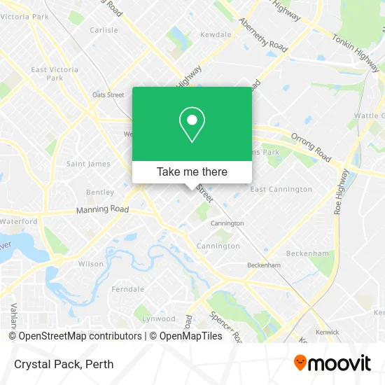
See Crystal Pack, Cannington, on the map
Public Transit to Crystal Pack in Cannington
Wondering how to get to Crystal Pack in Cannington? Moovit helps you find the best way to get to Crystal Pack with step-by-step directions from the nearest public transit station.
Moovit provides free maps and live directions to help you navigate through your city. View schedules, routes, timetables, and find out how long does it take to get to Crystal Pack in real time.
Looking for the nearest stop or station to Crystal Pack? Check out this list of stops closest to your destination: Queens Park Stn; Sevenoaks St After Wharf St; Renou St Before Wharf St; Renou St After Wharf St; Cecil Av After Carousel Rd.
Bus: 222, 51, 930, ARMADALE LINE, THORNLIE-COCKBURN LINE, 907, 908, 36, 224, 225, 34, 72, 100, 177, 200.Train: ARMADALE LINE, THORNLIE-COCKBURN LINE.
Want to see if there’s another route that gets you there at an earlier time? Moovit helps you find alternative routes or times. Get directions from and directions to Crystal Pack easily from the Moovit App or Website.
We make riding to Crystal Pack easy, which is why over 1.5 million users, including users in Cannington, trust Moovit as the best app for public transit. You don’t need to download an individual bus app or train app, Moovit is your all-in-one transit app that helps you find the best bus time or train time available.
For information on prices of train and bus, costs and ride fares to Crystal Pack, please check the Moovit app.
Use the app to navigate to popular places including to the airport, hospital, stadium, grocery store, mall, coffee shop, school, college, and university.
Crystal Pack Address: Mallard Way 112-114 Cannington, 6107 Perth street in Cannington
- About My Bathroom & Kitchen,
- Cannington Leisureplex,
- Hambley's Supa Iga,
- Perth Home and Garden Services,
- Punjaab Hair Studio,
- Computermall,
- Robert McIntyre & Associates,
- Sai Auto Care,
- Western Australia Arms & Armour Society (Inc) : Home,
- St Joseph's Primary School,
- Perth Training Centre,
- Bodhi Siksa Buddhist Society Wa,
- St Josephs School,
- Dan Iyo Harago,
- Centro Keilor Downs,
- Dealy Park,
- Cannington Leisureplex,
- Cannington Library,
- Dealy Square,
- Sevenoaks St Before Wharf St
Places Near Crystal Pack (Cannington)
- Karrinyup Shopping Centre, Karrinyup,
- Blue Boat House,
- Royal Perth Hospital, Perth,
- Mount Hospital, Perth,
- IKEA, Innaloo,
- Westfield Carousel, Cannington,
- McCallum Park, Victoria Park,
- Perth Convention Exhibition Centre, Perth,
- Optus Stadium, Burswood,
- Pelicaan Investment Ho, Bellevue,
- Rac Arena, Perth,
- DFO, Perth Airport,
- Aqwa Aquarium, Hillarys,
- Crown Perth Casino, Burswood,
- Fiona Stanley Hospital, Murdoch,
- Scitech, West Perth,
- Watertown, Perth,
- Langley Park, Perth,
- Sir Charles Gairdner Hospital, Nedlands,
- Yankee Mart, Baldivis
How to get to popular places in Perth with public transport
Get around Cannington by public transport!
Travelling around Cannington has never been so easy. See step by step directions as you travel to any attraction, street or major public transport station. View bus and train timetables, arrival times, service alerts and detailed routes on a map, so you know exactly how to get to anywhere in Cannington.
When travelling to any destination around Cannington use Moovit's Live Directions with Get Off Notifications to know exactly where and how far to walk, how long to wait for your line , and how many stops are left. Moovit will alert you when it’s time to get off — no need to constantly re-check whether yours is the next stop.
Wondering how to use public transport in Cannington or how to pay for public transport in Cannington? Moovit public transport app can help you navigate your way with public transport easily, and at minimum cost. It includes public transport fees, ticket prices, and costs. Looking for a map of Cannington public transport lines? Moovit public transport app shows all public transport maps in Cannington with all Bus, Train and Ferry routes and stops on an interactive map.
Perth has 3 transport type(s), including: Bus, Train and Ferry, operated by several transport agencies, including Transperth Rail, Transwa, Transperth Ferry, Transperth, TransBusselton, TransAlbany, TransGoldfields, TransEsperance, TransGeraldton, TransCarnarvon, TransHedland, TransKarratha, TransBunbury, Mandurah Bus Charter and TransBroome