Directions to Digital Resolutions (Duncraig) with public transport
The following transport lines have routes that pass near Digital Resolutions
 Bus: 444, YANCHEP LINE, 904, 443.
- Train: YANCHEP LINE.
How to get to Digital Resolutions by bus?
Click on the bus route to see step by step directions with maps, line arrival times and updated time schedules.
From Belridge Secondary College, Beldon
43 minFrom Karrinyup Road Wanneroo Road Intersection, Balcatta
43 minFrom Darch, Darch
45 minFrom Malaga, Malaga
44 minFrom Wa Police Academy, Joondalup
55 minFrom HBF Arena, Joondalup
60 minFrom Arena Joondalup, Joondalup
60 minFrom Servite College, Tuart Hill
76 minFrom Girrawheen, Girrawheen
45 minFrom 40 Hasler Road, Osborne Park
75 min
How to get to Digital Resolutions by train?
Click on the train route to see step by step directions with maps, line arrival times and updated time schedules.
Bus stops near Digital Resolutions in Duncraig
Bus lines to Digital Resolutions in Duncraig
What are the nearest stations to Digital Resolutions?
The nearest stations to Digital Resolutions are:
- Glengarry Dr Before Foston Dr is 91 meters away, 2 min walk.
- Greenwood Stn is 836 meters away, 11 min walk.
- Lilburne Rd After Edna Wy is 917 meters away, 12 min walk.
Which bus line stops near Digital Resolutions?
444 (Warwick Stn)
Which train line stops near Digital Resolutions?
YANCHEP LINE (Elizabeth Quay Stn)
What’s the nearest bus station to Digital Resolutions in Duncraig?
The nearest bus station to Digital Resolutions in Duncraig is Glengarry Dr Before Foston Dr. It’s a 2 min walk away.
What time is the first train to Digital Resolutions in Duncraig?
The YANCHEP LINE is the first train that goes to Digital Resolutions in Duncraig. It stops nearby at 05:05.
What time is the last train to Digital Resolutions in Duncraig?
The YANCHEP LINE is the last train that goes to Digital Resolutions in Duncraig. It stops nearby at 00:33.
What time is the first bus to Digital Resolutions in Duncraig?
The 443 is the first bus that goes to Digital Resolutions in Duncraig. It stops nearby at 05:21.
What time is the last bus to Digital Resolutions in Duncraig?
The 443 is the last bus that goes to Digital Resolutions in Duncraig. It stops nearby at 23:10.
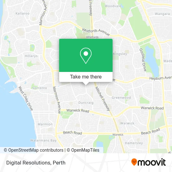
See Digital Resolutions, Duncraig, on the map
Public Transit to Digital Resolutions in Duncraig
Wondering how to get to Digital Resolutions in Duncraig? Moovit helps you find the best way to get to Digital Resolutions with step-by-step directions from the nearest public transit station.
Moovit provides free maps and live directions to help you navigate through your city. View schedules, routes, timetables, and find out how long does it take to get to Digital Resolutions in real time.
Looking for the nearest stop or station to Digital Resolutions? Check out this list of stops closest to your destination: Glengarry Dr Before Foston Dr; Greenwood Stn; Lilburne Rd After Edna Wy.
Bus: 444, YANCHEP LINE, 904, 443.Train: YANCHEP LINE.
Want to see if there’s another route that gets you there at an earlier time? Moovit helps you find alternative routes or times. Get directions from and directions to Digital Resolutions easily from the Moovit App or Website.
We make riding to Digital Resolutions easy, which is why over 1.5 million users, including users in Duncraig, trust Moovit as the best app for public transit. You don’t need to download an individual bus app or train app, Moovit is your all-in-one transit app that helps you find the best bus time or train time available.
For information on prices of bus and train, costs and ride fares to Digital Resolutions, please check the Moovit app.
Use the app to navigate to popular places including to the airport, hospital, stadium, grocery store, mall, coffee shop, school, college, and university.
Digital Resolutions Address: 126 Glengarry Dr Duncraig WA 6023 street in Duncraig
- Caprice Limousines,
- Williams Maxi Cab,
- Ray White North Quays,
- Melene Car Park,
- Archie & Co Design,
- Motion Studio of Dance,
- Happy Healthy Hoops,
- Pearman Deborah,
- Glengarry Drive,
- Alfreton Park,
- Made West,
- Island Villa Club,
- Bubbamilk Express Lactation Cookies,
- Centro Keilor Downs,
- Kindy Dance Time Duncraig,
- St Stephens School,
- Zig Zags Oshc Glengarry,
- Perth Plumbing Co,
- Ochre West Consulting Engineers,
- Carana
Places Near Digital Resolutions (Duncraig)
- Rac Arena, Perth,
- Westfield Carousel, Cannington,
- Perth Convention Exhibition Centre, Perth,
- Scitech, West Perth,
- Langley Park, Perth,
- Sir Charles Gairdner Hospital, Nedlands,
- IKEA, Innaloo,
- Fiona Stanley Hospital, Murdoch,
- Pelicaan Investment Ho, Bellevue,
- Watertown, Perth,
- Blue Boat House,
- Optus Stadium, Burswood,
- McCallum Park, Victoria Park,
- Karrinyup Shopping Centre, Karrinyup,
- Aqwa Aquarium, Hillarys,
- Mount Hospital, Perth,
- Crown Perth Casino, Burswood,
- Yankee Mart, Baldivis,
- DFO, Perth Airport,
- Royal Perth Hospital, Perth
How to get to popular places in Perth with public transport
Get around Duncraig by public transport!
Travelling around Duncraig has never been so easy. See step by step directions as you travel to any attraction, street or major public transport station. View bus and train timetables, arrival times, service alerts and detailed routes on a map, so you know exactly how to get to anywhere in Duncraig.
When travelling to any destination around Duncraig use Moovit's Live Directions with Get Off Notifications to know exactly where and how far to walk, how long to wait for your line , and how many stops are left. Moovit will alert you when it’s time to get off — no need to constantly re-check whether yours is the next stop.
Wondering how to use public transport in Duncraig or how to pay for public transport in Duncraig? Moovit public transport app can help you navigate your way with public transport easily, and at minimum cost. It includes public transport fees, ticket prices, and costs. Looking for a map of Duncraig public transport lines? Moovit public transport app shows all public transport maps in Duncraig with all Bus, Train and Ferry routes and stops on an interactive map.
Perth has 3 transport type(s), including: Bus, Train and Ferry, operated by several transport agencies, including Transperth Rail, Transwa, Transperth Ferry, Transperth, TransBusselton, TransAlbany, TransGoldfields, TransEsperance, TransGeraldton, TransCarnarvon, TransHedland, TransKarratha, TransBunbury, Mandurah Bus Charter and TransBroome