Directions to Edge Pro Systems (Quinns Rocks) with public transport
The following transport lines have routes that pass near Edge Pro Systems
 Bus: 481, 480, 482.
- Train: YANCHEP LINE.
How to get to Edge Pro Systems by bus?
Click on the bus route to see step by step directions with maps, line arrival times and updated time schedules.
From Perth's Outback Splash, Wanneroo
69 minFrom Northshore Christian Grammar School, Alkimos
51 minFrom Lakeside Joondalup Shopping Centre, Joondalup
43 minFrom Amberton Park, Eglinton
68 minFrom Wanneroo Botanic Gardens & Mini Golf, Wanneroo
67 minFrom Arena Joondalup, Joondalup
48 minFrom HBF Arena, Joondalup
52 minFrom Fatma Funda Mizrak, Joondalup
44 minFrom Aegis Shorehaven, Alkimos
51 min
How to get to Edge Pro Systems by train?
Click on the train route to see step by step directions with maps, line arrival times and updated time schedules.
Bus stops near Edge Pro Systems in Quinns Rocks
Bus lines to Edge Pro Systems in Quinns Rocks
What are the nearest stations to Edge Pro Systems?
The nearest stations to Edge Pro Systems are:
- Santa Barbara Pde After Camira Wy is 106 meters away, 2 min walk.
- Robinson Av After Hazel Av is 894 meters away, 12 min walk.
- Marmion Av Before Ashcott Gte is 1300 meters away, 17 min walk.
Which bus line stops near Edge Pro Systems?
481 (Clarkson Stn)
Which train line stops near Edge Pro Systems?
YANCHEP LINE (Yanchep Stn)
What’s the nearest bus station to Edge Pro Systems in Quinns Rocks?
The nearest bus station to Edge Pro Systems in Quinns Rocks is Santa Barbara Pde After Camira Wy. It’s a 2 min walk away.
What time is the first bus to Edge Pro Systems in Quinns Rocks?
The 480 is the first bus that goes to Edge Pro Systems in Quinns Rocks. It stops nearby at 04:54.
What time is the last bus to Edge Pro Systems in Quinns Rocks?
The 481 is the last bus that goes to Edge Pro Systems in Quinns Rocks. It stops nearby at 00:06.
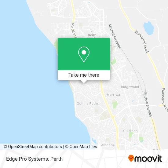
See Edge Pro Systems, Quinns Rocks, on the map
Public Transit to Edge Pro Systems in Quinns Rocks
Wondering how to get to Edge Pro Systems in Quinns Rocks? Moovit helps you find the best way to get to Edge Pro Systems with step-by-step directions from the nearest public transit station.
Moovit provides free maps and live directions to help you navigate through your city. View schedules, routes, timetables, and find out how long does it take to get to Edge Pro Systems in real time.
Looking for the nearest stop or station to Edge Pro Systems? Check out this list of stops closest to your destination: Santa Barbara Pde After Camira Wy; Robinson Av After Hazel Av; Marmion Av Before Ashcott Gte.
Bus: 481, 480, 482.Train: YANCHEP LINE.
Want to see if there’s another route that gets you there at an earlier time? Moovit helps you find alternative routes or times. Get directions from and directions to Edge Pro Systems easily from the Moovit App or Website.
We make riding to Edge Pro Systems easy, which is why over 1.5 million users, including users in Quinns Rocks, trust Moovit as the best app for public transit. You don’t need to download an individual bus app or train app, Moovit is your all-in-one transit app that helps you find the best bus time or train time available.
For information on prices of bus and train, costs and ride fares to Edge Pro Systems, please check the Moovit app.
Use the app to navigate to popular places including to the airport, hospital, stadium, grocery store, mall, coffee shop, school, college, and university.
Edge Pro Systems Address: Camira Way Quinns Rocks WA 6030 street in Quinns Rocks
- Insurance Advisernet Fordsure,
- Charmont Creations Furniture,
- Roside Hanc Uins Ock,
- Wa Fencing Solutions,
- Avhi Group,
- Luke James Electrical,
- Layla's Dance Studio,
- Gfe Audiovisual,
- Amelies Pizza and Burgers,
- Insurance Advisernet Australia Perth North,
- Hair by Trudy Kydd,
- Mt Medical Laser Tattoo Removal,
- Magical Garden Portraits,
- Harcourts Rent,
- Eco Bread-Home Based Traditional Polish Sourdough Micro Bakery Perthwa,
- Jodoko Strata Management,
- Shanines Cleaning Castle,
- Christina Burki,
- Primecraftedgoods,
- Quinns Rock Sand Supplies
Places Near Edge Pro Systems (Quinns Rocks)
- Blue Boat House,
- McCallum Park, Victoria Park,
- Langley Park, Perth,
- Sir Charles Gairdner Hospital, Nedlands,
- Mount Hospital, Perth,
- Crown Perth Casino, Burswood,
- IKEA, Innaloo,
- Royal Perth Hospital, Perth,
- Karrinyup Shopping Centre, Karrinyup,
- Westfield Carousel, Cannington,
- Optus Stadium, Burswood,
- Fiona Stanley Hospital, Murdoch,
- Yankee Mart, Baldivis,
- DFO, Perth Airport,
- Aqwa Aquarium, Hillarys,
- Scitech, West Perth,
- Perth Convention Exhibition Centre, Perth,
- Hillarys Boat Harbour,
- Pelicaan Investment Ho, Bellevue,
- Rac Arena, Perth
How to get to popular places in Perth with public transport
Get around Quinns Rocks by public transport!
Travelling around Quinns Rocks has never been so easy. See step by step directions as you travel to any attraction, street or major public transport station. View bus and train timetables, arrival times, service alerts and detailed routes on a map, so you know exactly how to get to anywhere in Quinns Rocks.
When travelling to any destination around Quinns Rocks use Moovit's Live Directions with Get Off Notifications to know exactly where and how far to walk, how long to wait for your line , and how many stops are left. Moovit will alert you when it’s time to get off — no need to constantly re-check whether yours is the next stop.
Wondering how to use public transport in Quinns Rocks or how to pay for public transport in Quinns Rocks? Moovit public transport app can help you navigate your way with public transport easily, and at minimum cost. It includes public transport fees, ticket prices, and costs. Looking for a map of Quinns Rocks public transport lines? Moovit public transport app shows all public transport maps in Quinns Rocks with all Bus, Train and Ferry routes and stops on an interactive map.
Perth has 3 transport type(s), including: Bus, Train and Ferry, operated by several transport agencies, including Transperth Rail, Transwa, Transperth Ferry, Transperth, TransBusselton, TransAlbany, TransGoldfields, TransEsperance, TransGeraldton, TransCarnarvon, TransHedland, TransKarratha, TransBunbury, Mandurah Bus Charter and TransBroome