Directions to Electrotech Cabling Solutions (West Perth) with public transport
The following transport lines have routes that pass near Electrotech Cabling Solutions
 Bus: 19, 360, 403, 960, PERTH BLUE CAT.
- Train: AIRPORT LINE, FREMANTLE LINE, ARMADALE LINE, ELLENBROOK LINE, MIDLAND LINE.
How to get to Electrotech Cabling Solutions by bus?
Click on the bus route to see step by step directions with maps, line arrival times and updated time schedules.
From Redcliffe, Redcliffe
68 minFrom Taxi Rank - Perth Domestic Airport, Perth Airport
68 minFrom John XXIII College, Mount Claremont
63 minFrom Perth Airport Domestic Terminal T3 T4, Perth Airport
68 minFrom Nedlands, Nedlands
37 minFrom Karrinyup Shopping Centre, Karrinyup
61 minFrom Perth Airport-Terminal 4, Perth Airport
66 minFrom Broadway, Nedlands
34 minFrom Terminal 3 & Terminal 4, Perth Airport
70 minFrom Crawley, Western Australia, Crawley
43 min
How to get to Electrotech Cabling Solutions by train?
Click on the train route to see step by step directions with maps, line arrival times and updated time schedules.
Bus stops near Electrotech Cabling Solutions in West Perth
Train stations near Electrotech Cabling Solutions in West Perth
Bus lines to Electrotech Cabling Solutions in West Perth
- 19, Perth Busport,VIEW
- 960, Curtin University Bus Stn,VIEW
- 360, Alexander Heights,VIEW
- 384, Perth Busport,VIEW
- 386, Kingsway City Shop Ctr,VIEW
- 386X, Perth Busport,VIEW
- 388, Warwick Stn,VIEW
- 389, Wanneroo,VIEW
- 970, Perth,VIEW
- 970X, Perth Busport,VIEW
- 990, Glendalough Stn,VIEW
- PERTH BLUE CAT, Elizabeth Quay Bus Stn,VIEW
- 15, Glendalough Stn,VIEW
- 402, Stirling Stn,VIEW
- 403, Stirling Stn,VIEW
- 404, Tuart Hill,VIEW
- 652, Mirrabooka Bus Stn,VIEW
What are the nearest stations to Electrotech Cabling Solutions?
The nearest stations to Electrotech Cabling Solutions are:
- Fitzgerald St After Randell St is 394 meters away, 6 min walk.
- Fitzgerald St Before Newcastle St is 467 meters away, 7 min walk.
- Charles St After Vincent St is 485 meters away, 7 min walk.
- Fitzgerald St Fitzgerald Street Cat Id 11 is 589 meters away, 8 min walk.
- Newcastle St After Strathcona St is 605 meters away, 8 min walk.
- Fitzgerald St After Bulwer St is 694 meters away, 10 min walk.
- Mciver Stn is 895 meters away, 13 min walk.
- Perth Underground Stn is 1222 meters away, 16 min walk.
- Perth Stn is 1222 meters away, 16 min walk.
Which bus lines stop near Electrotech Cabling Solutions?
These bus lines stop near Electrotech Cabling Solutions: 19, 360, 403, 960, PERTH BLUE CAT.
Which train lines stop near Electrotech Cabling Solutions?
These train lines stop near Electrotech Cabling Solutions: AIRPORT LINE, FREMANTLE LINE.
What’s the nearest train station to Electrotech Cabling Solutions in West Perth?
The nearest train station to Electrotech Cabling Solutions in West Perth is Mciver Stn. It’s a 13 min walk away.
What’s the nearest bus station to Electrotech Cabling Solutions in West Perth?
The nearest bus station to Electrotech Cabling Solutions in West Perth is Fitzgerald St After Randell St. It’s a 6 min walk away.
What time is the first train to Electrotech Cabling Solutions in West Perth?
The ARMADALE LINE is the first train that goes to Electrotech Cabling Solutions in West Perth. It stops nearby at 05:03.
What time is the last train to Electrotech Cabling Solutions in West Perth?
The FREMANTLE LINE is the last train that goes to Electrotech Cabling Solutions in West Perth. It stops nearby at 00:38.
What time is the first bus to Electrotech Cabling Solutions in West Perth?
The 388 is the first bus that goes to Electrotech Cabling Solutions in West Perth. It stops nearby at 04:57.
What time is the last bus to Electrotech Cabling Solutions in West Perth?
The 386 is the last bus that goes to Electrotech Cabling Solutions in West Perth. It stops nearby at 00:39.
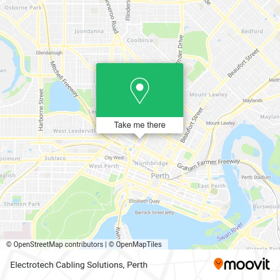
See Electrotech Cabling Solutions, West Perth, on the map
Public Transit to Electrotech Cabling Solutions in West Perth
Wondering how to get to Electrotech Cabling Solutions in West Perth? Moovit helps you find the best way to get to Electrotech Cabling Solutions with step-by-step directions from the nearest public transit station.
Moovit provides free maps and live directions to help you navigate through your city. View schedules, routes, timetables, and find out how long does it take to get to Electrotech Cabling Solutions in real time.
Looking for the nearest stop or station to Electrotech Cabling Solutions? Check out this list of stops closest to your destination: Fitzgerald St After Randell St; Fitzgerald St Before Newcastle St; Charles St After Vincent St; Fitzgerald St Fitzgerald Street Cat Id 11; Newcastle St After Strathcona St; Fitzgerald St After Bulwer St; Mciver Stn; Perth Underground Stn; Perth Stn.
Bus: 19, 360, 403, 960, PERTH BLUE CAT, 384, 386, 386X, 388, 389.Train: AIRPORT LINE, FREMANTLE LINE, ARMADALE LINE, ELLENBROOK LINE, MIDLAND LINE, THORNLIE-COCKBURN LINE, MANDURAH LINE, YANCHEP LINE.
Want to see if there’s another route that gets you there at an earlier time? Moovit helps you find alternative routes or times. Get directions from and directions to Electrotech Cabling Solutions easily from the Moovit App or Website.
We make riding to Electrotech Cabling Solutions easy, which is why over 1.5 million users, including users in West Perth, trust Moovit as the best app for public transit. You don’t need to download an individual bus app or train app, Moovit is your all-in-one transit app that helps you find the best bus time or train time available.
For information on prices of bus and train, costs and ride fares to Electrotech Cabling Solutions, please check the Moovit app.
Use the app to navigate to popular places including to the airport, hospital, stadium, grocery store, mall, coffee shop, school, college, and university.
Electrotech Cabling Solutions Address: Carr St 15-19 West Perth, 6005 Perth street in West Perth
- Zappeion Apartments,
- Adonis Massage studio,
- Greek Orthodox Church Of Evangelismos,
- Town Inn,
- Schoolwear Central,
- St Brigids Church,
- The Italian Club,
- Dorrien Gardens,
- BGC Stadium Dorrien Gardens,
- The Bottleyard,
- Buddhist Compassion Relief Tzu Chi Foundation,
- Atelier W - Architectural DGN Stu,
- Newcastle St Before Golding St,
- Miss Pinay Property,
- Lone Star City Backpackers,
- Hyde Park Hotel,
- Spoonfedesign,
- BMO Harris Bank,
- Royal Park Hall,
- Brisbane St Family Day Care
Places Near Electrotech Cabling Solutions (West Perth)
- Scitech, West Perth,
- DFO, Perth Airport,
- IKEA, Innaloo,
- Karrinyup Shopping Centre, Karrinyup,
- Royal Perth Hospital, Perth,
- Optus Stadium, Burswood,
- Pelicaan Investment Ho, Bellevue,
- Sir Charles Gairdner Hospital, Nedlands,
- Aqwa Aquarium, Hillarys,
- Perth Convention Exhibition Centre, Perth,
- Westfield Carousel, Cannington,
- Blue Boat House,
- Rac Arena, Perth,
- Mount Hospital, Perth,
- Watertown, Perth,
- Yankee Mart, Baldivis,
- McCallum Park, Victoria Park,
- Fiona Stanley Hospital, Murdoch,
- Crown Perth Casino, Burswood,
- Langley Park, Perth
How to get to popular places in Perth with public transport
Get around West Perth by public transport!
Travelling around West Perth has never been so easy. See step by step directions as you travel to any attraction, street or major public transport station. View bus and train timetables, arrival times, service alerts and detailed routes on a map, so you know exactly how to get to anywhere in West Perth.
When travelling to any destination around West Perth use Moovit's Live Directions with Get Off Notifications to know exactly where and how far to walk, how long to wait for your line , and how many stops are left. Moovit will alert you when it’s time to get off — no need to constantly re-check whether yours is the next stop.
Wondering how to use public transport in West Perth or how to pay for public transport in West Perth? Moovit public transport app can help you navigate your way with public transport easily, and at minimum cost. It includes public transport fees, ticket prices, and costs. Looking for a map of West Perth public transport lines? Moovit public transport app shows all public transport maps in West Perth with all Bus, Train and Ferry routes and stops on an interactive map.
Perth has 3 transport type(s), including: Bus, Train and Ferry, operated by several transport agencies, including Transperth Rail, Transwa, Transperth Ferry, Transperth, TransBusselton, TransAlbany, TransGoldfields, TransEsperance, TransGeraldton, TransCarnarvon, TransHedland, TransKarratha, TransBunbury, Mandurah Bus Charter and TransBroome