Elm Tree Rd stop - Friday schedule
| Line | Direction | Time |
|---|---|---|
| 47 | Longbridge Island | 05:20 |
| 45 | Longbridge Island | 05:34 |
| 47 | Longbridge Island | 05:50 |
| 45 | Longbridge Island | 06:05 |
| 47 | Longbridge Island | 06:22 |
| 45 | Longbridge Island | 06:35 |
| 47 | Longbridge Island | 06:46 |
| 45 | Longbridge Island | 06:55 |
| 47 | Longbridge Island | 07:03 |
| 45 | Longbridge Island | 07:12 |
| 47 | Longbridge Island | 07:19 |
| 45 | Longbridge Island | 07:27 |
| 47 | Longbridge Island | 07:34 |
| 45 | Longbridge Island | 07:42 |
| 47 | Longbridge Island | 07:48 |
| 45 | Longbridge Island | 07:54 |
| 47 | Longbridge Island | 08:01 |
| 45 | Longbridge Island | 08:06 |
| 47 | Longbridge Island | 08:15 |
| 45 | Longbridge Island | 08:20 |
| 47 | Longbridge Island | 08:26 |
| 45 | Longbridge Island | 08:35 |
| 47 | Longbridge Island | 08:41 |
| 45 | Longbridge Island | 08:49 |
| 47 | Longbridge Island | 08:54 |
Directions to Elm Tree Rd stop (Stirchley) with public transport
The following transport lines have routes that pass near Elm Tree Rd
 Bus: 11A, 45, 47, 55, 11C.
- Train: WEST MIDLANDS RAILWAY.
How to get to Elm Tree Rd stop by bus?
Click on the bus route to see step by step directions with maps, line arrival times and updated time schedules.
How to get to Elm Tree Rd stop by train?
Click on the train route to see step by step directions with maps, line arrival times and updated time schedules.
Bus stops near Elm Tree Rd stop in Stirchley
- Elm Tree Rd, 1 min walk,
- Hazelwell St, 5 min walk,
- Breedon Cross, 6 min walk,
- Lea House Rd, 7 min walk,
Train stations near Elm Tree Rd station in Stirchley
- Pineapple Road, 12 min walk,
Bus lines to Elm Tree Rd stop in Stirchley
- 45, Carrs Lane,
- 47, Longbridge Island,
- 55, Tesco,
- 11A, Shirley Road,
- 11C, Six Ways,
- 27, Highfield Road/Tixall Road,
What are the nearest stations to Elm Tree Rd?
The nearest stations to Elm Tree Rd are:
- Elm Tree Rd is 65 meters away, 1 min walk.
- Hazelwell St is 360 meters away, 5 min walk.
- Breedon Cross is 421 meters away, 6 min walk.
- Lea House Rd is 542 meters away, 7 min walk.
- Pineapple Road is 871 meters away, 12 min walk.
Which bus lines stop near Elm Tree Rd?
These bus lines stop near Elm Tree Rd: 11A, 45, 47.
Which train line stops near Elm Tree Rd?
WEST MIDLANDS RAILWAY (Redditch)
What’s the nearest train station to Elm Tree Rd in Stirchley?
The nearest train station to Elm Tree Rd in Stirchley is Pineapple Road. It’s a 12 min walk away.
What’s the nearest bus station to Elm Tree Rd in Stirchley?
The nearest bus station to Elm Tree Rd in Stirchley is Elm Tree Rd. It’s a 1 min walk away.
What time is the first train to Elm Tree Rd in Stirchley?
The WEST MIDLANDS RAILWAY is the first train that goes to Elm Tree Rd in Stirchley. It stops nearby at 09:13.
What time is the last train to Elm Tree Rd in Stirchley?
The WEST MIDLANDS RAILWAY is the last train that goes to Elm Tree Rd in Stirchley. It stops nearby at 23:35.
What time is the first bus to Elm Tree Rd in Stirchley?
The 11C is the first bus that goes to Elm Tree Rd in Stirchley. It stops nearby at 06:13.
What time is the last bus to Elm Tree Rd in Stirchley?
The 45 is the last bus that goes to Elm Tree Rd in Stirchley. It stops nearby at 00:26.
Elm Tree Rd station
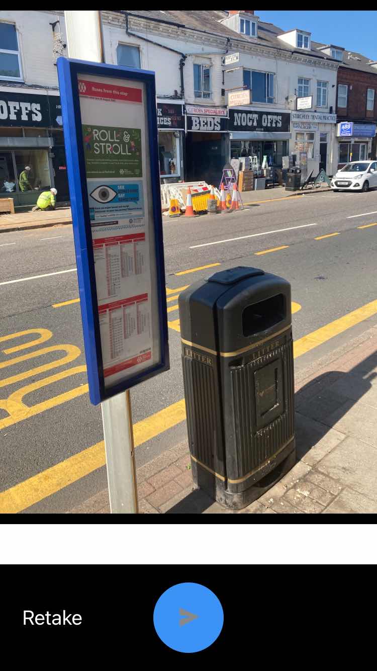 Taken by Anonymous
See Elm Tree Rd stop, Stirchley, on the map
Public transport to Elm Tree Rd stop (ID: nwmawjdm) in Stirchley
Looking for directions to Elm Tree Rd in Stirchley, United Kingdom?
Download the Moovit App to find the current schedule and step-by-step directions for Bus or Train routes that pass through Elm Tree Rd.
Looking for the nearest stops closest to Elm Tree Rd ? Check out this list of closest stops to your destination: Elm Tree Rd; Hazelwell St; Breedon Cross; Lea House Rd; Pineapple Road.
Bus: 11A, 45, 47, 55, 11C, 27.Train: WEST MIDLANDS RAILWAY.
We make riding on public transit to Elm Tree Rd easy, which is why over 1.5 million users, including users in Stirchley trust Moovit as the best app for public transit.
Use the app to navigate to popular places including to the airport, hospital, stadium, grocery store, mall, coffee shop, school, college, and university.
Elm Tree Rd stop’s code is nwmawjdm
The first line to this stop is 47, at 05:20, and the last line is 45 at 00:25.
1513 Pershore Road, Birmingham, England, United Kingdom
This stop serves National Express West Midlands’s lines
- Elm Tree Rd,
- Hazelwell St,
- Breedon Cross,
- Lea House Rd
Bus stops near Elm Tree Rd stop
- Pineapple Road
Train station near Elm Tree Rd station
- Tesco,
- Aberdeen St,
- Dale House,
- Swan Island,
- Bakers Lane,
- Ward End Library,
- Peterbrook Road,
- Solihull Ice Rink,
- John Kyrle High School,
- Cole Hall Lane,
- Lockwood Rd,
- Court Oak Rd,
- Bilbrook,
- Crabbs Cross,
- Queen Mary's Grammar School,
- Tesco,
- Chad Rd,
- Parliament Street,
- Marston Green Tavern,
- Old Square
Popular public transport stations in Stirchley
Get around Stirchley by public transport!
Travelling around Stirchley has never been so easy. See step by step directions as you travel to any attraction, street or major public transport station. View bus and train timetables, arrival times, service alerts and detailed routes on a map, so you know exactly how to get to anywhere in Stirchley.
When travelling to any destination around Stirchley use Moovit's Live Directions with Get Off Notifications to know exactly where and how far to walk, how long to wait for your line , and how many stops are left. Moovit will alert you when it’s time to get off — no need to constantly re-check whether yours is the next stop.
Wondering how to use public transport in Stirchley or how to pay for public transport in Stirchley? Moovit public transport app can help you navigate your way with public transport easily, and at minimum cost. It includes public transport fees, ticket prices, and costs. Looking for a map of Stirchley public transport lines? Moovit public transport app shows all public transport maps in Stirchley with all Bus, Train and Light rail routes and stops on an interactive map.
West Midlands has 3 transport type(s), including: Bus, Train and Light rail, operated by several transport agencies, including National Express West Midlands, National Express Coventry, National Express, Diamond Bus, Arriva Midlands, Stagecoach Midlands, West Midlands Metro, Stagecoach West, Stagecoach South Wales, First Potteries, First Worcestershire, LandFlight, trentbarton, D & G Bus and Flexibus