Directions to Erceg Management (Perth) with public transport
The following transport lines have routes that pass near Erceg Management
 Bus: 40, 41, 42, 43, 67.
- Train: AIRPORT LINE, ELLENBROOK LINE, MIDLAND LINE, ARMADALE LINE, THORNLIE-COCKBURN LINE.
How to get to Erceg Management by bus?
Click on the bus route to see step by step directions with maps, line arrival times and updated time schedules.
From Yokine, Yokine
56 minFrom Balga, Balga
59 minFrom Broadwater Resort Apartments Como Perth, Como
42 minFrom Mirrabooka, Mirrabooka
69 minFrom King Edward Memorial Hospital, Subiaco
42 minFrom Evolve Kids Fitness, Balcatta
65 minFrom Milroy Lodge, Shenton Park
55 minFrom Gwelup, Gwelup
76 minFrom Guildford Cemetery, South Guildford
77 min
How to get to Erceg Management by train?
Click on the train route to see step by step directions with maps, line arrival times and updated time schedules.
Bus stops near Erceg Management in Perth
Train station near Erceg Management in Perth
- Claisebrook Stn, 10 min walk,VIEW
Bus lines to Erceg Management in Perth
- 40, Galleria Bus Stn,VIEW
- 41, Bayswater Stn,VIEW
- 42, Maylands,VIEW
- 43, Maylands,VIEW
- 652, Perth Stadium Bus Stn,VIEW
- ALBANY, Katanning,VIEW
- AUSTRALIND RAIL REPLACEMENT, Bunbury Passenger,VIEW
- ESPERANCE, East Perth,VIEW
- GERALDTON, East Perth,VIEW
- KALBARRI, Kalbarri,VIEW
- PEMBERTON, East Perth Stn - Transwa,VIEW
- 67, Mirrabooka Bus Stn,VIEW
- 68, Mirrabooka Bus Stn,VIEW
- 950, Galleria Bus Stn,VIEW
- 901, Perth Busport,VIEW
- 902, Perth,VIEW
- 903, Ellenbrook Stn,VIEW
What are the nearest stations to Erceg Management?
The nearest stations to Erceg Management are:
- Lord St After Marlborough St is 51 meters away, 2 min walk.
- Lord St Before Murchison Tce is 390 meters away, 6 min walk.
- Transwa Bay Transwa East Perth is 398 meters away, 6 min walk.
- Beaufort St After Saint Albans Av is 727 meters away, 10 min walk.
- Claisebrook Stn is 753 meters away, 10 min walk.
- East Perth Stn is 2485 meters away, 32 min walk.
Which bus lines stop near Erceg Management?
These bus lines stop near Erceg Management: 40, 41, 42, 43, 67.
Which train lines stop near Erceg Management?
These train lines stop near Erceg Management: AIRPORT LINE, ELLENBROOK LINE, MIDLAND LINE.
What’s the nearest train station to Erceg Management in Perth?
The nearest train station to Erceg Management in Perth is Claisebrook Stn. It’s a 10 min walk away.
What’s the nearest bus station to Erceg Management in Perth?
The nearest bus station to Erceg Management in Perth is Lord St After Marlborough St. It’s a 2 min walk away.
What time is the first train to Erceg Management in Perth?
The ARMADALE LINE is the first train that goes to Erceg Management in Perth. It stops nearby at 05:06.
What time is the last train to Erceg Management in Perth?
The ARMADALE LINE is the last train that goes to Erceg Management in Perth. It stops nearby at 00:27.
What time is the first bus to Erceg Management in Perth?
The 950 is the first bus that goes to Erceg Management in Perth. It stops nearby at 04:45.
What time is the last bus to Erceg Management in Perth?
The 950 is the last bus that goes to Erceg Management in Perth. It stops nearby at 01:15.
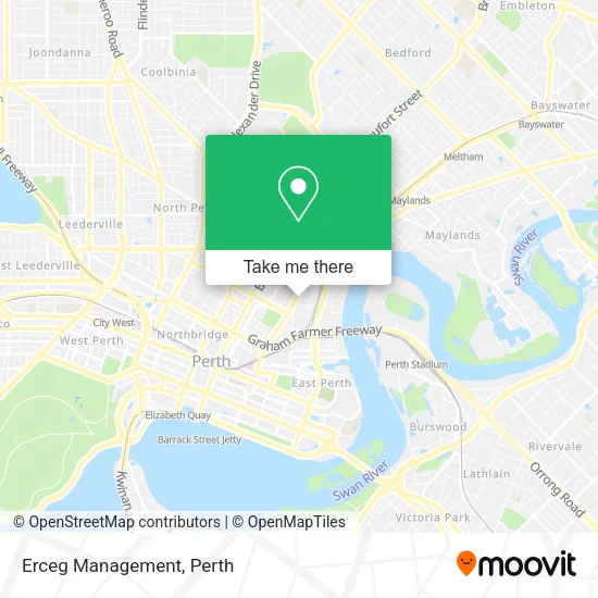
See Erceg Management, Perth, on the map
Public Transit to Erceg Management in Perth
Wondering how to get to Erceg Management in Perth? Moovit helps you find the best way to get to Erceg Management with step-by-step directions from the nearest public transit station.
Moovit provides free maps and live directions to help you navigate through your city. View schedules, routes, timetables, and find out how long does it take to get to Erceg Management in real time.
Looking for the nearest stop or station to Erceg Management? Check out this list of stops closest to your destination: Lord St After Marlborough St; Lord St Before Murchison Tce; Transwa Bay Transwa East Perth; Beaufort St After Saint Albans Av; Claisebrook Stn; East Perth Stn.
Bus: 40, 41, 42, 43, 67, 652, ALBANY, AUSTRALIND RAIL REPLACEMENT, ESPERANCE, GERALDTON, KALBARRI, 68, 950, 901, 902, 903.Train: AIRPORT LINE, ELLENBROOK LINE, MIDLAND LINE, ARMADALE LINE, THORNLIE-COCKBURN LINE.
Want to see if there’s another route that gets you there at an earlier time? Moovit helps you find alternative routes or times. Get directions from and directions to Erceg Management easily from the Moovit App or Website.
We make riding to Erceg Management easy, which is why over 1.5 million users, including users in Perth, trust Moovit as the best app for public transit. You don’t need to download an individual bus app or train app, Moovit is your all-in-one transit app that helps you find the best bus time or train time available.
For information on prices of bus and train, costs and ride fares to Erceg Management, please check the Moovit app.
Use the app to navigate to popular places including to the airport, hospital, stadium, grocery store, mall, coffee shop, school, college, and university.
Erceg Management Address: Lord St 320 Highgate, 6003 Perth street in Perth
- Concept Building Design,
- East Perth Terminal Kalgoorlie Railway,
- Century 21,
- Parking Lot,
- The Prospector,
- Public Transport Centre,
- Transwa Bay Transwa East Perth Set Down,
- Public Transport Centre - East Perth Station,
- Transwa Bay East Perth,
- East Perth Terminal,
- The Indian Pacific,
- East Perth Train Station,
- East Perth Station,
- East Perth Train Station Car Park,
- Central TAFE,
- George Phillipos,
- Transperth Parking,
- Stow House Hair,
- Cornelie Court,
- Mount Lawley Tafe
Places Near Erceg Management (Perth)
- Sir Charles Gairdner Hospital, Nedlands,
- Karrinyup Shopping Centre, Karrinyup,
- Scitech, West Perth,
- DFO, Perth Airport,
- Fiona Stanley Hospital, Murdoch,
- Yankee Mart, Baldivis,
- McCallum Park, Victoria Park,
- Perth Convention Exhibition Centre, Perth,
- Optus Stadium, Burswood,
- Crown Perth Casino, Burswood,
- Langley Park, Perth,
- Rac Arena, Perth,
- Pelicaan Investment Ho, Bellevue,
- Watertown, Perth,
- Blue Boat House,
- Royal Perth Hospital, Perth,
- Westfield Carousel, Cannington,
- IKEA, Innaloo,
- Mount Hospital, Perth,
- Aqwa Aquarium, Hillarys
How to get to popular places in Perth with public transport
Get around Perth by public transport!
Travelling around Perth has never been so easy. See step by step directions as you travel to any attraction, street or major public transport station. View bus and train timetables, arrival times, service alerts and detailed routes on a map, so you know exactly how to get to anywhere in Perth.
When travelling to any destination around Perth use Moovit's Live Directions with Get Off Notifications to know exactly where and how far to walk, how long to wait for your line , and how many stops are left. Moovit will alert you when it’s time to get off — no need to constantly re-check whether yours is the next stop.
Wondering how to use public transport in Perth or how to pay for public transport in Perth? Moovit public transport app can help you navigate your way with public transport easily, and at minimum cost. It includes public transport fees, ticket prices, and costs. Looking for a map of Perth public transport lines? Moovit public transport app shows all public transport maps in Perth with all Bus, Train and Ferry routes and stops on an interactive map.
Perth has 3 transport type(s), including: Bus, Train and Ferry, operated by several transport agencies, including Transperth Rail, Transwa, Transperth Ferry, Transperth, TransBusselton, TransAlbany, TransGoldfields, TransEsperance, TransGeraldton, TransCarnarvon, TransHedland, TransKarratha, TransBunbury, Mandurah Bus Charter and TransBroome