Directions to Ettalong (Ettalong Beach) with public transport
The following transport lines have routes that pass near Ettalong
How to get to Ettalong by bus?
Click on the bus route to see step by step directions with maps, line arrival times and updated time schedules.
How to get to Ettalong by train?
Click on the train route to see step by step directions with maps, line arrival times and updated time schedules.
Bus stops near Ettalong in Ettalong Beach
- Barrenjoey Rd after Bangalow St, 6 min walk,
- Barrenjoey Rd before Palm St, 6 min walk,
- Ocean View Rd before Picnic Pde, 7 min walk,
- Ocean View Rd after Picnic Pde, 7 min walk,
- Ocean View Rd at Memorial Ave, 7 min walk,
- Ocean View Rd at Broken Bay Rd, 7 min walk,
- Ettalong Public School, Uligandi St, 8 min walk,
Ferry stations near Ettalong in Ettalong Beach
- Empire Bay Wharf, 31 min walk,
- Ettalong Wharf, 36 min walk,
Train stations near Ettalong in Ettalong Beach
- Woy Woy Station, 57 min walk,
Bus lines to Ettalong in Ettalong Beach
- 55, Ettalong Beach to Gosford via Woy Woy and Umina Beach,
- 2056, Ettalong Memorial Club to St John the Baptist PS,
- 2088, Orange Grove Rd to Brisbane Waters College, Umina,
- 2539, St Edwards Brothers College to Ocean Beach Rd at Veron Rd,
- 2558, Central Coast Grammar School to Woy Woy Station via St Huberts Island,
- 2567, Green Point College to Woy Woy Station via St Hurbet Island,
- 2584, Ettalong PS to Taylor St at Bassan St,
- 2597, Woy Woy Station to West St opposite Bullion St,
- 2632, Brisbane Waters College, Umina to West St opp Bullion St,
- 50/3, Woy Woy to Umina & Booker Bay (Loop Service),
- 55/3, Woy Woy to Ettalong & Umina Beach (Loop Service),
- 2012, West St to Ettalong Memorial Club,
- 2048, Woy Woy Station to Central Coast Grammar School,
- 2060, Woy Woy Station to Green Point College,
- 53, Woy Woy to Booker Bay (Loop Service),
- 59, Wagstaffe to Woy Woy via Empire Bay, Booker Bay & Ettalong,
- 64, Woy Woy to Gosford via Empire Bay & Kincumber,
- 2061, Woy Woy Station to St John the Baptist PS,
- 5364, Woy Woy to Kincumber via Ettalong & Empire Bay,
- 2104, St Patricks,
What are the nearest stations to Ettalong?
The nearest stations to Ettalong are:
- Barrenjoey Rd after Bangalow St is 386 meters away, 6 min walk.
- Barrenjoey Rd before Palm St is 386 meters away, 6 min walk.
- Ocean View Rd before Picnic Pde is 496 meters away, 7 min walk.
- Ocean View Rd after Picnic Pde is 496 meters away, 7 min walk.
- Ocean View Rd at Memorial Ave is 503 meters away, 7 min walk.
- Ocean View Rd at Broken Bay Rd is 518 meters away, 7 min walk.
- Ettalong Public School, Uligandi St is 555 meters away, 8 min walk.
- Empire Bay Wharf is 2406 meters away, 31 min walk.
- Ettalong Wharf is 2733 meters away, 36 min walk.
- Woy Woy Station is 4380 meters away, 57 min walk.
Which bus lines stop near Ettalong?
These bus lines stop near Ettalong: 2095, 50/3, 53, 55, 64.
Which train line stops near Ettalong?
CCN
Which ferry line stops near Ettalong?
WAGE
What’s the nearest bus stop to Ettalong in Ettalong Beach?
The nearest bus stops to Ettalong in Ettalong Beach are Barrenjoey Rd after Bangalow St and Barrenjoey Rd before Palm St. The closest one is a 6 min walk away.
What time is the first train to Ettalong in Ettalong Beach?
The CCN is the first train that goes to Ettalong in Ettalong Beach. It stops nearby at 03:13.
What time is the last train to Ettalong in Ettalong Beach?
The CCN is the last train that goes to Ettalong in Ettalong Beach. It stops nearby at 04:09.
What time is the first bus to Ettalong in Ettalong Beach?
The 64 is the first bus that goes to Ettalong in Ettalong Beach. It stops nearby at 04:42.
What time is the last bus to Ettalong in Ettalong Beach?
The 50/3 is the last bus that goes to Ettalong in Ettalong Beach. It stops nearby at 23:34.
What time is the first ferry to Ettalong in Ettalong Beach?
The EMPB is the first ferry that goes to Ettalong in Ettalong Beach. It stops nearby at 05:49.
What time is the last ferry to Ettalong in Ettalong Beach?
The EMPB is the last ferry that goes to Ettalong in Ettalong Beach. It stops nearby at 18:40.
How much is the train fare to Ettalong?
The train fare to Ettalong costs about $2.80 - $9.84.
How much is the bus fare to Ettalong?
The bus fare to Ettalong costs about $2.24 - $5.33.
See Ettalong, Ettalong Beach, on the map
Public Transit to Ettalong in Ettalong Beach
Wondering how to get to Ettalong in Ettalong Beach, Australia? Moovit helps you find the best way to get to Ettalong with step-by-step directions from the nearest public transit station.
Moovit provides free maps and live directions to help you navigate through your city. View schedules, routes, timetables, and find out how long does it take to get to Ettalong in real time.
Looking for the nearest stop or station to Ettalong? Check out this list of stops closest to your destination: Barrenjoey Rd after Bangalow St; Barrenjoey Rd before Palm St; Ocean View Rd before Picnic Pde; Ocean View Rd after Picnic Pde; Ocean View Rd at Memorial Ave; Ocean View Rd at Broken Bay Rd; Ettalong Public School; Empire Bay Wharf; Ettalong Wharf; Woy Woy Station.
Bus: 2095, 50/3, 53, 55, 64, 2056, 2088, 2539, 2558, 55/3, 2012, 2048, 2060, 59, 2061, 5364, 2104, 2579.Train: CCN.Ferry: WAGE, EMPB.
Want to see if there’s another route that gets you there at an earlier time? Moovit helps you find alternative routes or times. Get directions from and directions to Ettalong easily from the Moovit App or Website.
We make riding to Ettalong easy, which is why over 1.5 million users, including users in Ettalong Beach, trust Moovit as the best app for public transit. You don’t need to download an individual bus app or train app, Moovit is your all-in-one transit app that helps you find the best bus time or train time available.
For information on prices of bus, train and ferry, costs and ride fares to Ettalong, please check the Moovit app.
Use the app to navigate to popular places including to the airport, hospital, stadium, grocery store, mall, coffee shop, school, college, and university.
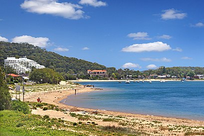
Ettalong Address: The Esplanade Ettalong Beach, 2257 Central Coast street in Ettalong Beach
Attractions near Ettalong
How to get to popular places in Sydney with public transit
Get around Sydney by public transport!
Travelling around Sydney has never been so easy. See step by step directions as you travel to any attraction, street or major public transport station. View bus and train timetables, arrival times, service alerts and detailed routes on a map, so you know exactly how to get to anywhere in Sydney.
When travelling to any destination around Sydney use Moovit's Live Directions with Get Off Notifications to know exactly where and how far to walk, how long to wait for your line , and how many stops are left. Moovit will alert you when it’s time to get off — no need to constantly re-check whether yours is the next stop.
Wondering how to use public transport in Sydney or how to pay for public transport in Sydney? Moovit public transport app can help you navigate your way with public transport easily, and at minimum cost. It includes public transport fees, ticket prices, and costs. Looking for a map of Sydney public transport lines? Moovit public transport app shows all public transport maps in Sydney with all Bus, Train, Metro, Light rail and Ferry routes and stops on an interactive map.
Sydney has 5 transport type(s), including: Bus, Train, Metro, Light rail and Ferry, operated by several transport agencies, including Sydney Metro, Sydney Trains, Sydney Light Rail, Sydney Ferries, Intercity Trains, Intercity Train, NSW TrainLink, CDC NSW R14, U-Go Mobility, Keolis Downer Northern Beaches, Manly Fast Ferry, Transdev John Holland Buses, Busways, Busways North West, Dysons Buslines