Directions to Extra Edge Community Services (Victoria Park) with public transport
The following transport lines have routes that pass near Extra Edge Community Services
 Bus: 178, 220, 270, 38, 930.
- Train: ARMADALE LINE, THORNLIE-COCKBURN LINE, FREMANTLE LINE, STADIUM SPECIAL, YANCHEP LINE.
How to get to Extra Edge Community Services by bus?
Click on the bus route to see step by step directions with maps, line arrival times and updated time schedules.
From Guildford, Guildford
50 minFrom Kings Park, Perth
29 minFrom 1 Neil Street, Osborne Park
62 minFrom Forrestfield, Forrestfield
54 minFrom Willetton Senior High School, Willetton
67 minFrom St John of God Hospital, Subiaco
53 minFrom Sir Charles Gardiner Hospital - Intensive Unit, Crawley
49 minFrom Booragoon, Booragoon
70 minFrom Subiaco Oval, Subiaco
55 minFrom DFO Harbour Town, West Perth
32 min
How to get to Extra Edge Community Services by train?
Click on the train route to see step by step directions with maps, line arrival times and updated time schedules.
Bus stops near Extra Edge Community Services in Victoria Park
Train stations near Extra Edge Community Services in Victoria Park
Bus lines to Extra Edge Community Services in Victoria Park
- ARMADALE LINE, Perth Stn,VIEW
- THORNLIE-COCKBURN LINE, Cannington Stn,VIEW
- 907, Perth,VIEW
- 908, Perth Stn,VIEW
- 38, Cloverdale,VIEW
- 39, Redcliffe Stn,VIEW
- 930, Elizabeth Quay Bus Stn,VIEW
- AIRPORT LINE, Mciver Stn,VIEW
- ELLENBROOK LINE, Mciver Stn,VIEW
- MIDLAND LINE, Midland Stn,VIEW
- 901, Perth Busport,VIEW
- 902, Perth,VIEW
- 903, Ellenbrook Stn,VIEW
- 930X, Thornlie Stn,VIEW
- 176, Oats Street Stn,VIEW
- 177, Bentley,VIEW
- 178, Elizabeth Quay Bus Stn,VIEW
- 179, Bull Creek Stn,VIEW
- 220, Armadale Senior High School,VIEW
- 284, Curtin Central Bus Stn,VIEW
What are the nearest stations to Extra Edge Community Services?
The nearest stations to Extra Edge Community Services are:
- Victoria Park Stn is 128 meters away, 3 min walk.
- Harper St Ursula Frayne Catholic College is 329 meters away, 6 min walk.
- East Perth Stn is 341 meters away, 5 min walk.
- Shepperton Rd - Ursula Frayne Catholic Coll Sen is 407 meters away, 7 min walk.
- Albany Hwy Before Duncan St is 549 meters away, 8 min walk.
- Perth Stadium Stn is 2660 meters away, 35 min walk.
- East Perth Stn Transwa East Perth is 4813 meters away, 63 min walk.
Which bus lines stop near Extra Edge Community Services?
These bus lines stop near Extra Edge Community Services: 178, 220, 270, 38, 930, 940.
Which train lines stop near Extra Edge Community Services?
These train lines stop near Extra Edge Community Services: ARMADALE LINE, THORNLIE-COCKBURN LINE.
What’s the nearest bus station to Extra Edge Community Services in Victoria Park?
The nearest bus station to Extra Edge Community Services in Victoria Park is Victoria Park Stn. It’s a 3 min walk away.
What time is the first train to Extra Edge Community Services in Victoria Park?
The ARMADALE LINE is the first train that goes to Extra Edge Community Services in Victoria Park. It stops nearby at 05:06.
What time is the last train to Extra Edge Community Services in Victoria Park?
The ARMADALE LINE is the last train that goes to Extra Edge Community Services in Victoria Park. It stops nearby at 00:27.
What time is the first bus to Extra Edge Community Services in Victoria Park?
The 930 is the first bus that goes to Extra Edge Community Services in Victoria Park. It stops nearby at 04:39.
What time is the last bus to Extra Edge Community Services in Victoria Park?
The 930 is the last bus that goes to Extra Edge Community Services in Victoria Park. It stops nearby at 00:31.
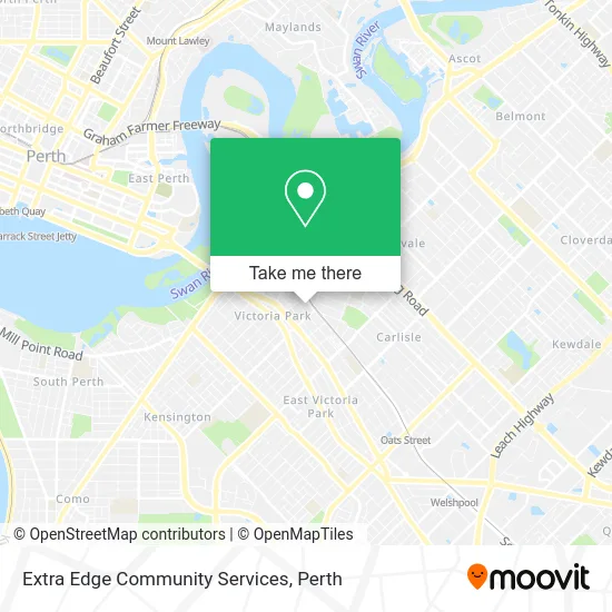
See Extra Edge Community Services, Victoria Park, on the map
Public Transit to Extra Edge Community Services in Victoria Park
Wondering how to get to Extra Edge Community Services in Victoria Park? Moovit helps you find the best way to get to Extra Edge Community Services with step-by-step directions from the nearest public transit station.
Moovit provides free maps and live directions to help you navigate through your city. View schedules, routes, timetables, and find out how long does it take to get to Extra Edge Community Services in real time.
Looking for the nearest stop or station to Extra Edge Community Services? Check out this list of stops closest to your destination: Victoria Park Stn; Harper St Ursula Frayne Catholic College; East Perth Stn; Shepperton Rd - Ursula Frayne Catholic Coll Sen; Albany Hwy Before Duncan St; Perth Stadium Stn; East Perth Stn Transwa East Perth.
Bus: 178, 220, 270, 38, 930, 940, ARMADALE LINE, THORNLIE-COCKBURN LINE, 907, 908, AIRPORT LINE, ELLENBROOK LINE, MIDLAND LINE, 901, 902, 39, 930X.Train: ARMADALE LINE, THORNLIE-COCKBURN LINE, FREMANTLE LINE, STADIUM SPECIAL, YANCHEP LINE, EAST PERTH STN TRANSWA EAST PERTH - KALGOORLIE STN TRANSWA KALGOORLIE, EAST PERTH STN TRANSWA EAST PERTH - MERREDIN STN TRANSWA MERREDIN, EAST PERTH STN TRANSWA EAST PERTH - NORTHAM STN TRANSWA NORTHAM.
Want to see if there’s another route that gets you there at an earlier time? Moovit helps you find alternative routes or times. Get directions from and directions to Extra Edge Community Services easily from the Moovit App or Website.
We make riding to Extra Edge Community Services easy, which is why over 1.5 million users, including users in Victoria Park, trust Moovit as the best app for public transit. You don’t need to download an individual bus app or train app, Moovit is your all-in-one transit app that helps you find the best bus time or train time available.
For information on prices of train and bus, costs and ride fares to Extra Edge Community Services, please check the Moovit app.
Use the app to navigate to popular places including to the airport, hospital, stadium, grocery store, mall, coffee shop, school, college, and university.
Extra Edge Community Services Address: Kitchener Ave Victoria Park, 6100 Perth street in Victoria Park
- Vic Park Presbyterian Church,
- 61 Kitchener Avenue,
- Visibility Gardens,
- The Arnold Cook Library,
- Kitchener Ave,
- Victoria Park Trainstation,
- Duncan Reserve,
- Victoria Park Station Car Park,
- 15 Duncan Street,
- Ursula Frayne Catholic College (Duncan Street Campus),
- St Joachim's Church,
- Centrelink,
- Shepperton Road,
- Cash Loan Money Centre,
- Fantasy Karaoke,
- Barista HQ Perth,
- Woolworths,
- Victoria Park Central,
- Chemist Warehouse,
- Edith Cowan University
Places Near Extra Edge Community Services (Victoria Park)
- Perth Convention Exhibition Centre, Perth,
- Karrinyup Shopping Centre, Karrinyup,
- Langley Park, Perth,
- DFO, Perth Airport,
- Mount Hospital, Perth,
- Sir Charles Gairdner Hospital, Nedlands,
- Royal Perth Hospital, Perth,
- Scitech, West Perth,
- Rac Arena, Perth,
- Pelicaan Investment Ho, Bellevue,
- Crown Perth Casino, Burswood,
- McCallum Park, Victoria Park,
- Westfield Carousel, Cannington,
- IKEA, Innaloo,
- Optus Stadium, Burswood,
- Fiona Stanley Hospital, Murdoch,
- Yankee Mart, Baldivis,
- Watertown, Perth,
- Aqwa Aquarium, Hillarys,
- Blue Boat House
How to get to popular places in Perth with public transport
Get around Victoria Park by public transport!
Travelling around Victoria Park has never been so easy. See step by step directions as you travel to any attraction, street or major public transport station. View bus and train timetables, arrival times, service alerts and detailed routes on a map, so you know exactly how to get to anywhere in Victoria Park.
When travelling to any destination around Victoria Park use Moovit's Live Directions with Get Off Notifications to know exactly where and how far to walk, how long to wait for your line , and how many stops are left. Moovit will alert you when it’s time to get off — no need to constantly re-check whether yours is the next stop.
Wondering how to use public transport in Victoria Park or how to pay for public transport in Victoria Park? Moovit public transport app can help you navigate your way with public transport easily, and at minimum cost. It includes public transport fees, ticket prices, and costs. Looking for a map of Victoria Park public transport lines? Moovit public transport app shows all public transport maps in Victoria Park with all Bus, Train and Ferry routes and stops on an interactive map.
Perth has 3 transport type(s), including: Bus, Train and Ferry, operated by several transport agencies, including Transperth Rail, Transwa, Transperth Ferry, Transperth, TransBusselton, TransAlbany, TransGoldfields, TransEsperance, TransGeraldton, TransCarnarvon, TransHedland, TransKarratha, TransBunbury, Mandurah Bus Charter and TransBroome