Directions to Fazely Developments (Dalkeith) with public transport
The following transport lines have routes that pass near Fazely Developments
 Bus: 24, 23.
- Train: AIRPORT LINE, FREMANTLE LINE, 906.
How to get to Fazely Developments by bus?
Click on the bus route to see step by step directions with maps, line arrival times and updated time schedules.
From The Charles Hotel, North Perth
74 minFrom Crowne Plaza, East Perth
48 minFrom Royal Perth Hospital Goderich Street Clinic, Perth
50 minFrom South Beach, South Fremantle
82 minFrom Hale School, Wembley Downs
58 minFrom Carlisle Station WA Australia, Carlisle
65 minFrom The Brisbane Hotel, Perth
44 minFrom Mount Lawley, Mount Lawley
64 minFrom Fremantle Arts Centre, Fremantle
67 min
Bus stops near Fazely Developments in Dalkeith
Train station near Fazely Developments in Dalkeith
- Karrakatta Stn, 16 min walk,VIEW
What are the nearest stations to Fazely Developments?
The nearest stations to Fazely Developments are:
- Birdwood Pde Before Throssell St is 9 meters away, 1 min walk.
- Birdwood Pde Before Waratah Av is 662 meters away, 9 min walk.
- Karrakatta Stn is 1197 meters away, 16 min walk.
Which bus line stops near Fazely Developments?
24 (Claremont Stn)
What’s the nearest train station to Fazely Developments in Dalkeith?
The nearest train station to Fazely Developments in Dalkeith is Karrakatta Stn. It’s a 16 min walk away.
What’s the nearest bus station to Fazely Developments in Dalkeith?
The nearest bus station to Fazely Developments in Dalkeith is Birdwood Pde Before Throssell St. It’s a 1 min walk away.
What time is the first train to Fazely Developments in Dalkeith?
The FREMANTLE LINE is the first train that goes to Fazely Developments in Dalkeith. It stops nearby at 05:30.
What time is the last train to Fazely Developments in Dalkeith?
The FREMANTLE LINE is the last train that goes to Fazely Developments in Dalkeith. It stops nearby at 00:33.
What time is the first bus to Fazely Developments in Dalkeith?
The 24 is the first bus that goes to Fazely Developments in Dalkeith. It stops nearby at 05:12.
What time is the last bus to Fazely Developments in Dalkeith?
The 24 is the last bus that goes to Fazely Developments in Dalkeith. It stops nearby at 00:04.
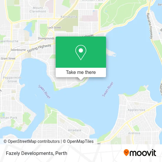
See Fazely Developments, Dalkeith, on the map
Public Transit to Fazely Developments in Dalkeith
Wondering how to get to Fazely Developments in Dalkeith? Moovit helps you find the best way to get to Fazely Developments with step-by-step directions from the nearest public transit station.
Moovit provides free maps and live directions to help you navigate through your city. View schedules, routes, timetables, and find out how long does it take to get to Fazely Developments in real time.
Looking for the nearest stop or station to Fazely Developments? Check out this list of stops closest to your destination: Birdwood Pde Before Throssell St; Birdwood Pde Before Waratah Av; Karrakatta Stn.
Bus: 24, 23.Train: AIRPORT LINE, FREMANTLE LINE, 906.
Want to see if there’s another route that gets you there at an earlier time? Moovit helps you find alternative routes or times. Get directions from and directions to Fazely Developments easily from the Moovit App or Website.
We make riding to Fazely Developments easy, which is why over 1.5 million users, including users in Dalkeith, trust Moovit as the best app for public transit. You don’t need to download an individual bus app or train app, Moovit is your all-in-one transit app that helps you find the best bus time or train time available.
For information on prices of bus and train, costs and ride fares to Fazely Developments, please check the Moovit app.
Use the app to navigate to popular places including to the airport, hospital, stadium, grocery store, mall, coffee shop, school, college, and university.
Fazely Developments Address: 71 Birdwood Pde Dalkeith WA 6009 street in Dalkeith
- Parking Lot,
- Perth Flying Squadron Yacht Club,
- BP,
- Beatrice Rd Reserve,
- Lak Holdings,
- Dôme Café - East Fremantle,
- Namafelo,
- Perth City Cranes,
- Gallop House,
- White Canvas Design,
- Al Enterprises Aust Pty LTD Atf Ala,
- Perth Flying Squadron Yacht Club,
- Birdwood Park,
- Hazel House,
- Cussonsmedia,
- Nedlands Yacht Club,
- Dalkeith WA Australia,
- Tennis HQ,
- Fulfilling Yoga,
- JP Equity Partners
Places Near Fazely Developments (Dalkeith)
- Aqwa Aquarium, Hillarys,
- Optus Stadium, Burswood,
- Yankee Mart, Baldivis,
- Sir Charles Gairdner Hospital, Nedlands,
- Rac Arena, Perth,
- Blue Boat House,
- Karrinyup Shopping Centre, Karrinyup,
- Royal Perth Hospital, Perth,
- Scitech, West Perth,
- Crown Perth Casino, Burswood,
- Westfield Carousel, Cannington,
- Pelicaan Investment Ho, Bellevue,
- IKEA, Innaloo,
- Langley Park, Perth,
- Perth Convention Exhibition Centre, Perth,
- McCallum Park, Victoria Park,
- Hillarys Boat Harbour,
- Fiona Stanley Hospital, Murdoch,
- DFO, Perth Airport,
- Mount Hospital, Perth
How to get to popular places in Perth with public transport
Get around Dalkeith by public transport!
Travelling around Dalkeith has never been so easy. See step by step directions as you travel to any attraction, street or major public transport station. View bus and train timetables, arrival times, service alerts and detailed routes on a map, so you know exactly how to get to anywhere in Dalkeith.
When travelling to any destination around Dalkeith use Moovit's Live Directions with Get Off Notifications to know exactly where and how far to walk, how long to wait for your line , and how many stops are left. Moovit will alert you when it’s time to get off — no need to constantly re-check whether yours is the next stop.
Wondering how to use public transport in Dalkeith or how to pay for public transport in Dalkeith? Moovit public transport app can help you navigate your way with public transport easily, and at minimum cost. It includes public transport fees, ticket prices, and costs. Looking for a map of Dalkeith public transport lines? Moovit public transport app shows all public transport maps in Dalkeith with all Bus, Train and Ferry routes and stops on an interactive map.
Perth has 3 transport type(s), including: Bus, Train and Ferry, operated by several transport agencies, including Transperth Rail, Transwa, Transperth Ferry, Transperth, TransBusselton, TransAlbany, TransGoldfields, TransEsperance, TransGeraldton, TransCarnarvon, TransHedland, TransKarratha, TransBunbury, Mandurah Bus Charter and TransBroome