How to get to Finger Ink by bus?
Click on the bus route to see step by step directions with maps, line arrival times and updated time schedules.
From Saint John Of God Murdoch Hospital, Murdoch
40 minFrom Milroy Lodge, Shenton Park
43 minFrom Claremont Showground, Claremont
29 minFrom Canning Bridge Station, Como
40 minFrom Aviation Heritage Museum, Bull Creek
43 minFrom WA Athletics Stadium, Mount Claremont
77 minFrom Bendat Basketball Centre, Floreat
75 minFrom Coogee Beach, Coogee
31 minFrom Sir Charles Gairdner Hospital, Nedlands
34 minFrom HBF Stadium, Mount Claremont
75 min
How to get to Finger Ink by train?
Click on the train route to see step by step directions with maps, line arrival times and updated time schedules.
Bus stops near Finger Ink in North Fremantle
Train station near Finger Ink in North Fremantle
- Mosman Park Stn, 45 min walk,VIEW
Bus lines to Finger Ink in North Fremantle
What are the nearest stations to Finger Ink?
The nearest stations to Finger Ink are:
- Harvest Rd After Stirling Hwy is 491 meters away, 7 min walk.
- Stirling Hwy After Queen Victoria St is 574 meters away, 8 min walk.
- Stirling Hwy After Alfred Rd is 602 meters away, 8 min walk.
- Queen Victoria St - Fremantle Traffic Bridge is 821 meters away, 11 min walk.
- Mosman Park Stn is 3466 meters away, 45 min walk.
Which bus lines stop near Finger Ink?
These bus lines stop near Finger Ink: 910, 998, 999.
Which train line stops near Finger Ink?
FREMANTLE LINE (Fremantle Stn)
What’s the nearest bus station to Finger Ink in North Fremantle?
The nearest bus station to Finger Ink in North Fremantle is Harvest Rd After Stirling Hwy. It’s a 7 min walk away.
What time is the first train to Finger Ink in North Fremantle?
The FREMANTLE LINE is the first train that goes to Finger Ink in North Fremantle. It stops nearby at 07:08.
What time is the last train to Finger Ink in North Fremantle?
The FREMANTLE LINE is the last train that goes to Finger Ink in North Fremantle. It stops nearby at 00:38.
What time is the first bus to Finger Ink in North Fremantle?
The 910 is the first bus that goes to Finger Ink in North Fremantle. It stops nearby at 06:05.
What time is the last bus to Finger Ink in North Fremantle?
The 910 is the last bus that goes to Finger Ink in North Fremantle. It stops nearby at 00:24.
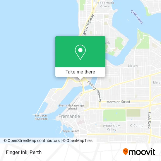
See Finger Ink, North Fremantle, on the map
Public Transit to Finger Ink in North Fremantle
Wondering how to get to Finger Ink in North Fremantle? Moovit helps you find the best way to get to Finger Ink with step-by-step directions from the nearest public transit station.
Moovit provides free maps and live directions to help you navigate through your city. View schedules, routes, timetables, and find out how long does it take to get to Finger Ink in real time.
Looking for the nearest stop or station to Finger Ink? Check out this list of stops closest to your destination: Harvest Rd After Stirling Hwy; Stirling Hwy After Queen Victoria St; Stirling Hwy After Alfred Rd; Queen Victoria St - Fremantle Traffic Bridge; Mosman Park Stn.
Bus: 910, 998, 999, 107, 111, 148, 158, 500, 659.Train: FREMANTLE LINE.
Want to see if there’s another route that gets you there at an earlier time? Moovit helps you find alternative routes or times. Get directions from and directions to Finger Ink easily from the Moovit App or Website.
We make riding to Finger Ink easy, which is why over 1.5 million users, including users in North Fremantle, trust Moovit as the best app for public transit. You don’t need to download an individual bus app or train app, Moovit is your all-in-one transit app that helps you find the best bus time or train time available.
For information on prices of bus and train, costs and ride fares to Finger Ink, please check the Moovit app.
Use the app to navigate to popular places including to the airport, hospital, stadium, grocery store, mall, coffee shop, school, college, and university.
Finger Ink Address: 34 Tydeman Rd North Fremantle WA 6159 street in North Fremantle
- Do A Dinner,
- Sandblasting,
- Harriette Gordon,
- Building Inspection Perth Wa,
- Heartspace Chiropractic North Fremantle Chiropractor,
- Telstra Payphone,
- Mancuso Art,
- Western Union,
- Osprey Creative Pty,
- Drop Low,
- Wine Education Centre,
- Old Bridge Cellars,
- Michael Johnson Hair,
- Opus Partners,
- Paula Flinn Breathwork & Movement,
- Aileen Thai Massage,
- Synergy Marine Services Australia,
- LKB the Low Tox Salon,
- Swan Maritime Institute,
- Apex Osteopathy and Athletic Performance North Fremantle
Places Near Finger Ink (North Fremantle)
- Aqwa Aquarium, Hillarys,
- Watertown, Perth,
- Rac Arena, Perth,
- Yankee Mart, Baldivis,
- Pelicaan Investment Ho, Bellevue,
- Karrinyup Shopping Centre, Karrinyup,
- Fiona Stanley Hospital, Murdoch,
- IKEA, Innaloo,
- DFO, Perth Airport,
- Crown Perth Casino, Burswood,
- Mount Hospital, Perth,
- Perth Convention Exhibition Centre, Perth,
- Langley Park, Perth,
- Royal Perth Hospital, Perth,
- Scitech, West Perth,
- Westfield Carousel, Cannington,
- Sir Charles Gairdner Hospital, Nedlands,
- Blue Boat House,
- McCallum Park, Victoria Park,
- Optus Stadium, Burswood
How to get to popular places in Perth with public transport
Get around North Fremantle by public transport!
Travelling around North Fremantle has never been so easy. See step by step directions as you travel to any attraction, street or major public transport station. View bus and train timetables, arrival times, service alerts and detailed routes on a map, so you know exactly how to get to anywhere in North Fremantle.
When travelling to any destination around North Fremantle use Moovit's Live Directions with Get Off Notifications to know exactly where and how far to walk, how long to wait for your line , and how many stops are left. Moovit will alert you when it’s time to get off — no need to constantly re-check whether yours is the next stop.
Wondering how to use public transport in North Fremantle or how to pay for public transport in North Fremantle? Moovit public transport app can help you navigate your way with public transport easily, and at minimum cost. It includes public transport fees, ticket prices, and costs. Looking for a map of North Fremantle public transport lines? Moovit public transport app shows all public transport maps in North Fremantle with all Bus, Train and Ferry routes and stops on an interactive map.
Perth has 3 transport type(s), including: Bus, Train and Ferry, operated by several transport agencies, including Transperth Rail, Transwa, Transperth Ferry, Transperth, TransBusselton, TransAlbany, TransGoldfields, TransEsperance, TransGeraldton, TransCarnarvon, TransHedland, TransKarratha, TransBunbury, Mandurah Bus Charter and TransBroome