Directions to Fremantle with public transportation
The following transport lines have routes that pass near Fremantle
 Bus: 910, 998, 999, 511, 512.
- Train: FREMANTLE LINE.
How to get to Fremantle by bus?
Click on the bus route to see step by step directions with maps, line arrival times and updated time schedules.
How to get to Fremantle by train?
Click on the train route to see step by step directions with maps, line arrival times and updated time schedules.
Bus stops near Fremantle
- Market St Before High St, 1 min walk,
- South Tce After Market St, 1 min walk,
- Queen St After Adelaide St, 5 min walk,
- Queen St Before Adelaide St, 5 min walk,
- Fremantle Stn, 6 min walk,
Bus routes to Fremantle
- 511, Fremantle Stn,
- 512, Murdoch Stn,
- 513, Kardinya Shop Ctr,
- 520, Fremantle Stn,
- 530, Fremantle,
- 531, Fremantle Stn,
- 532, South Fremantle,
- 548, Coogee,
- 549, Fremantle Stn,
- 998, Fremantle Stn,
- 999, Belmont Forum / Wright St,
- 107, Cottesloe Stn,
- 111, East Perth,
- 148, Como,
- 158, Fremantle Stn,
- 160, Fremantle Stn,
- 502, Fremantle Stn,
- 910, Fremantle Stn,
- 915, Fremantle Stn,
- 500, Bull Creek Stn,
What are the nearest stations to Fremantle?
The nearest stations to Fremantle are:
- Market St Before High St is 42 meters away, 1 min walk.
- South Tce After Market St is 52 meters away, 1 min walk.
- Queen St After Adelaide St is 353 meters away, 5 min walk.
- Queen St Before Adelaide St is 375 meters away, 5 min walk.
- Fremantle Stn is 422 meters away, 6 min walk.
Which bus lines stop near Fremantle?
These bus lines stop near Fremantle: 910, 998, 999.
Which train line stops near Fremantle?
FREMANTLE LINE (Fremantle Stn)
What’s the nearest bus station to Fremantle?
The nearest bus stations to Fremantle are Market St Before High St and South Tce After Market St. The closest one is a 1 min walk away.
What time is the first train to Fremantle?
The FREMANTLE LINE is the first train that goes to Fremantle. It stops nearby at 07:17.
What time is the last train to Fremantle?
The FREMANTLE LINE is the last train that goes to Fremantle. It stops nearby at 00:47.
What time is the first bus to Fremantle?
The 910 is the first bus that goes to Fremantle. It stops nearby at 06:02.
What time is the last bus to Fremantle?
The 910 is the last bus that goes to Fremantle. It stops nearby at 00:29.
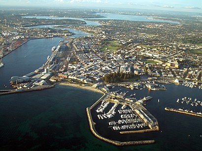
See Fremantle on the map
Public Transportation to Fremantle
Wondering how to get to Fremantle? Moovit helps you find the best way to get to Fremantle with step-by-step directions from the nearest public transit station.
Moovit provides free maps and live directions to help you navigate through your city. View schedules, routes, timetables, and find out how long does it take to get to Fremantle in real time.
Looking for the nearest stop or station to Fremantle? Check out this list of stops closest to your destination: Market St Before High St; South Tce After Market St; Queen St After Adelaide St; Queen St Before Adelaide St; Fremantle Stn.
Bus: 910, 998, 999, 511, 512, 513, 520, 530, 107, 111, 148, 158, 160, 500, FREMANTLE LINE, 659.Train: FREMANTLE LINE.
Want to see if there’s another route that gets you there at an earlier time? Moovit helps you find alternative routes or times. Get directions from and directions to Fremantle easily from the Moovit App or Website.
We make riding to Fremantle easy, which is why over 1.5 million users, including users in Fremantle, trust Moovit as the best app for public transit. You don’t need to download an individual bus app or train app, Moovit is your all-in-one transit app that helps you find the best bus time or train time available.
For information on prices of bus and train, costs and ride fares to Fremantle, please check the Moovit app.
Use the app to navigate to popular places including to the airport, hospital, stadium, grocery store, mall, coffee shop, school, college, and university.
Location: Fremantle, Perth
- Dumpling Time,
- Elizabeth's Secondhand Bookshop,
- The Newport Hotel,
- Bob's Shoe Store,
- RSL,
- National Hotel,
- The Blue House,
- Fremantle Markets - The Yard,
- Cicerellos Fremantle,
- Timezone,
- South Fremantle Football Club,
- Freemantle Esplanade,
- Jambo,
- Merenda Gallery Fine Art,
- Hoyts Millenium,
- Capri Restaurant,
- South Terrace Fremantle,
- Fremantle Town Hall,
- Notre Dame University - ND4 / 101,
- The Pickled Fairy & Other Myths
Places Near Fremantle
- McCallum Park, Victoria Park,
- The Perth Mint, East Perth,
- Mount Hospital, Perth,
- IKEA, Innaloo,
- Karrinyup Shopping Centre, Karrinyup,
- Royal Perth Hospital, Perth,
- Perth Convention Exhibition Centre, Perth,
- Crown Perth Casino, Burswood,
- Rac Arena, Perth,
- HBF Park, Perth,
- Optus Stadium, Burswood,
- Fiona Stanley Hospital, Murdoch,
- Sir Charles Gairdner Hospital, Nedlands,
- Scitech, West Perth,
- Scarborough Beach, Scarborough,
- Watertown, Perth,
- Blue Boat House,
- DFO, Perth Airport,
- Langley Park, Perth,
- Yankee Mart, Baldivis
How to get to popular places in Perth with public transport
Get around Fremantle by public transport!
Travelling around Fremantle has never been so easy. See step by step directions as you travel to any attraction, street or major public transport station. View bus and train timetables, arrival times, service alerts and detailed routes on a map, so you know exactly how to get to anywhere in Fremantle.
When travelling to any destination around Fremantle use Moovit's Live Directions with Get Off Notifications to know exactly where and how far to walk, how long to wait for your line , and how many stops are left. Moovit will alert you when it’s time to get off — no need to constantly re-check whether yours is the next stop.
Wondering how to use public transport in Fremantle or how to pay for public transport in Fremantle? Moovit public transport app can help you navigate your way with public transport easily, and at minimum cost. It includes public transport fees, ticket prices, and costs. Looking for a map of Fremantle public transport lines? Moovit public transport app shows all public transport maps in Fremantle with all Bus, Train and Ferry routes and stops on an interactive map.
Perth has 3 transport type(s), including: Bus, Train and Ferry, operated by several transport agencies, including Transperth Rail, Transwa, Transperth Ferry, Transperth, TransBusselton, TransAlbany, TransGoldfields, TransEsperance, TransGeraldton, TransCarnarvon, TransHedland, TransKarratha, TransBunbury, Mandurah Bus Charter and TransBroome