Goitside D stop - Sunday schedule
| Line | Direction | Time |
|---|---|---|
| 621 | Haworth Road | 08:33 |
| 621 | Haworth Road | 08:33 |
| 621 | Haworth Road | 08:54 |
| 621 | Haworth Road | 08:54 |
| 621 | Haworth Road | 09:44 |
| 621 | Haworth Road | 09:44 |
| 621 | Haworth Road | 10:08 |
| 621 | Haworth Road | 10:08 |
| 621 | Haworth Road | 10:44 |
| 621 | Haworth Road | 10:44 |
| 621 | Haworth Road | 11:20 |
| 621 | Haworth Road | 11:20 |
| 621 | Haworth Road | 11:51 |
| 621 | Haworth Road | 11:51 |
| 621 | Haworth Road | 12:23 |
| 621 | Haworth Road | 12:23 |
| 621 | Haworth Road | 12:59 |
| 621 | Haworth Road | 12:59 |
| 621 | Haworth Road | 13:32 |
| 621 | Haworth Road | 13:32 |
| 621 | Haworth Road | 14:05 |
| 621 | Haworth Road | 14:05 |
| 621 | Haworth Road | 14:44 |
| 621 | Haworth Road | 14:44 |
| 621 | Haworth Road | 15:15 |
Directions to Goitside D stop (Bradford) with public transport
The following transport lines have routes that pass near Goitside D
 Bus: 425, 576, 67, 72, A2.
- Train: NORTHERN, GRAND CENTRAL, LONDON NORTH EASTERN RAILWAY.
How to get to Goitside D stop by bus?
Click on the bus route to see step by step directions with maps, line arrival times and updated time schedules.
How to get to Goitside D stop by train?
Click on the train route to see step by step directions with maps, line arrival times and updated time schedules.
Bus stops near Goitside D stop in Bradford
- Goitside E, 4 min walk,
- Goitside F, 4 min walk,
- Rawson Square H, 4 min walk,
- Arkwright House, 5 min walk,
- City Park G, 5 min walk,
- Ice Arena I, 7 min walk,
Train stations near Goitside D station in Bradford
- Bradford Interchange, 48 min walk,
- Bradford Forster Square, 54 min walk,
Bus lines to Goitside D stop in Bradford
- 617, Bradford Intc,
- 618, Allerton,
- 620, Haworth Road,
- 621, Haworth Road,
- 635, Mayo Avenue Morrisons,
- 643, Bradford Interchange (Stand A),
- 644, J1 John Street,
- 676, Hope Hill View Airedale Avenue,
- 67, Bradford Intc,
- 607, Bradford Interchang,
- 615, Cottingley,
- 616, Bradford Intc,
- 619, Otley Road Terminus,
- 636, Bradford Intc,
- 637, Clayton Town End,
- 615, Bradford Intc,
- 576, Bradford Intc,
- 613, Bradford Interchang,
- 614, Bradford Intc,
What are the nearest stations to Goitside D?
The nearest stations to Goitside D are:
- Goitside E stop is 241 meters away, 4 min walk.
- Goitside F stop is 248 meters away, 4 min walk.
- Rawson Square H stop is 266 meters away, 4 min walk.
- Arkwright House stop is 322 meters away, 5 min walk.
- City Park G stop is 361 meters away, 5 min walk.
- Ice Arena I stop is 516 meters away, 7 min walk.
- Bradford Interchange station is 3700 meters away, 48 min walk.
- Bradford Forster Square station is 4163 meters away, 54 min walk.
Which bus lines stop near Goitside D?
These bus lines stop near Goitside D: 425, 576, 67, 72, A2.
Which train line stops near Goitside D?
NORTHERN (Halifax)
What’s the nearest bus station to Goitside D in Bradford?
The nearest bus stations to Goitside D in Bradford are Goitside E, Goitside F and Rawson Square H. The closest one is a 4 min walk away.
What time is the first train to Goitside D in Bradford?
The GRAND CENTRAL is the first train that goes to Goitside D in Bradford. It stops nearby at 08:00.
What time is the last train to Goitside D in Bradford?
The NORTHERN is the last train that goes to Goitside D in Bradford. It stops nearby at 23:54.
What time is the first bus to Goitside D in Bradford?
The 617 is the first bus that goes to Goitside D in Bradford. It stops nearby at 07:05.
What time is the last bus to Goitside D in Bradford?
The 618 is the last bus that goes to Goitside D in Bradford. It stops nearby at 23:44.
Goitside D station
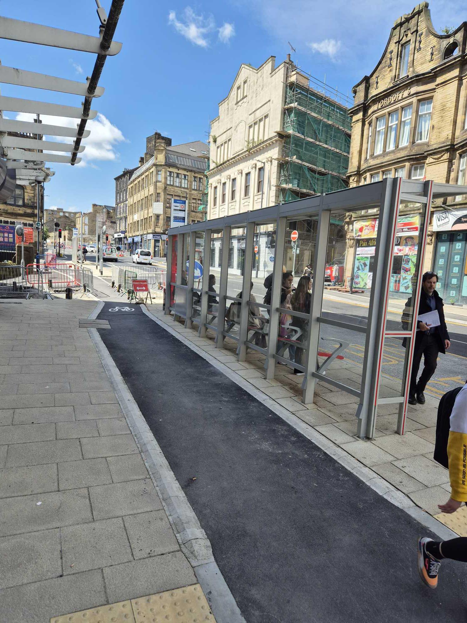 Taken by Anonymous
See Goitside D stop, Bradford, on the map
Public transport to Goitside D stop (ID: 45032472) in Bradford
Looking for directions to Goitside D in Bradford, United Kingdom?
Download the Moovit App to find the current schedule and step-by-step directions for Bus or Train routes that pass through Goitside D.
Looking for the nearest stops closest to Goitside D ? Check out this list of closest stops to your destination: Goitside E; Goitside F; Rawson Square H; Arkwright House; City Park G; Ice Arena I; Bradford Interchange; Bradford Forster Square.
Bus: 425, 576, 67, 72, A2, 620, 621, 617, 618, 635, 643, 644, 676, 607, 615, 616, 619.Train: NORTHERN, GRAND CENTRAL, LONDON NORTH EASTERN RAILWAY.
We make riding on public transit to Goitside D easy, which is why over 1.7 billion users, including users in Bradford trust Moovit as the best app for public transit.
Use the app to navigate to popular places including to the airport, hospital, stadium, grocery store, mall, coffee shop, school, college, and university.
Goitside D stop’s code is 45032472
The first line to this stop is 621, at 08:33, and the last line is 621 at 23:12.
Sunbridge Road, Bradford, England, United Kingdom
This stop serves First Bradford’s lines
Popular routes from Goitside D stop, Bradford
- Goitside E,
- Goitside F,
- Rawson Square H,
- Arkwright House,
- City Park G,
- Ice Arena I
Bus stops near Goitside D stop
- Bradford Interchange,
- Bradford Forster Square
Train stations near Goitside D station
- Ringways Ring Road,
- Ghyll Beck,
- Dovecote Park,
- Bailiff Bridge Junction,
- West Hill/Hill Top Lane,
- Spring Grove,
- Harehills Avenue,
- Duckworth Lane,
- Oakwood Mcdonalds,
- Goole Rawcliffe Road,
- Beeston Co-Op,
- Pudsey Town Hall,
- Westfield Lane Central Ave,
- St Aidan's School,
- St Michaels Church,
- Handsworth Road/Finchwell Road,
- Queen Elizabeth Barracks,
- Bachelor Gardens,
- St. George's Square,
- Gillygate
Popular public transport stations in Bradford
Get around Bradford by public transport!
Travelling around Bradford has never been so easy. See step by step directions as you travel to any attraction, street or major public transport station. View bus and train timetables, arrival times, service alerts and detailed routes on a map, so you know exactly how to get to anywhere in Bradford.
When travelling to any destination around Bradford use Moovit's Live Directions with Get Off Notifications to know exactly where and how far to walk, how long to wait for your line , and how many stops are left. Moovit will alert you when it’s time to get off — no need to constantly re-check whether yours is the next stop.
Wondering how to use public transport in Bradford or how to pay for public transport in Bradford? Moovit public transport app can help you navigate your way with public transport easily, and at minimum cost. It includes public transport fees, ticket prices, and costs. Looking for a map of Bradford public transport lines? Moovit public transport app shows all public transport maps in Bradford with all Bus, Train and Light rail routes and stops on an interactive map.
Yorkshire has 3 transport type(s), including: Bus, Train and Light rail, operated by several transport agencies, including First Leeds, First South Yorkshire, First York, Arriva Yorkshire, Stagecoach Yorkshire, National Rail, First Bradford, First Halifax, Calder Valley & Huddersfield, East Yorkshire, The Keighley Bus Company, South Yorkshire Future Tram, The Harrogate Bus Company, TM Travel, Coastliner and Stevenson's Travel