Directions to Hartshead Pike (Mossley) with public transport
The following transport lines have routes that pass near Hartshead Pike
 Bus: 350, 425, S350B, 870, 820.
- Train: TRANSPENNINE EXPRESS.
How to get to Hartshead Pike by bus?
Click on the bus route to see step by step directions with maps, line arrival times and updated time schedules.
How to get to Hartshead Pike by train?
Click on the train route to see step by step directions with maps, line arrival times and updated time schedules.
Bus stops near Hartshead Pike in Mossley
- The Billy Goat, 14 min walk,
- Broadcarr Lane, 16 min walk,
- Market Place, 17 min walk,
Light Rail stations near Hartshead Pike in Mossley
- Oldham Mumps (Manchester Metrolink), 17 min walk,
- Ashton-Under-Lyne (Manchester Metrolink), 26 min walk,
Bus lines to Hartshead Pike in Mossley
- 350, Ashton-Under-Lyne Interchange,
- S350B, Market Place,
- 870, St Damian's Rc Science College,
- 820, Huddersfield Rd/Staley Rd,
- 820, Staley Road,
- 870, Stalybridge Bus Station,
- 343, Hyde Bus Station,
- 343, Oldham Central Bus Station,
- 356, Oldham Bus Station,
- 822, Blue Coat School,
- 770, Oldham - Ashton Under Lyne,
- 828, Mossley - Dobcross,
What are the nearest stations to Hartshead Pike?
The nearest stations to Hartshead Pike are:
- The Billy Goat is 1101 meters away, 14 min walk.
- Broadcarr Lane is 1204 meters away, 16 min walk.
- Oldham Mumps (Manchester Metrolink) is 1235 meters away, 17 min walk.
- Market Place is 1315 meters away, 17 min walk.
- Ashton-Under-Lyne (Manchester Metrolink) is 2013 meters away, 26 min walk.
Which bus lines stop near Hartshead Pike?
These bus lines stop near Hartshead Pike: 350, 425.
Which train line stops near Hartshead Pike?
TRANSPENNINE EXPRESS (Manchester Piccadilly)
What’s the nearest light rail station to Hartshead Pike in Mossley?
The nearest light rail station to Hartshead Pike in Mossley is Oldham Mumps (Manchester Metrolink). It’s a 17 min walk away.
What’s the nearest bus station to Hartshead Pike in Mossley?
The nearest bus station to Hartshead Pike in Mossley is The Billy Goat. It’s a 14 min walk away.
What time is the first light rail to Hartshead Pike in Mossley?
The PINK LINE is the first light rail that goes to Hartshead Pike in Mossley. It stops nearby at 05:21.
What time is the last light rail to Hartshead Pike in Mossley?
The PINK LINE is the last light rail that goes to Hartshead Pike in Mossley. It stops nearby at 01:06.
What time is the first bus to Hartshead Pike in Mossley?
The 350 is the first bus that goes to Hartshead Pike in Mossley. It stops nearby at 05:08.
What time is the last bus to Hartshead Pike in Mossley?
The 350 is the last bus that goes to Hartshead Pike in Mossley. It stops nearby at 23:48.
See Hartshead Pike, Mossley, on the map
Public Transit to Hartshead Pike in Mossley
Wondering how to get to Hartshead Pike in Mossley? Moovit helps you find the best way to get to Hartshead Pike with step-by-step directions from the nearest public transit station.
Moovit provides free maps and live directions to help you navigate through your city. View schedules, routes, timetables, and find out how long does it take to get to Hartshead Pike in real time.
Looking for the nearest stop or station to Hartshead Pike? Check out this list of stops closest to your destination: The Billy Goat; Broadcarr Lane; Oldham Mumps (Manchester Metrolink); Market Place; Ashton-Under-Lyne (Manchester Metrolink).
Bus: 350, 425, S350B, 870, 820, 820, 870, 343, 343, 356, 822, 770, 828.Train: TRANSPENNINE EXPRESS.
Want to see if there’s another route that gets you there at an earlier time? Moovit helps you find alternative routes or times. Get directions from and directions to Hartshead Pike easily from the Moovit App or Website.
We make riding to Hartshead Pike easy, which is why over 1.5 million users, including users in Mossley, trust Moovit as the best app for public transit. You don’t need to download an individual bus app or train app, Moovit is your all-in-one transit app that helps you find the best bus time or train time available.
For information on prices of bus, train and light rail, costs and ride fares to Hartshead Pike, please check the Moovit app.
Use the app to navigate to popular places including to the airport, hospital, stadium, grocery store, mall, coffee shop, school, college, and university.
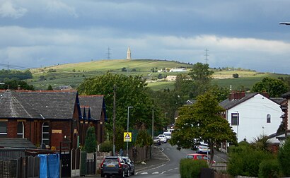
Hartshead Pike Address: Lily Lanes street in Mossley
- Brook Bottom,
- Knott Hill Farm,
- Elaines Market,
- Mossley FC,
- Mossley Football Club,
- Seel Park, Mossley AFC,
- Cockfields Farm,
- Cockfield Farm,
- Ol6 8ar,
- Tamewater Developments,
- Marston's Estates,
- Lower Hey Boarding Kennels & Cattery,
- Emmaus Mossley,
- Bibiint,
- Queen Street Manchester,
- Mossley Station,
- Steve BENTLEY,
- G & G Carpets,
- Emmaus Charity Shops,
- Emmaus Mossley
Places Near Hartshead Pike (Mossley)
- M12 6JH, Manchester,
- Ao Arena, Manchester,
- Salford Quays, Salford,
- Bramley-Moore Dock, Liverpool,
- Alder Hey Children's Hospital, Liverpool,
- Broadgreen Hospital, Liverpool,
- Lark Lane, Liverpool, Liverpool,
- Runway Visitor Park, Manchester,
- O2 Apollo Manchester, Manchester,
- Manchester Opera House, Manchester,
- Bec Arena, Trafford Park,
- Heaton Park, Manchester,
- P Louise, Denton,
- St Helens Hospital, St Helens,
- The Trafford Centre, Trafford Park,
- Wythenshawe Hospital, Manchester,
- Royal lancaster Infirmary - Medical Unit 1, Lancaster,
- Co-OP Live Arena, Manchester,
- Bowlers Exhibition Centre, Trafford Park,
- Plouise Makeup Academy, Prestwich
How to get to popular places in North West with public transport
Get around Mossley by public transport!
Travelling around Mossley has never been so easy. See step by step directions as you travel to any attraction, street or major public transport station. View bus and train timetables, arrival times, service alerts and detailed routes on a map, so you know exactly how to get to anywhere in Mossley.
When travelling to any destination around Mossley use Moovit's Live Directions with Get Off Notifications to know exactly where and how far to walk, how long to wait for your line , and how many stops are left. Moovit will alert you when it’s time to get off — no need to constantly re-check whether yours is the next stop.
Wondering how to use public transport in Mossley or how to pay for public transport in Mossley? Moovit public transport app can help you navigate your way with public transport easily, and at minimum cost. It includes public transport fees, ticket prices, and costs. Looking for a map of Mossley public transport lines? Moovit public transport app shows all public transport maps in Mossley with all Bus, Train, Light rail and Ferry routes and stops on an interactive map.
North West has 4 transport type(s), including: Bus, Train, Light rail and Ferry, operated by several transport agencies, including Arriva North West, Stagecoach Merseyside and South Lancashire, Stagecoach Cumbria and North Lancashire, First Halifax, National Express, Warrington's Own Buses, First Potteries, Rosso, Blackpool Transport, The Blackburn Bus Company, The Burnley Bus Company, Vision Bus, National Rail, Huyton Travel and Stotts Tours