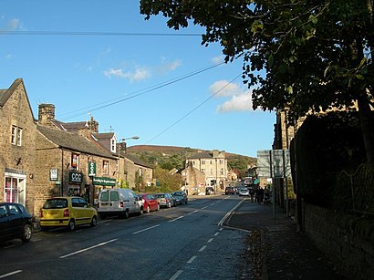
Directions to Hathersage with public transportation
The following transport lines have routes that pass near Hathersage
How to get to Hathersage by bus?
Click on the bus route to see step by step directions with maps, line arrival times and updated time schedules.
Bus stations near Hathersage
- Rail Bridge,1 min walk,
Train stations near Hathersage
- Hathersage,12 min walk,
Bus routes to Hathersage
- BLUE,Chesterfield,
- 257,Bakewell,
- 271,Castleton,
- 272,Castleton,
- 772,Ecclesall,
What are the nearest stations to Hathersage?
The nearest stations to Hathersage are:
- Rail Bridge is 0 meters away, 1 min walk.
- Hathersage is 873 meters away, 12 min walk.
Which bus lines stop near Hathersage?
These bus lines stop near Hathersage: 272, BLUE.
What’s the nearest train station to Hathersage?
The nearest train station to Hathersage is Hathersage. It’s a 12 min walk away.
What’s the nearest bus stop to Hathersage?
The nearest bus stop to Hathersage is Rail Bridge. It’s a 1 min walk away.
What time is the first train to Hathersage?
The NORTHERN is the first train that goes to Hathersage. It stops nearby at 08:40.
What time is the last train to Hathersage?
The EAST MIDLANDS RAILWAY is the last train that goes to Hathersage. It stops nearby at 23:13.
What time is the first bus to Hathersage?
The 272 is the first bus that goes to Hathersage. It stops nearby at 09:28.
What time is the last bus to Hathersage?
The NORTHERN is the last bus that goes to Hathersage. It stops nearby at 23:22.
See Hathersage on the map
Public Transportation to Hathersage
Wondering how to get to Hathersage, United Kingdom? Moovit helps you find the best way to get to Hathersage with step-by-step directions from the nearest public transit station.
Moovit provides free maps and live directions to help you navigate through your city. View schedules, routes, timetables, and find out how long does it take to get to Hathersage in real time.
Looking for the nearest stop or station to Hathersage? Check out this list of stops closest to your destination: Rail Bridge; Hathersage.
Bus:272BLUE257271772Train:EAST MIDLANDS RAILWAYNORTHERNNORTHERN
Want to see if there’s another route that gets you there at an earlier time? Moovit helps you find alternative routes or times. Get directions from and directions to Hathersage easily from the Moovit App or Website.
We make riding to Hathersage easy, which is why over 1.5 million users, including users in Yorkshire, trust Moovit as the best app for public transit. You don’t need to download an individual bus app or train app, Moovit is your all-in-one transit app that helps you find the best bus time or train time available.
For information on prices of bus, costs and ride fares to Hathersage, please check the Moovit app.
Use the app to navigate to popular places including to the airport, hospital, stadium, grocery store, mall, coffee shop, school, college, and university.
Location: Yorkshire
Popular routes to Hathersage
Popular routes from Hathersage
Attractions near Hathersage
S32 1dd,Hathersage Playground,Little John's Grave,The Plough Inn,The Riverside Herb Centre,North Lees Campsite,Peak District National Park,Stanage Edge,Hope Valley ,Green's Paper Mill Dam,Over Owler Tor,Surprise View,Shatton Lane,Stanage Edge,Robin Hood's Cave,Surprise View,Higger Tor,Upper Burbage Bridge,Padley Gorge,Sir William HillHow to get to popular attractions in Yorkshire with public transportation
Skelton Lake Service Station, Leeds,Bowland Fell Park, Wigglesworth,Whitehall Road, Leeds,BD13, Bradford,Graves Park Farm, Sheffield,Big Fun, Hull,Highfield Medical Centre, Leeds,Silkwood Business Park, Wakefield,MORRISONS, Harrogate,Amazon Uk (Lba1), Doncaster,Sutton Park, Hull,Skipsea Sands Holiday Park - Park Resorts, Skipsea,Royal Hallamshire Hospital, Sheffield, Sheffield,The Light, Leeds,Spire Methley Park Hospital, Leeds,Leeds University Student Union (Stylus and Function), Leeds,Red Brick Mill, Heckmondwike,East Park, Hull,Leeds Coach Station Dyer Street, Leeds,Haltemprice CrematoriumGet around Yorkshire by public transport!
Travelling around Yorkshire has never been so easy. See step by step directions as you travel to any attraction, street or major public transport station. View bus and train timetables, arrival times, service alerts and detailed routes on a map, so you know exactly how to get to anywhere in Yorkshire.
When travelling to any destination around Yorkshire use Moovit's Live Directions with Get Off Notifications to know exactly where and how far to walk, how long to wait for your line , and how many stops are left. Moovit will alert you when it’s time to get off — no need to constantly re-check whether yours is the next stop.
Wondering how to use public transport in Yorkshire or how to pay for public transport in Yorkshire? Moovit public transport app can help you navigate your way with public transport easily, and at minimum cost. It includes public transport fees, ticket prices, and costs. Looking for a map of Yorkshire public transport lines? Moovit public transport app shows all public transport maps in Yorkshire with all bus routes and stops on an interactive map.
Yorkshire has 1 transport type(s), including: bus, operated by several transport agencies, including First Leeds, First South Yorkshire, First York, Arriva Yorkshire, Stagecoach Yorkshire, National Rail, First Bradford, First Halifax, Calder Valley & Huddersfield, East Yorkshire, The Keighley Bus Company, South Yorkshire Future Tram, The Harrogate Bus Company, National Rail, TM Travel and Coastliner