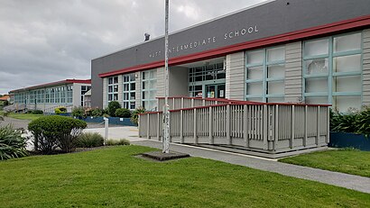
Hutt Intermediate School stop - Sunday schedule
| Line | Direction | Time |
|---|---|---|
| 842 | Hutt Valley High School (School Stop) | 08:20 |
| 154 | Hutt Valley High School (School Stop) | 08:23 |
| 120 | Hutt Valley High School (School Stop) | 08:23 |
| 849 | Hutt Valley High School (Opposite) | 08:25 |
| 852 | Hutt Intermediate School | 08:30 |
| 853 | Hutt Intermediate School | 08:35 |
| 854 | Hutt Intermediate School | 08:35 |
| 848 | Tirohanga Road (Opposite 43) | 15:07 |
| 855 | Korokoro - Singers Road | 15:07 |
| 823 | Stokes Valley - Rakau Grove | 15:10 |
| 852 | Dowse Drive at Magnolia Grove (Near 24) | 15:10 |
| 853 | Dowse Drive at Magnolia Grove (Near 24) | 15:10 |
| 887 | Eastbourne - Muritai Road (Near 497) | 15:10 |
| 843 | Kelson - Major Drive | 15:11 |
| 145 | Belmont - Hill Road | 15:15 |
Directions to Hutt Intermediate School stop (Wellington) with public transport
The following transport lines have routes that pass near Hutt Intermediate School
How to get to Hutt Intermediate School stop by bus?
Click on the bus route to see step by step directions with maps, line arrival times and updated time schedules.
How to get to Hutt Intermediate School stop by train?
Click on the train route to see step by step directions with maps, line arrival times and updated time schedules.
Bus stops near Hutt Intermediate School stop in Wellington
- Knights Road at Mahoe Street (Near 146), 6 min walk,
- Knights Road at Mahoe Street, 7 min walk,
- Knights Road at Chilton St James School, 7 min walk,
- Guthrie Street at Trafalgar Street, 7 min walk,
- Knights Road Opposite Chilton St James School, 8 min walk,
- Guthrie Street at Brook Street, 9 min walk,
- Sacred Heart College - Hautana Street (School Stop), 12 min walk,
- Waterloo Road at St Bernard's College, 13 min walk,
- Waterloo Road Opposite St Bernard's College, 14 min walk,
- Waterloo Road Opposite Chilton St James School, 18 min walk,
Train stations near Hutt Intermediate School station in Wellington
- Waterloo Station, 20 min walk,
- Melling Station, 31 min walk,
Bus lines to Hutt Intermediate School stop in Wellington
- 121, Stokes Valley Heights - Naenae - Lower Hutt - Seaview,
- 130, Naenae - Waterloo - Lower Hutt - Petone,
- 145, Belmont - Melling - Lower Hutt,
- 149, Waterloo - Lower Hutt - Tirohanga - Lower Hutt - Waterloo,
- 150, Kelson - Lower Hutt - Maungaraki - Petone,
- 852, Maungaraki - Hutt Central Schools,
- 853, Maungaraki - Normandale - Hutt Central Schools,
- 854, Petone - Hutt Central Schools,
- 843, Kelson - Major Drive,
- 849, Hutt Valley High School (Opposite),
- 888, Eastbourne - Muritai Road (Near 497),
- 160, Wainuiomata North - Waterloo - Lower Hutt,
- 170, Lower Hutt - Wainuiomata South - Lower Hutt,
- 848, Tirohanga Road (Opposite 43),
- 887, Eastbourne - Muritai Road (Near 497),
- N66, Wainuiomata South - Hine Road,
- 931, Topaz Street Opposite Pearl Grove,
- 120, Stokes Valley - Taita - Epuni - Lower Hutt,
- 154, Petone - Korokoro - Petone,
- 842, Kelson - Hutt Central Schools,
What are the nearest stations to Hutt Intermediate School?
The nearest stations to Hutt Intermediate School are:
- Knights Road at Mahoe Street (Near 146) is 422 meters away, 6 min walk.
- Knights Road at Mahoe Street is 463 meters away, 7 min walk.
- Knights Road at Chilton St James School is 478 meters away, 7 min walk.
- Guthrie Street at Trafalgar Street is 511 meters away, 7 min walk.
- Knights Road Opposite Chilton St James School is 548 meters away, 8 min walk.
- Guthrie Street at Brook Street is 623 meters away, 9 min walk.
- Sacred Heart College - Hautana Street (School Stop) is 873 meters away, 12 min walk.
- Waterloo Road at St Bernard's College is 1009 meters away, 13 min walk.
- Waterloo Road Opposite St Bernard's College is 1069 meters away, 14 min walk.
- Waterloo Road Opposite Chilton St James School is 1342 meters away, 18 min walk.
- Waterloo Station is 1503 meters away, 20 min walk.
- Melling Station is 2449 meters away, 31 min walk.
Which bus lines stop near Hutt Intermediate School?
These bus lines stop near Hutt Intermediate School: 130, 83.
Which train line stops near Hutt Intermediate School?
HVL (Upper Hutt)
What’s the nearest train station to Hutt Intermediate School in Wellington?
The nearest train station to Hutt Intermediate School in Wellington is Waterloo Station. It’s a 20 min walk away.
What’s the nearest bus station to Hutt Intermediate School in Wellington?
The nearest bus station to Hutt Intermediate School in Wellington is Knights Road at Mahoe Street (Near 146). It’s a 6 min walk away.
What time is the first train to Hutt Intermediate School in Wellington?
The HVL is the first train that goes to Hutt Intermediate School in Wellington. It stops nearby at 06:23.
What time is the last train to Hutt Intermediate School in Wellington?
The HVL is the last train that goes to Hutt Intermediate School in Wellington. It stops nearby at 23:31.
What time is the first bus to Hutt Intermediate School in Wellington?
The 130 is the first bus that goes to Hutt Intermediate School in Wellington. It stops nearby at 07:15.
What time is the last bus to Hutt Intermediate School in Wellington?
The 170 is the last bus that goes to Hutt Intermediate School in Wellington. It stops nearby at 23:34.
See Hutt Intermediate School stop, Wellington, on the map
Public transport to Hutt Intermediate School stop (ID: 8152) in Wellington
Looking for directions to Hutt Intermediate School in Wellington, New Zealand?
Download the Moovit App to find the current schedule and step-by-step directions for Train or Bus routes that pass through Hutt Intermediate School.
Looking for the nearest stops closest to Hutt Intermediate School ? Check out this list of closest stops to your destination: Knights Road at Mahoe Street (Near 146); Knights Road at Mahoe Street; Knights Road at Chilton St James School; Guthrie Street at Trafalgar Street; Knights Road Opposite Chilton St James School; Guthrie Street at Brook Street; Sacred Heart College - Hautana Street (School Stop); Waterloo Road at St Bernard's College; Waterloo Road Opposite St Bernard's College; Waterloo Road Opposite Chilton St James School; Waterloo Station; Melling Station.
Bus: 130, 83, 121, 145, 149, 150, 843, 849, 888, 160, 170.Train: HVL, WRL, MEL.
We make riding on public transit to Hutt Intermediate School easy, which is why over 1.5 million users, including users in Wellington trust Moovit as the best app for public transit.
Use the app to navigate to popular places including to the airport, hospital, stadium, grocery store, mall, coffee shop, school, college, and university.
Hutt Intermediate School stop’s code is 8152
The first line to this stop is 842, at 08:20, and the last line is 145 at 15:15.
20 Kauri Street, Lower Hutt, New Zealand
This stop serves Tranzit Coachlines and NZ Bus’s lines
Bus stops near Hutt Intermediate School stop
Popular public transport stations in Wellington
Get around Wellington by public transport!
Travelling around Wellington has never been so easy. See step by step directions as you travel to any attraction, street or major public transport station. View bus and train timetables, arrival times, service alerts and detailed routes on a map, so you know exactly how to get to anywhere in Wellington.
When travelling to any destination around Wellington use Moovit's Live Directions with Get Off Notifications to know exactly where and how far to walk, how long to wait for your line , and how many stops are left. Moovit will alert you when it’s time to get off — no need to constantly re-check whether yours is the next stop.
Wondering how to use public transport in Wellington or how to pay for public transport in Wellington? Moovit public transport app can help you navigate your way with public transport easily, and at minimum cost. It includes public transport fees, ticket prices, and costs. Looking for a map of Wellington public transport lines? Moovit public transport app shows all public transport maps in Wellington with all Bus, Train, Ferry and Cable Car routes and stops on an interactive map.
Wellington has 4 transport type(s), including: Bus, Train, Ferry and Cable Car, operated by several transport agencies, including Tranzit Coachlines, NZ Bus, Metlink Rail, Mana Coach Services Limited, Uzabus, East By West Ferry, Wellington Cable Car and Uzabus (Horizons)