Directions to Ilkley with public transportation
The following transport lines have routes that pass near Ilkley
How to get to Ilkley by bus?
Click on the bus route to see step by step directions with maps, line arrival times and updated time schedules.
How to get to Ilkley by train?
Click on the train route to see step by step directions with maps, line arrival times and updated time schedules.
Bus stations near Ilkley
- Skipton Road Netherwood,1 min walk,
- Beverley Rise,20 min walk,
Bus routes to Ilkley
- 62,Ilkley - Keighley,
- V63,Menston - Skipton,
- 64,Skipton - Ilkley,
- 74,Ilkley - Grassington,
- 74A,Grassington - Ilkley,
- 862,Keighley - Ilkley,
- 864,Malham - Skipton,
- 873,Skipton - Ilkley,
- 874,Buckden - Wetherby,
- 875,Wigginton - Hawes,
- 876,Hawes - Kettlewell With Starbotton,
- 961,Ilkley Circular,
What are the nearest stations to Ilkley?
The nearest stations to Ilkley are:
- Skipton Road Netherwood is 0 meters away, 1 min walk.
- Beverley Rise is 1491 meters away, 20 min walk.
Which bus lines stop near Ilkley?
These bus lines stop near Ilkley: 62, 864, 874, 875.
Which train line stops near Ilkley?
NORTHERN
What’s the nearest bus stop to Ilkley?
The nearest bus stop to Ilkley is Skipton Road Netherwood. It’s a 1 min walk away.
What time is the first bus to Ilkley?
The 862 is the first bus that goes to Ilkley. It stops nearby at 08:57.
What time is the last bus to Ilkley?
The 62 is the last bus that goes to Ilkley. It stops nearby at 23:18.
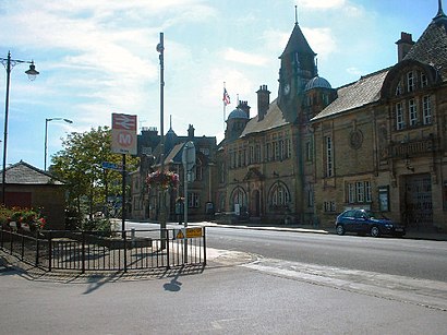
See Ilkley on the map
Public Transportation to Ilkley
Wondering how to get to Ilkley, United Kingdom? Moovit helps you find the best way to get to Ilkley with step-by-step directions from the nearest public transit station.
Moovit provides free maps and live directions to help you navigate through your city. View schedules, routes, timetables, and find out how long does it take to get to Ilkley in real time.
Looking for the nearest stop or station to Ilkley? Check out this list of stops closest to your destination: Skipton Road Netherwood; Beverley Rise.
Bus:62864874875V63647474A961Train:NORTHERN
Want to see if there’s another route that gets you there at an earlier time? Moovit helps you find alternative routes or times. Get directions from and directions to Ilkley easily from the Moovit App or Website.
We make riding to Ilkley easy, which is why over 1.5 million users, including users in Yorkshire, trust Moovit as the best app for public transit. You don’t need to download an individual bus app or train app, Moovit is your all-in-one transit app that helps you find the best bus time or train time available.
For information on prices of bus and train, costs and ride fares to Ilkley, please check the Moovit app.
Use the app to navigate to popular places including to the airport, hospital, stadium, grocery store, mall, coffee shop, school, college, and university.
Location: Yorkshire
Popular routes to Ilkley
Popular routes from Ilkley
Attractions near Ilkley
River Wharfe (The Beach),Netherwood House,Satvik Services Limited,Lime Kiln,Cockerham Electrical Contractors,Whatwoodyoulik,Pridegrove Limited,Simpla Systems,Ambulance Uk,Hollin Grange Management Company,Ilkley Golf Club,George Stevens,Wharfe View Cottage Ilkley,The Briery Retreat & Conference Centre,The Briary Retreat Centre,Ls29 9bw,Walmer Road,Pinoso Womenswear,Les Sapins,Ghyll Royd Management CompanyHow to get to popular attractions in Yorkshire with public transportation
Endcliffe Student Village, Sheffield,Sutton Park, Hull,Holiday Inn York City Centre, York,Northern Rail Training Academy, Leeds,Sheffield Wednesday F.C., Sheffield,Walkers Nurseries and Garden Centre, Blaxton,LS27 0TS, Morley,The Marriott Hotel, York, York,St Mary's College, Hull, Hull,M62 Junction 37, Howden,Calderdale College, Halifax,Cohen Computer Cluster, Leeds,Shepcote Lane, Sheffield, Sheffield,Leeds Dental Institute, Leeds,Titanic Spa, Huddersfield,Chapel Allerton Hospital, Leeds,Sheffield College Hillsborough Campus, Sheffield,Morrisons Distribution Centre, Wakefield,Park Lane College, Leeds,Whitby Abbey, WhitbyGet around Yorkshire by public transport!
Travelling around Yorkshire has never been so easy. See step by step directions as you travel to any attraction, street or major public transport station. View bus and train timetables, arrival times, service alerts and detailed routes on a map, so you know exactly how to get to anywhere in Yorkshire.
When travelling to any destination around Yorkshire use Moovit's Live Directions with Get Off Notifications to know exactly where and how far to walk, how long to wait for your line , and how many stops are left. Moovit will alert you when it’s time to get off — no need to constantly re-check whether yours is the next stop.
Wondering how to use public transport in Yorkshire or how to pay for public transport in Yorkshire? Moovit public transport app can help you navigate your way with public transport easily, and at minimum cost. It includes public transport fees, ticket prices, and costs. Looking for a map of Yorkshire public transport lines? Moovit public transport app shows all public transport maps in Yorkshire with all bus or train routes and stops on an interactive map.
Yorkshire has 2 transport type(s), including: bus or train, operated by several transport agencies, including First Leeds, First South Yorkshire, First York, Arriva Yorkshire, Stagecoach Yorkshire, National Rail, First Bradford, First Halifax, Calder Valley & Huddersfield, East Yorkshire, The Keighley Bus Company, South Yorkshire Future Tram, The Harrogate Bus Company, National Rail, TM Travel and Coastliner