Directions to Jon Sanders Drive (Wembley) with public transport
The following transport lines have routes that pass near Jon Sanders Drive
 Bus: 407, 990, 998, 999.
- Train: YANCHEP LINE.
How to get to Jon Sanders Drive by bus?
Click on the bus route to see step by step directions with maps, line arrival times and updated time schedules.
From Alexander Heights Shopping Centre, Alexander Heights
72 minFrom Crown Towers, Burswood
74 minFrom ZLR*Merchandise, Sorrento
62 minFrom Hilton, Perth
49 minFrom Victoria Park Western Australia, Victoria Park
68 minFrom Warwick Stadium, Warwick
65 minFrom Metro Hotel Perth, South Perth
75 minFrom Starcevich Ward, Hollywood Hospital, Nedlands
52 minFrom South Perth Hospital, South Perth
73 min
How to get to Jon Sanders Drive by train?
Click on the train route to see step by step directions with maps, line arrival times and updated time schedules.
Bus stops near Jon Sanders Drive in Wembley
What are the nearest stations to Jon Sanders Drive?
The nearest stations to Jon Sanders Drive are:
- Scarborough Beach Rd Before Drake St is 82 meters away, 2 min walk.
- Hasler Rd Before Teakle Rd is 145 meters away, 2 min walk.
Which bus lines stop near Jon Sanders Drive?
These bus lines stop near Jon Sanders Drive: 407, 990, 998, 999.
Which train line stops near Jon Sanders Drive?
YANCHEP LINE (Yanchep Stn)
What’s the nearest bus station to Jon Sanders Drive in Wembley?
The nearest bus stations to Jon Sanders Drive in Wembley are Scarborough Beach Rd Before Drake St and Hasler Rd Before Teakle Rd. The closest one is a 2 min walk away.
What time is the first bus to Jon Sanders Drive in Wembley?
The 990 is the first bus that goes to Jon Sanders Drive in Wembley. It stops nearby at 04:43.
What time is the last bus to Jon Sanders Drive in Wembley?
The 990 is the last bus that goes to Jon Sanders Drive in Wembley. It stops nearby at 00:31.
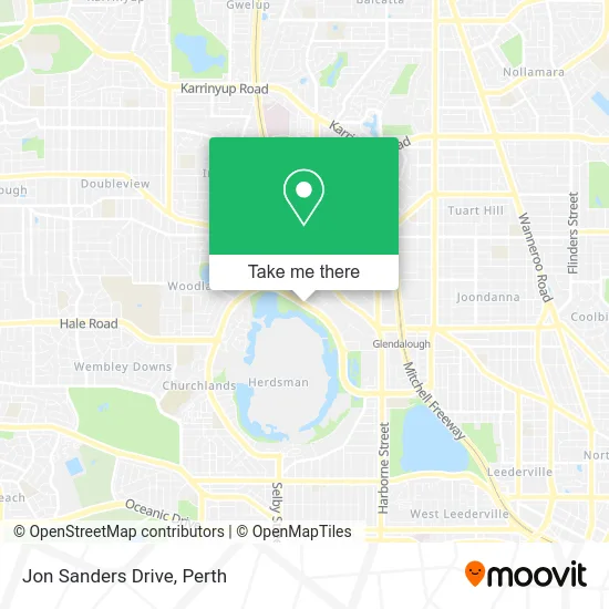
See Jon Sanders Drive, Wembley, on the map
Public Transit to Jon Sanders Drive in Wembley
Wondering how to get to Jon Sanders Drive in Wembley? Moovit helps you find the best way to get to Jon Sanders Drive with step-by-step directions from the nearest public transit station.
Moovit provides free maps and live directions to help you navigate through your city. View schedules, routes, timetables, and find out how long does it take to get to Jon Sanders Drive in real time.
Looking for the nearest stop or station to Jon Sanders Drive? Check out this list of stops closest to your destination: Scarborough Beach Rd Before Drake St; Hasler Rd Before Teakle Rd.
Bus: 407, 990, 998, 999.Train: YANCHEP LINE.
Want to see if there’s another route that gets you there at an earlier time? Moovit helps you find alternative routes or times. Get directions from and directions to Jon Sanders Drive easily from the Moovit App or Website.
We make riding to Jon Sanders Drive easy, which is why over 1.5 million users, including users in Wembley, trust Moovit as the best app for public transit. You don’t need to download an individual bus app or train app, Moovit is your all-in-one transit app that helps you find the best bus time or train time available.
For information on prices of bus and train, costs and ride fares to Jon Sanders Drive, please check the Moovit app.
Use the app to navigate to popular places including to the airport, hospital, stadium, grocery store, mall, coffee shop, school, college, and university.
Jon Sanders Drive Address: Jon Sanders Dr, Osborne Park WA 6017, Australia street in Wembley
- Pinoy Perth New Home Agent,
- Matador Mining,
- Endeavour Homes,
- Goodlife Homes,
- Catalpa Group,
- MTM Marion Exploration,
- Mineral Resources Minres,
- NWCH Village,
- Workskil Australia,
- 40 Hasler Road,
- Centrelink / Medicare,
- Construction Training Fund,
- Dôme,
- Rwwa Westspeed,
- Perth Racing Club,
- The Development Consultancy,
- Webb & Waltman,
- Fiori Coffee Pty Limited,
- Stanilite Electronics,
- Lex Education
Places Near Jon Sanders Drive (Wembley)
- Crown Perth Casino, Burswood,
- Langley Park, Perth,
- Fiona Stanley Hospital, Murdoch,
- DFO, Perth Airport,
- Rac Arena, Perth,
- Pelicaan Investment Ho, Bellevue,
- Aqwa Aquarium, Hillarys,
- Karrinyup Shopping Centre, Karrinyup,
- Westfield Carousel, Cannington,
- Yankee Mart, Baldivis,
- Royal Perth Hospital, Perth,
- Sir Charles Gairdner Hospital, Nedlands,
- McCallum Park, Victoria Park,
- Mount Hospital, Perth,
- Hillarys Boat Harbour,
- IKEA, Innaloo,
- Blue Boat House,
- Scitech, West Perth,
- Perth Convention Exhibition Centre, Perth,
- Optus Stadium, Burswood
How to get to popular places in Perth with public transport
Get around Wembley by public transport!
Travelling around Wembley has never been so easy. See step by step directions as you travel to any attraction, street or major public transport station. View bus and train timetables, arrival times, service alerts and detailed routes on a map, so you know exactly how to get to anywhere in Wembley.
When travelling to any destination around Wembley use Moovit's Live Directions with Get Off Notifications to know exactly where and how far to walk, how long to wait for your line , and how many stops are left. Moovit will alert you when it’s time to get off — no need to constantly re-check whether yours is the next stop.
Wondering how to use public transport in Wembley or how to pay for public transport in Wembley? Moovit public transport app can help you navigate your way with public transport easily, and at minimum cost. It includes public transport fees, ticket prices, and costs. Looking for a map of Wembley public transport lines? Moovit public transport app shows all public transport maps in Wembley with all Bus, Train and Ferry routes and stops on an interactive map.
Perth has 3 transport type(s), including: Bus, Train and Ferry, operated by several transport agencies, including Transperth Rail, Transwa, Transperth Ferry, Transperth, TransBusselton, TransAlbany, TransGoldfields, TransEsperance, TransGeraldton, TransCarnarvon, TransHedland, TransKarratha, TransBunbury, Mandurah Bus Charter and TransBroome