Directions to KSM Insurance Solutions (Innaloo) with public transport
The following transport lines have routes that pass near KSM Insurance Solutions
How to get to KSM Insurance Solutions by bus?
Click on the bus route to see step by step directions with maps, line arrival times and updated time schedules.
How to get to KSM Insurance Solutions by train?
Click on the train route to see step by step directions with maps, line arrival times and updated time schedules.
Bus stops near KSM Insurance Solutions in Innaloo
Bus lines to KSM Insurance Solutions in Innaloo
- SCARBOROUGH BEACH BUS STN SCARBOROUGH BEACH BUS STN CAT ID 20 - STIRLING STN, Stirling Stn,VIEW
- 412, Stirling Stn,VIEW
- 413, Stirling Stn,VIEW
- 998, Galleria Bus Stn,VIEW
- 999, Stirling Stn,VIEW
- 410, Karrinyup Bus Stn,VIEW
- 421, Stirling Stn,VIEW
- 422, Stirling Stn,VIEW
- 423, Stirling Stn,VIEW
- YANCHEP LINE, Leederville Stn,VIEW
- 402, Stirling Stn,VIEW
- 403, Stirling Stn,VIEW
- 414, Glendalough Stn,VIEW
- 415, Stirling Stn,VIEW
- 424, Stirling Stn,VIEW
- 425, Warwick Stn,VIEW
- 427, Stirling Stn,VIEW
- 428, Warwick Stn,VIEW
- 904, Perth,VIEW
What are the nearest stations to KSM Insurance Solutions?
The nearest stations to KSM Insurance Solutions are:
- Ellen Stirling Bvd Ikea Cat Id 38 is 27 meters away, 1 min walk.
- Ellen Stirling Bvd Ikea Cat Id 2 is 198 meters away, 3 min walk.
- Cedric St Before Ellen Stirling Bvd is 470 meters away, 7 min walk.
- Stirling Stn is 580 meters away, 8 min walk.
Which bus lines stop near KSM Insurance Solutions?
These bus lines stop near KSM Insurance Solutions: 402, 403, 415, 998.
Which train line stops near KSM Insurance Solutions?
YANCHEP LINE (Yanchep Stn)
What’s the nearest bus station to KSM Insurance Solutions in Innaloo?
The nearest bus station to KSM Insurance Solutions in Innaloo is Ellen Stirling Bvd Ikea Cat Id 38. It’s a 1 min walk away.
What time is the first train to KSM Insurance Solutions in Innaloo?
The YANCHEP LINE is the first train that goes to KSM Insurance Solutions in Innaloo. It stops nearby at 05:12.
What time is the last train to KSM Insurance Solutions in Innaloo?
The YANCHEP LINE is the last train that goes to KSM Insurance Solutions in Innaloo. It stops nearby at 00:26.
What time is the first bus to KSM Insurance Solutions in Innaloo?
The SCARBOROUGH BEACH BUS STN SCARBOROUGH BEACH BUS STN CAT ID 20 - STIRLING STN is the first bus that goes to KSM Insurance Solutions in Innaloo. It stops nearby at 05:01.
What time is the last bus to KSM Insurance Solutions in Innaloo?
The 403 is the last bus that goes to KSM Insurance Solutions in Innaloo. It stops nearby at 00:05.
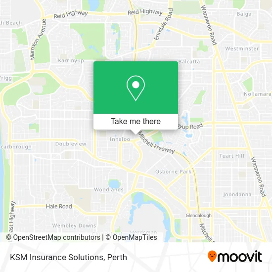
See KSM Insurance Solutions, Innaloo, on the map
Public Transit to KSM Insurance Solutions in Innaloo
Wondering how to get to KSM Insurance Solutions in Innaloo? Moovit helps you find the best way to get to KSM Insurance Solutions with step-by-step directions from the nearest public transit station.
Moovit provides free maps and live directions to help you navigate through your city. View schedules, routes, timetables, and find out how long does it take to get to KSM Insurance Solutions in real time.
Looking for the nearest stop or station to KSM Insurance Solutions? Check out this list of stops closest to your destination: Ellen Stirling Bvd Ikea Cat Id 38; Ellen Stirling Bvd Ikea Cat Id 2; Cedric St Before Ellen Stirling Bvd; Stirling Stn.
Bus: 402, 403, 415, 998, SCARBOROUGH BEACH BUS STN SCARBOROUGH BEACH BUS STN CAT ID 20 - STIRLING STN, 412, 413, 999, 410, 421, 422, 423, YANCHEP LINE, 414.Train: YANCHEP LINE.
Want to see if there’s another route that gets you there at an earlier time? Moovit helps you find alternative routes or times. Get directions from and directions to KSM Insurance Solutions easily from the Moovit App or Website.
We make riding to KSM Insurance Solutions easy, which is why over 1.5 million users, including users in Innaloo, trust Moovit as the best app for public transit. You don’t need to download an individual bus app or train app, Moovit is your all-in-one transit app that helps you find the best bus time or train time available.
For information on prices of bus and train, costs and ride fares to KSM Insurance Solutions, please check the Moovit app.
Use the app to navigate to popular places including to the airport, hospital, stadium, grocery store, mall, coffee shop, school, college, and university.
KSM Insurance Solutions Address: Hertha Rd Innaloo WA 6018 street in Innaloo
- W.A. Interpreters,
- Gloria Apartments,
- Geneff Hertha Reserve,
- Access Commercial Operations,
- Nannies,
- Hourglass Relaxation Massage,
- 2 Tassels Place Car Park,
- Bliss Beauty Salon,
- Alaric Arokiasamy Sports & General Podiatrist Innaloo,
- Medela Health,
- Tassels Sports Bar,
- NU-Age Settlements,
- Quest,
- Elastin Perth,
- Tassels Place Bar & Bistro,
- Lifecorpus,
- RCX Productions Wedding Videographer,
- Nationwide Training Perth,
- Genevieve,
- Leukaemia Foundation
Places Near KSM Insurance Solutions (Innaloo)
- Rac Arena, Perth,
- Karrinyup Shopping Centre, Karrinyup,
- DFO, Perth Airport,
- Perth Convention Exhibition Centre, Perth,
- Blue Boat House,
- Mount Hospital, Perth,
- Crown Perth Casino, Burswood,
- Langley Park, Perth,
- IKEA, Innaloo,
- McCallum Park, Victoria Park,
- Sir Charles Gairdner Hospital, Nedlands,
- Westfield Carousel, Cannington,
- Fiona Stanley Hospital, Murdoch,
- Royal Perth Hospital, Perth,
- Pelicaan Investment Ho, Bellevue,
- Yankee Mart, Baldivis,
- Aqwa Aquarium, Hillarys,
- Watertown, Perth,
- Optus Stadium, Burswood,
- Scitech, West Perth
How to get to popular places in Perth with public transport
Get around Innaloo by public transport!
Travelling around Innaloo has never been so easy. See step by step directions as you travel to any attraction, street or major public transport station. View bus and train timetables, arrival times, service alerts and detailed routes on a map, so you know exactly how to get to anywhere in Innaloo.
When travelling to any destination around Innaloo use Moovit's Live Directions with Get Off Notifications to know exactly where and how far to walk, how long to wait for your line , and how many stops are left. Moovit will alert you when it’s time to get off — no need to constantly re-check whether yours is the next stop.
Wondering how to use public transport in Innaloo or how to pay for public transport in Innaloo? Moovit public transport app can help you navigate your way with public transport easily, and at minimum cost. It includes public transport fees, ticket prices, and costs. Looking for a map of Innaloo public transport lines? Moovit public transport app shows all public transport maps in Innaloo with all Bus, Train and Ferry routes and stops on an interactive map.
Perth has 3 transport type(s), including: Bus, Train and Ferry, operated by several transport agencies, including Transperth Rail, Transwa, Transperth Ferry, Transperth, TransBusselton, TransAlbany, TransGoldfields, TransEsperance, TransGeraldton, TransCarnarvon, TransHedland, TransKarratha, TransBunbury, Mandurah Bus Charter and TransBroome