How to get to Keys by bus?
Click on the bus route to see step by step directions with maps, line arrival times and updated time schedules.
From Warnbro Station, Warnbro
58 minFrom Kolbe Catholic College, Rockingham
36 minFrom Waikiki Private Hospital, Waikiki
58 minFrom Skypower Holdings Pt, Beeliar
46 minFrom Yankee Mart, Baldivis
73 minFrom Safety Bay Senior High School, Safety Bay
56 minFrom Foxhound Holdings Pty, Rockingham
27 minFrom Tafe - Rockingham Campus, Rockingham
34 minFrom Stockland Shopping Centre Baldivis, Baldivis
73 min
Bus stops near Keys in Medina
What are the nearest stations to Keys?
The nearest stations to Keys are:
- Hewison Rd After Ellis Ct is 59 meters away, 2 min walk.
- Gilmore Av Before Thomas Rd is 574 meters away, 8 min walk.
Which bus lines stop near Keys?
These bus lines stop near Keys: 540, 549.
What’s the nearest bus station to Keys in Medina?
The nearest bus station to Keys in Medina is Hewison Rd After Ellis Ct. It’s a 2 min walk away.
What time is the first bus to Keys in Medina?
The 549 is the first bus that goes to Keys in Medina. It stops nearby at 05:35.
What time is the last bus to Keys in Medina?
The 549 is the last bus that goes to Keys in Medina. It stops nearby at 00:58.
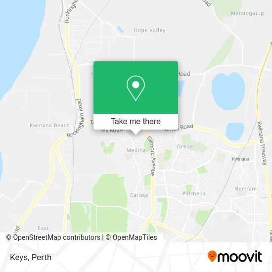
See Keys, Medina, on the map
Public Transit to Keys in Medina
Wondering how to get to Keys in Medina? Moovit helps you find the best way to get to Keys with step-by-step directions from the nearest public transit station.
Moovit provides free maps and live directions to help you navigate through your city. View schedules, routes, timetables, and find out how long does it take to get to Keys in real time.
Looking for the nearest stop or station to Keys? Check out this list of stops closest to your destination: Hewison Rd After Ellis Ct; Gilmore Av Before Thomas Rd.
Bus: 540, 549.
Want to see if there’s another route that gets you there at an earlier time? Moovit helps you find alternative routes or times. Get directions from and directions to Keys easily from the Moovit App or Website.
We make riding to Keys easy, which is why over 1.5 million users, including users in Medina, trust Moovit as the best app for public transit. You don’t need to download an individual bus app or train app, Moovit is your all-in-one transit app that helps you find the best bus time or train time available.
For information on prices of bus and train, costs and ride fares to Keys, please check the Moovit app.
Use the app to navigate to popular places including to the airport, hospital, stadium, grocery store, mall, coffee shop, school, college, and university.
Keys Address: Hewison Rd Medina WA 6167 street in Medina
- Info-Solutions,
- Garden Hard Club,
- Balingup Western Australia,
- Webfluence,
- Quirky Queen Gallery,
- Harcourts Mandurah,
- Hewison Reserve,
- The Salvation Army,
- Outdoor Ping Pong Table by Popp,
- Perth Wicking Beds,
- Jennie Bryant Realty,
- Maple Tree Service,
- Handy Sheila,
- Postans,
- Kwinana Knights,
- Coastal Bus Service,
- Kinderpark Early Learning Centre Medina,
- Commercial Cleaning,
- Pink Cleaning,
- Medina Oval
Places Near Keys (Medina)
- Sir Charles Gairdner Hospital, Nedlands,
- Watertown, Perth,
- Scitech, West Perth,
- Fiona Stanley Hospital, Murdoch,
- Yankee Mart, Baldivis,
- Blue Boat House,
- Aqwa Aquarium, Hillarys,
- Perth Convention Exhibition Centre, Perth,
- McCallum Park, Victoria Park,
- Pelicaan Investment Ho, Bellevue,
- IKEA, Innaloo,
- Crown Perth Casino, Burswood,
- Mount Hospital, Perth,
- Westfield Carousel, Cannington,
- Rac Arena, Perth,
- Optus Stadium, Burswood,
- Langley Park, Perth,
- Royal Perth Hospital, Perth,
- DFO, Perth Airport,
- Karrinyup Shopping Centre, Karrinyup
How to get to popular places in Perth with public transport
Get around Medina by public transport!
Travelling around Medina has never been so easy. See step by step directions as you travel to any attraction, street or major public transport station. View bus and train timetables, arrival times, service alerts and detailed routes on a map, so you know exactly how to get to anywhere in Medina.
When travelling to any destination around Medina use Moovit's Live Directions with Get Off Notifications to know exactly where and how far to walk, how long to wait for your line , and how many stops are left. Moovit will alert you when it’s time to get off — no need to constantly re-check whether yours is the next stop.
Wondering how to use public transport in Medina or how to pay for public transport in Medina? Moovit public transport app can help you navigate your way with public transport easily, and at minimum cost. It includes public transport fees, ticket prices, and costs. Looking for a map of Medina public transport lines? Moovit public transport app shows all public transport maps in Medina with all Bus, Train and Ferry routes and stops on an interactive map.
Perth has 3 transport type(s), including: Bus, Train and Ferry, operated by several transport agencies, including Transperth Rail, Transwa, Transperth Ferry, Transperth, TransBusselton, TransAlbany, TransGoldfields, TransEsperance, TransGeraldton, TransCarnarvon, TransHedland, TransKarratha, TransBunbury, Mandurah Bus Charter and TransBroome