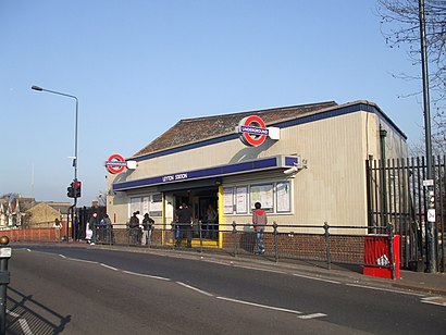
Leyton Station (B) stop - Wednesday schedule
| Line | Direction | Time |
|---|---|---|
| 158 | Chingford Mount | 03:12 |
| 69 | Walthamstow Central | 03:24 |
| 158 | Chingford Mount | 03:42 |
| 69 | Walthamstow Central | 03:54 |
| 158 | Chingford Mount | 04:12 |
| 69 | Walthamstow Central | 04:24 |
| 158 | Chingford Mount | 04:42 |
| 69 | Walthamstow Central | 04:54 |
| 97 | Chingford Station | 04:56 |
| 158 | Chingford Mount | 04:57 |
| 158 | Chingford Mount | 05:12 |
| 97 | Chingford Station | 05:16 |
| 69 | Walthamstow Central | 05:19 |
| 58 | Walthamstow Central | 05:21 |
| 158 | Chingford Mount | 05:27 |
| 97 | Chingford Station | 05:36 |
| 69 | Walthamstow Central | 05:39 |
| 58 | Walthamstow Central | 05:41 |
| 158 | Chingford Mount | 05:42 |
| 97 | Chingford Station | 05:51 |
| 158 | Chingford Mount | 05:57 |
| 69 | Walthamstow Central | 05:58 |
| 58 | Walthamstow Central | 06:01 |
| 97 | Chingford Station | 06:06 |
| 158 | Chingford Mount | 06:09 |
Directions to Leyton Station (B) with public transportation
The following transport lines have routes that pass near Leyton Station (B)
How to get to Leyton Station (B) by bus?
Click on the bus route to see step by step directions with maps, line arrival times and updated time schedules.
How to get to Leyton Station (B) by train?
Click on the train route to see step by step directions with maps, line arrival times and updated time schedules.
How to get to Leyton Station (B) by Tube?
Click on the Tube route to see step by step directions with maps, line arrival times and updated time schedules.
Tube station near Leyton Station (B)
- Leyton, 2 min walk,
Bus stops near Leyton Station (B)
- Leyton Station (A), 2 min walk,
- Leyton High Road / Leyton Station (C), 3 min walk,
- York Road (E), 3 min walk,
Dlr station near Leyton Station (B)
- Stratford International DLR, 14 min walk,
Train stations near Leyton Station (B)
- Leytonstone High Road, 19 min walk,
- Maryland, 24 min walk,
Bus routes to Leyton Station (B)
- 58, Walthamstow Central,
- 69, Canning Town,
- 97, Chingford Station,
- 158, Stratford,
- W13, Woodford Wells,
- W15, Hackney Town Hall,
- N26, Chingford Station,
What are the nearest stations to Leyton Station (B)?
The nearest stations to Leyton Station (B) are:
- Leyton is 88 meters away, 2 min walk.
- Leyton Station (A) is 129 meters away, 2 min walk.
- Leyton High Road / Leyton Station (C) is 150 meters away, 3 min walk.
- York Road (E) is 163 meters away, 3 min walk.
- Stratford International DLR is 1035 meters away, 14 min walk.
- Leytonstone High Road is 1438 meters away, 19 min walk.
- Maryland is 1832 meters away, 24 min walk.
Which bus lines stop near Leyton Station (B)?
These bus lines stop near Leyton Station (B): 158, 97, W15.
Which train lines stop near Leyton Station (B)?
These train lines stop near Leyton Station (B): ELIZABETH, MILDMAY LINE, SOUTHEASTERN, SUFFRAGETTE LINE.
Which Tube line stops near Leyton Station (B)?
CENTRAL (Ealing Broadway - Hainault)
What’s the nearest Tube station to Leyton Station (B)?
The nearest Tube station to Leyton Station (B) is Leyton. It’s a 2 min walk away.
What’s the nearest train station to Leyton Station (B)?
The nearest train station to Leyton Station (B) is Leytonstone High Road. It’s a 19 min walk away.
What’s the nearest bus stop to Leyton Station (B)?
The nearest bus stop to Leyton Station (B) is Leyton Station (A). It’s a 2 min walk away.
What’s the nearest DLR station to Leyton Station (B)?
The nearest DLR station to Leyton Station (B) is Stratford International DLR. It’s a 14 min walk away.
What time is the first Tube to Leyton Station (B)?
The CENTRAL is the first Tube that goes to Leyton Station (B). It stops nearby at 05:34.
What time is the last Tube to Leyton Station (B)?
The CENTRAL is the last Tube that goes to Leyton Station (B). It stops nearby at 00:52.
What time is the first train to Leyton Station (B)?
The ELIZABETH is the first train that goes to Leyton Station (B). It stops nearby at 05:17.
What time is the last train to Leyton Station (B)?
The ELIZABETH is the last train that goes to Leyton Station (B). It stops nearby at 01:04.
What time is the first bus to Leyton Station (B)?
The 158 is the first bus that goes to Leyton Station (B). It stops nearby at 03:00.
What time is the last bus to Leyton Station (B)?
The N26 is the last bus that goes to Leyton Station (B). It stops nearby at 03:47.
What time is the first DLR to Leyton Station (B)?
The DLR is the first DLR that goes to Leyton Station (B). It stops nearby at 05:25.
What time is the last DLR to Leyton Station (B)?
The DLR is the last DLR that goes to Leyton Station (B). It stops nearby at 00:43.
See Leyton Station (B) on the map
Public transport to Leyton Station (B) stop (ID: B)
Looking for directions to Leyton Station (B) in Leyton, United Kingdom?
Download the Moovit App to find the current schedule and step-by-step directions for Tube, Bus or Train routes that pass through Leyton Station (B).
Looking for the nearest stops closest to Leyton Station (B) ? Check out this list of closest stops to your destination: Leyton; Leyton Station (A); Leyton High Road / Leyton Station (C); York Road (E); Stratford International DLR; Leytonstone High Road; Maryland.
Bus: 158, 97, W15, 58, 69, W13.Train: ELIZABETH, MILDMAY LINE, SOUTHEASTERN, SUFFRAGETTE LINE, OVERGROUND.Tube: CENTRAL.DLR: DLR.
We make riding on public transit to Leyton Station (B) easy, which is why over 1.5 million users, including users in Leyton trust Moovit as the best app for public transit.
Use the app to navigate to popular places including to the airport, hospital, stadium, grocery store, mall, coffee shop, school, college, and university.
Leyton Station (B) stop’s code is B
The first line to this stop is 158, at 03:12, and the last line is 69 at 02:54.
Maud Road, London, England, United Kingdom
This stop serves London Buses’s lines
Tube station near Leyton Station (B)
Bus stops near Leyton Station (B)
Dlr station near Leyton Station (B)
Popular public transport stations in Leyton
Get around Leyton by public transport!
Travelling around Leyton has never been so easy. See step by step directions as you travel to any attraction, street or major public transport station. View bus and train timetables, arrival times, service alerts and detailed routes on a map, so you know exactly how to get to anywhere in Leyton.
When travelling to any destination around Leyton use Moovit's Live Directions with Get Off Notifications to know exactly where and how far to walk, how long to wait for your line , and how many stops are left. Moovit will alert you when it’s time to get off — no need to constantly re-check whether yours is the next stop.
Wondering how to use public transport in Leyton or how to pay for public transport in Leyton? Moovit public transport app can help you navigate your way with public transport easily, and at minimum cost. It includes public transport fees, ticket prices, and costs. Looking for a map of Leyton public transport lines? Moovit public transport app shows all public transport maps in Leyton with all Bus, Train, Tube, Tramlink, River Bus and DLR routes and stops on an interactive map.
London has 6 transport type(s), including: Bus, Train, Tube, Tramlink, River Bus and DLR, operated by several transport agencies, including London Buses, Transport for London, London Underground, London River Services, National Rail, Luton Airport Shuttle, Bayliss Executive Travel, Edward Thomas, Metrobus, Coggeshall Community Bus, Tendring Community Transport, Sullivan Buses, Z & S Transport, Central Connect and Compass Travel