Directions to Loading Zone (Crawley) with public transport
The following transport lines have routes that pass near Loading Zone
 Bus: 24, 96, 97, ELIZABETH QUAY BUS STN - HACKETT DR UWA BUSINESS SCHOOL CAT ID 123, 23.
- Train: AIRPORT LINE, FREMANTLE LINE, 906.
How to get to Loading Zone by bus?
Click on the bus route to see step by step directions with maps, line arrival times and updated time schedules.
From Mercure Hotel, Perth
31 minFrom Optus Stadium, Burswood
69 minFrom Rydges Perth Kings Square, Perth
32 minFrom Stirling Station, Osborne Park
42 minFrom Taxi Rank, Fremantle
61 minFrom Bentley Plaza Shopping Centre, Bentley
64 minFrom Flag Motor Lodge, Rivervale
59 minFrom The Merrywell, Burswood
50 minFrom Fremantle Hospital And Health Service, Fremantle
69 minFrom Gloucester Park, East Perth
51 min
How to get to Loading Zone by train?
Click on the train route to see step by step directions with maps, line arrival times and updated time schedules.
Bus stops near Loading Zone in Crawley
Train station near Loading Zone in Crawley
- Karrakatta Stn, 39 min walk,VIEW
Bus lines to Loading Zone in Crawley
What are the nearest stations to Loading Zone?
The nearest stations to Loading Zone are:
- Fairway After Myers St is 103 meters away, 2 min walk.
- Broadway Before Caporn St is 169 meters away, 3 min walk.
- Broadway Caporn Street Cat Id 124 is 192 meters away, 3 min walk.
- Bruce St Before Elizabeth St is 574 meters away, 8 min walk.
- Karrakatta Stn is 3041 meters away, 39 min walk.
Which bus lines stop near Loading Zone?
These bus lines stop near Loading Zone: 24, 96, 97.
Which train lines stop near Loading Zone?
These train lines stop near Loading Zone: AIRPORT LINE, FREMANTLE LINE.
What’s the nearest bus station to Loading Zone in Crawley?
The nearest bus station to Loading Zone in Crawley is Fairway After Myers St. It’s a 2 min walk away.
What time is the first train to Loading Zone in Crawley?
The FREMANTLE LINE is the first train that goes to Loading Zone in Crawley. It stops nearby at 05:30.
What time is the last train to Loading Zone in Crawley?
The FREMANTLE LINE is the last train that goes to Loading Zone in Crawley. It stops nearby at 00:33.
What time is the first bus to Loading Zone in Crawley?
The ELIZABETH QUAY BUS STN - HACKETT DR UWA BUSINESS SCHOOL CAT ID 123 is the first bus that goes to Loading Zone in Crawley. It stops nearby at 05:02.
What time is the last bus to Loading Zone in Crawley?
The 24 is the last bus that goes to Loading Zone in Crawley. It stops nearby at 00:00.
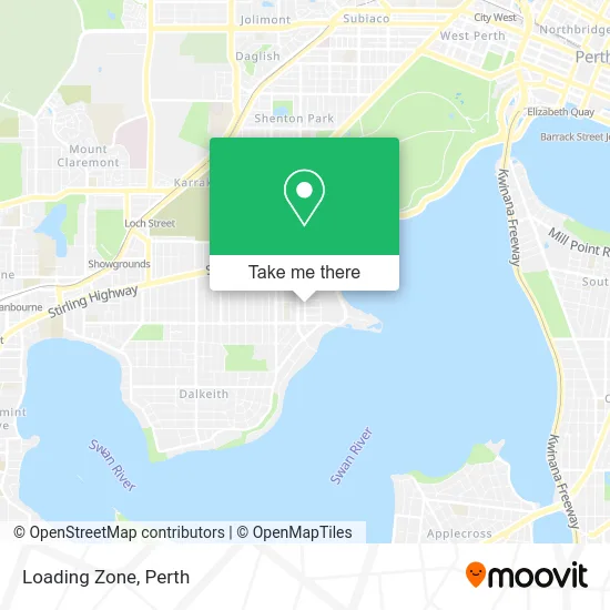
See Loading Zone, Crawley, on the map
Public Transit to Loading Zone in Crawley
Wondering how to get to Loading Zone in Crawley? Moovit helps you find the best way to get to Loading Zone with step-by-step directions from the nearest public transit station.
Moovit provides free maps and live directions to help you navigate through your city. View schedules, routes, timetables, and find out how long does it take to get to Loading Zone in real time.
Looking for the nearest stop or station to Loading Zone? Check out this list of stops closest to your destination: Fairway After Myers St; Broadway Before Caporn St; Broadway Caporn Street Cat Id 124; Bruce St Before Elizabeth St; Karrakatta Stn.
Bus: 24, 96, 97, ELIZABETH QUAY BUS STN - HACKETT DR UWA BUSINESS SCHOOL CAT ID 123, 23.Train: AIRPORT LINE, FREMANTLE LINE, 906.
Want to see if there’s another route that gets you there at an earlier time? Moovit helps you find alternative routes or times. Get directions from and directions to Loading Zone easily from the Moovit App or Website.
We make riding to Loading Zone easy, which is why over 1.5 million users, including users in Crawley, trust Moovit as the best app for public transit. You don’t need to download an individual bus app or train app, Moovit is your all-in-one transit app that helps you find the best bus time or train time available.
For information on prices of bus and train, costs and ride fares to Loading Zone, please check the Moovit app.
Use the app to navigate to popular places including to the airport, hospital, stadium, grocery store, mall, coffee shop, school, college, and university.
Loading Zone Address: Fairway Crawley WA 6009 street in Crawley
- Lice Clinics of Australia Nedlands,
- Tonari Totoro,
- Passport Photos Perth - University Cameras,
- Ciao Italia,
- Kingsway Methodist Church,
- Broadway,
- Travel Scene at Travel Impressions,
- Uwa Sports Science Hall,
- UWA Anatomy and Human Biology Building,
- John Bloomfield Lecture Theatre,
- Uwa Aquatic Centre,
- UWA,
- Room 105, ENCM Building,
- ENCM G11,
- Wilsmore And Tattersall Lecture Theatres,
- UWA Civil and Mechanical Engineering Building,
- Wine Tours Swan Valley,
- 150 Broadway,
- Re-Vision Group,
- ELT2
Places Near Loading Zone (Crawley)
- Karrinyup Shopping Centre, Karrinyup,
- McCallum Park, Victoria Park,
- Sir Charles Gairdner Hospital, Nedlands,
- Hillarys Boat Harbour,
- Mount Hospital, Perth,
- Perth Convention Exhibition Centre, Perth,
- Yankee Mart, Baldivis,
- Aqwa Aquarium, Hillarys,
- Westfield Carousel, Cannington,
- Optus Stadium, Burswood,
- Pelicaan Investment Ho, Bellevue,
- Langley Park, Perth,
- Crown Perth Casino, Burswood,
- DFO, Perth Airport,
- Scitech, West Perth,
- Royal Perth Hospital, Perth,
- Rac Arena, Perth,
- Blue Boat House,
- Fiona Stanley Hospital, Murdoch,
- IKEA, Innaloo
How to get to popular places in Perth with public transport
Get around Crawley by public transport!
Travelling around Crawley has never been so easy. See step by step directions as you travel to any attraction, street or major public transport station. View bus and train timetables, arrival times, service alerts and detailed routes on a map, so you know exactly how to get to anywhere in Crawley.
When travelling to any destination around Crawley use Moovit's Live Directions with Get Off Notifications to know exactly where and how far to walk, how long to wait for your line , and how many stops are left. Moovit will alert you when it’s time to get off — no need to constantly re-check whether yours is the next stop.
Wondering how to use public transport in Crawley or how to pay for public transport in Crawley? Moovit public transport app can help you navigate your way with public transport easily, and at minimum cost. It includes public transport fees, ticket prices, and costs. Looking for a map of Crawley public transport lines? Moovit public transport app shows all public transport maps in Crawley with all Bus, Train and Ferry routes and stops on an interactive map.
Perth has 3 transport type(s), including: Bus, Train and Ferry, operated by several transport agencies, including Transperth Rail, Transwa, Transperth Ferry, Transperth, TransBusselton, TransAlbany, TransGoldfields, TransEsperance, TransGeraldton, TransCarnarvon, TransHedland, TransKarratha, TransBunbury, Mandurah Bus Charter and TransBroome