Directions to MMS Recovery Wolverhampton (St. Peter's) with public transport
The following transport lines have routes that pass near MMS Recovery Wolverhampton
 Bus: 11, 3, 32, 33, 4.
- Train: AVANTI WEST COAST, CROSSCOUNTRY, TRANSPORT FOR WALES, WEST MIDLANDS RAILWAY.
How to get to MMS Recovery Wolverhampton by bus?
Click on the bus route to see step by step directions with maps, line arrival times and updated time schedules.
From Goscote Hospital, Walsall, Blakenall
78 minFrom Watling Street Police Station, Penkridge South East
43 minFrom WS10, Wednesbury North
66 minFrom Walsall College Wisemore Campus, Blakenall
58 minFrom Russells Hall Hospital, St. James's
93 minFrom National Express Pensnett Garage, Brockmoor And Pensnett
81 minFrom Reedswood Retail Park, Birchills Leamore
66 minFrom Hollybush Garden Centre, Cheslyn Hay North And Saredon
38 minFrom Crown Wharf Retail Park, St. Matthew's
53 min
How to get to MMS Recovery Wolverhampton by train?
Click on the train route to see step by step directions with maps, line arrival times and updated time schedules.
Bus stops near MMS Recovery Wolverhampton in St. Peter's
Light Rail stations near MMS Recovery Wolverhampton in St. Peter's
- The Royal (West Midlands Metro), 30 min walk,VIEW
Train station near MMS Recovery Wolverhampton in St. Peter's
- Wolverhampton, 53 min walk,VIEW
Bus lines to MMS Recovery Wolverhampton in St. Peter's
- 5, Wolverhampton Bus Station,VIEW
- 5, Church Road,VIEW
- 794, Three Tuns Lane,VIEW
- 3, Castlecroft Road,VIEW
- 4, Moog,VIEW
- 62, University Of Wolverhampton,VIEW
- 62A, University Of Wolverhampton,VIEW
- 876, Crown Bridge,VIEW
- 3, University Of Wolverhampton,VIEW
- 32, Wolverhampton Bus Station,VIEW
- 33, Wolverhampton Bus Station,VIEW
What are the nearest stations to MMS Recovery Wolverhampton?
The nearest stations to MMS Recovery Wolverhampton are:
- Dunstall Hill is 115 meters away, 2 min walk.
- Five Ways is 219 meters away, 3 min walk.
- The Royal (West Midlands Metro) is 2304 meters away, 30 min walk.
- Wolverhampton is 4128 meters away, 53 min walk.
Which bus lines stop near MMS Recovery Wolverhampton?
These bus lines stop near MMS Recovery Wolverhampton: 11, 3, 32, 33, 4, 876.
What’s the nearest light rail station to MMS Recovery Wolverhampton in St. Peter's?
The nearest light rail station to MMS Recovery Wolverhampton in St. Peter's is The Royal (West Midlands Metro). It’s a 30 min walk away.
What’s the nearest bus station to MMS Recovery Wolverhampton in St. Peter's?
The nearest bus station to MMS Recovery Wolverhampton in St. Peter's is Dunstall Hill. It’s a 2 min walk away.
What time is the first light rail to MMS Recovery Wolverhampton in St. Peter's?
The METRO is the first light rail that goes to MMS Recovery Wolverhampton in St. Peter's. It stops nearby at 07:45.
What time is the last light rail to MMS Recovery Wolverhampton in St. Peter's?
The METRO is the last light rail that goes to MMS Recovery Wolverhampton in St. Peter's. It stops nearby at 00:12.
What time is the first train to MMS Recovery Wolverhampton in St. Peter's?
The AVANTI WEST COAST is the first train that goes to MMS Recovery Wolverhampton in St. Peter's. It stops nearby at 08:01.
What time is the last train to MMS Recovery Wolverhampton in St. Peter's?
The AVANTI WEST COAST is the last train that goes to MMS Recovery Wolverhampton in St. Peter's. It stops nearby at 01:43.
What time is the first bus to MMS Recovery Wolverhampton in St. Peter's?
The 4 is the first bus that goes to MMS Recovery Wolverhampton in St. Peter's. It stops nearby at 09:18.
What time is the last bus to MMS Recovery Wolverhampton in St. Peter's?
The 32 is the last bus that goes to MMS Recovery Wolverhampton in St. Peter's. It stops nearby at 23:39.
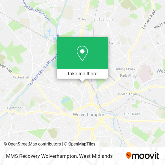
See MMS Recovery Wolverhampton, St. Peter's, on the map
Public Transit to MMS Recovery Wolverhampton in St. Peter's
Wondering how to get to MMS Recovery Wolverhampton in St. Peter's? Moovit helps you find the best way to get to MMS Recovery Wolverhampton with step-by-step directions from the nearest public transit station.
Moovit provides free maps and live directions to help you navigate through your city. View schedules, routes, timetables, and find out how long does it take to get to MMS Recovery Wolverhampton in real time.
Looking for the nearest stop or station to MMS Recovery Wolverhampton? Check out this list of stops closest to your destination: Dunstall Hill; Five Ways; The Royal (West Midlands Metro); Wolverhampton.
Bus: 11, 3, 32, 33, 4, 876, 5, 5, 794, 62, 62A.Train: AVANTI WEST COAST, CROSSCOUNTRY, TRANSPORT FOR WALES, WEST MIDLANDS RAILWAY.
Want to see if there’s another route that gets you there at an earlier time? Moovit helps you find alternative routes or times. Get directions from and directions to MMS Recovery Wolverhampton easily from the Moovit App or Website.
We make riding to MMS Recovery Wolverhampton easy, which is why over 1.5 million users, including users in St. Peter's, trust Moovit as the best app for public transit. You don’t need to download an individual bus app or train app, Moovit is your all-in-one transit app that helps you find the best bus time or train time available.
For information on prices of bus, costs and ride fares to MMS Recovery Wolverhampton, please check the Moovit app.
Use the app to navigate to popular places including to the airport, hospital, stadium, grocery store, mall, coffee shop, school, college, and university.
MMS Recovery Wolverhampton Address: 19 Dunstall Hill Wolverhampton Wolverhampton WV6 0 street in St. Peter's
- Erf Electrical Wholesalers,
- Lcp Properties,
- Wahab Group of Industry,
- Kaut,
- Wickes,
- Prime Business Consultant,
- Studio,
- Wv6 0nf,
- Wickes Wolverhampton,
- Malik Butchers,
- Mbk Two,
- WV10 6HT,
- Dunstall Hill Primary School,
- Halfords 0775,
- Deefleeked* Deefleeked,
- Noire Kickz,
- Full Outer Join,
- Red Cross Walk,
- Snickhed,
- African Cuisine
Places Near MMS Recovery Wolverhampton (St. Peter's)
- Tally Ho Police Training, Birmingham, Edgbaston,
- Fort Shopping Centre, Birmingham, Pype Hayes,
- Birmingham Dental Hospital, Edgbaston,
- Waseley Hills Crematorium, Frankley Great Park,
- The Merry Hill Centre, Brierley Hill,
- Hagley Road, Edgbaston,
- Crown Wharf Retail Park, St. Matthew's,
- Bickerstaff Endoscopy Unit (PRH), Apley Castle,
- One Stop Shopping Centre, Perry Barr,
- Lilleshall Hall National Sports Centre, Telford,
- Studley Castle, Studley,
- Birmingham And Midland Eye Centre, Soho & Jewellery Quarter,
- Bournville Staff Shop (Cadbury World), Bournville & Cotteridge,
- Stratford Road, Sparkhill,
- Royal Orthopaedic Hospital, Northfield,
- IKEA Wednesbury, Oldbury,
- Boundary Mill Stores, Bentley And Darlaston North,
- Heritage Building (Queen Elizabeth Hospital), Edgbaston,
- Travelodge Birmingham Airport Hotel Birmingham, Bickenhill,
- Wolstanton Retail Park, Wolstanton
How to get to popular places in West Midlands with public transport
Get around St. Peter's by public transport!
Travelling around St. Peter's has never been so easy. See step by step directions as you travel to any attraction, street or major public transport station. View bus and train timetables, arrival times, service alerts and detailed routes on a map, so you know exactly how to get to anywhere in St. Peter's.
When travelling to any destination around St. Peter's use Moovit's Live Directions with Get Off Notifications to know exactly where and how far to walk, how long to wait for your line , and how many stops are left. Moovit will alert you when it’s time to get off — no need to constantly re-check whether yours is the next stop.
Wondering how to use public transport in St. Peter's or how to pay for public transport in St. Peter's? Moovit public transport app can help you navigate your way with public transport easily, and at minimum cost. It includes public transport fees, ticket prices, and costs. Looking for a map of St. Peter's public transport lines? Moovit public transport app shows all public transport maps in St. Peter's with all Bus, Train and Light rail routes and stops on an interactive map.
West Midlands has 3 transport type(s), including: Bus, Train and Light rail, operated by several transport agencies, including National Express West Midlands, National Express Coventry, National Express, Diamond Bus, Arriva Midlands, Stagecoach Midlands, West Midlands Metro, Stagecoach West, Stagecoach South Wales, First Potteries, First Worcestershire, LandFlight, trentbarton, D & G Bus and Flexibus