Directions to Mason Signs & Display (Davenport) with public transport
The following transport lines have routes that pass near Mason Signs & Display
 Bus: 827, AUSTRALIND RAIL REPLACEMENT, EAST PERTH.
How to get to Mason Signs & Display by bus?
Click on the bus route to see step by step directions with maps, line arrival times and updated time schedules.
From Pinjarra Park Racecourse, Meelon
143 minFrom Our Lady Of Mercy College, Australind
60 minFrom Bunbury Senior High School, Bunbury
42 minFrom Brunswick Show, Brunswick
72 minFrom Brunswick Junction, Brunswick
69 minFrom Caves House Hotel Yallingup, Yallingup
119 minFrom Australind Senior High School, Australind
74 minFrom Yallingup, Yallingup
129 minFrom Treendale Shopping Centre, Australind
49 min
Bus stops near Mason Signs & Display in Davenport
Bus lines to Mason Signs & Display in Davenport
What are the nearest stations to Mason Signs & Display?
The nearest stations to Mason Signs & Display are:
- Beddingfield St Transwa Bunbury Activ is 64 meters away, 2 min walk.
- South Western Hwy Before Nash St is 1243 meters away, 17 min walk.
Which bus lines stop near Mason Signs & Display?
These bus lines stop near Mason Signs & Display: 827, AUSTRALIND RAIL REPLACEMENT.
What’s the nearest bus station to Mason Signs & Display in Davenport?
The nearest bus station to Mason Signs & Display in Davenport is Beddingfield St Transwa Bunbury Activ. It’s a 2 min walk away.
What time is the first bus to Mason Signs & Display in Davenport?
The 827 is the first bus that goes to Mason Signs & Display in Davenport. It stops nearby at 06:50.
What time is the last bus to Mason Signs & Display in Davenport?
The 827 is the last bus that goes to Mason Signs & Display in Davenport. It stops nearby at 18:02.
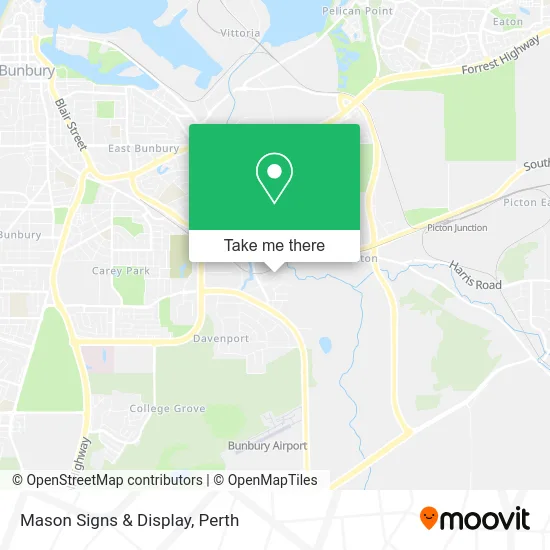
See Mason Signs & Display, Davenport, on the map
Public Transit to Mason Signs & Display in Davenport
Wondering how to get to Mason Signs & Display in Davenport? Moovit helps you find the best way to get to Mason Signs & Display with step-by-step directions from the nearest public transit station.
Moovit provides free maps and live directions to help you navigate through your city. View schedules, routes, timetables, and find out how long does it take to get to Mason Signs & Display in real time.
Looking for the nearest stop or station to Mason Signs & Display? Check out this list of stops closest to your destination: Beddingfield St Transwa Bunbury Activ; South Western Hwy Before Nash St.
Bus: 827, AUSTRALIND RAIL REPLACEMENT, EAST PERTH.
Want to see if there’s another route that gets you there at an earlier time? Moovit helps you find alternative routes or times. Get directions from and directions to Mason Signs & Display easily from the Moovit App or Website.
We make riding to Mason Signs & Display easy, which is why over 1.5 million users, including users in Davenport, trust Moovit as the best app for public transit. You don’t need to download an individual bus app or train app, Moovit is your all-in-one transit app that helps you find the best bus time or train time available.
For information on prices of bus, costs and ride fares to Mason Signs & Display, please check the Moovit app.
Use the app to navigate to popular places including to the airport, hospital, stadium, grocery store, mall, coffee shop, school, college, and university.
Mason Signs & Display Address: 12 Beddingfield St Davenport WA 6230 street in Davenport
- Overflow Industrial,
- Mik Waters Fabrication,
- Steve Dunn Carpentry & Joinery,
- Supersett Constructions,
- Alumatrix,
- TWB Engineering,
- Activ Bunbury,
- Workpower Inc,
- Terry Leeder Cabinets,
- Touchtech Australia,
- Atek Industrial Supplies,
- United Fluid Power Gro,
- Napoli Auto Repairs,
- Coastal Formwork,
- Brockman Mechanical and Refrigeration,
- Ausmic Pest Control,
- South West Engineering Supplies,
- H2O Pumps & Irrigation,
- Xpress Outdoors -,
- Form X
Places Near Mason Signs & Display (Davenport)
- DFO, Perth Airport,
- Crown Perth Casino, Burswood,
- Langley Park, Perth,
- IKEA, Innaloo,
- Scitech, West Perth,
- Westfield Carousel, Cannington,
- Optus Stadium, Burswood,
- Rac Arena, Perth,
- Pelicaan Investment Ho, Bellevue,
- McCallum Park, Victoria Park,
- Yankee Mart, Baldivis,
- Mount Hospital, Perth,
- Fiona Stanley Hospital, Murdoch,
- Sir Charles Gairdner Hospital, Nedlands,
- Hillarys Boat Harbour,
- Blue Boat House,
- Karrinyup Shopping Centre, Karrinyup,
- Royal Perth Hospital, Perth,
- Aqwa Aquarium, Hillarys,
- Perth Convention Exhibition Centre, Perth
How to get to popular places in Perth with public transport
Get around Davenport by public transport!
Travelling around Davenport has never been so easy. See step by step directions as you travel to any attraction, street or major public transport station. View bus and train timetables, arrival times, service alerts and detailed routes on a map, so you know exactly how to get to anywhere in Davenport.
When travelling to any destination around Davenport use Moovit's Live Directions with Get Off Notifications to know exactly where and how far to walk, how long to wait for your line , and how many stops are left. Moovit will alert you when it’s time to get off — no need to constantly re-check whether yours is the next stop.
Wondering how to use public transport in Davenport or how to pay for public transport in Davenport? Moovit public transport app can help you navigate your way with public transport easily, and at minimum cost. It includes public transport fees, ticket prices, and costs. Looking for a map of Davenport public transport lines? Moovit public transport app shows all public transport maps in Davenport with all Bus, Train and Ferry routes and stops on an interactive map.
Perth has 3 transport type(s), including: Bus, Train and Ferry, operated by several transport agencies, including Transperth Rail, Transwa, Transperth Ferry, Transperth, TransBusselton, TransAlbany, TransGoldfields, TransEsperance, TransGeraldton, TransCarnarvon, TransHedland, TransKarratha, TransBunbury, Mandurah Bus Charter and TransBroome