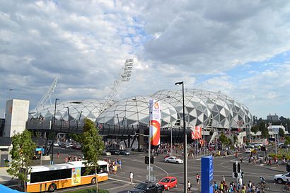
Directions to Melbourne Rectangular Stadium with public transportation
The following transport lines have routes that pass near Melbourne Rectangular Stadium
 Bus: 246, 605.
- Train: FRANKSTON, GLEN WAVERLEY, HURSTBRIDGE, MERNDA, SANDRINGHAM.
- Tram: 70.
How to get to Melbourne Rectangular Stadium by bus?
Click on the bus route to see step by step directions with maps, line arrival times and updated time schedules.
How to get to Melbourne Rectangular Stadium by train?
Click on the train route to see step by step directions with maps, line arrival times and updated time schedules.
Tram stations near Melbourne Rectangular Stadium
- Mcg Gates 4-7/John Cain Arena #7c, 3 min walk,
Bus stops near Melbourne Rectangular Stadium
- Witchwood Cl/Punt Rd, 10 min walk,
- Melbourne Girls Grammar/Anderson St, 11 min walk,
Bus routes to Melbourne Rectangular Stadium
- 246, Elsternwick Station,
- 605, City (Queen Street),
What are the nearest stations to Melbourne Rectangular Stadium?
The nearest stations to Melbourne Rectangular Stadium are:
- Mcg Gates 4-7/John Cain Arena #7c is 160 meters away, 3 min walk.
- Witchwood Cl/Punt Rd is 718 meters away, 10 min walk.
- Melbourne Girls Grammar/Anderson St is 807 meters away, 11 min walk.
Which bus lines stop near Melbourne Rectangular Stadium?
These bus lines stop near Melbourne Rectangular Stadium: 246, 605.
Which train lines stop near Melbourne Rectangular Stadium?
These train lines stop near Melbourne Rectangular Stadium: FRANKSTON, GLEN WAVERLEY, HURSTBRIDGE, MERNDA, SANDRINGHAM.
Which tram line stops near Melbourne Rectangular Stadium?
70 (Wattle Park)
What’s the nearest tram station to Melbourne Rectangular Stadium?
The nearest tram station to Melbourne Rectangular Stadium is Mcg Gates 4-7/John Cain Arena #7c. It’s a 3 min walk away.
What’s the nearest bus station to Melbourne Rectangular Stadium?
The nearest bus station to Melbourne Rectangular Stadium is Witchwood Cl/Punt Rd. It’s a 10 min walk away.
What time is the first tram to Melbourne Rectangular Stadium?
The 70 is the first tram that goes to Melbourne Rectangular Stadium. It stops nearby at 07:35.
What time is the last tram to Melbourne Rectangular Stadium?
The 70 is the last tram that goes to Melbourne Rectangular Stadium. It stops nearby at 00:23.
What time is the first bus to Melbourne Rectangular Stadium?
The 246 is the first bus that goes to Melbourne Rectangular Stadium. It stops nearby at 06:44.
What time is the last bus to Melbourne Rectangular Stadium?
The 246 is the last bus that goes to Melbourne Rectangular Stadium. It stops nearby at 23:22.
See Melbourne Rectangular Stadium on the map
Public Transportation to Melbourne Rectangular Stadium
Wondering how to get to Melbourne Rectangular Stadium? Moovit helps you find the best way to get to Melbourne Rectangular Stadium with step-by-step directions from the nearest public transit station.
Moovit provides free maps and live directions to help you navigate through your city. View schedules, routes, timetables, and find out how long does it take to get to Melbourne Rectangular Stadium in real time.
Looking for the nearest stop or station to Melbourne Rectangular Stadium? Check out this list of stops closest to your destination: Mcg Gates 4-7/John Cain Arena #7c; Witchwood Cl/Punt Rd; Melbourne Girls Grammar/Anderson St.
Bus: 246, 605.Train: FRANKSTON, GLEN WAVERLEY, HURSTBRIDGE, MERNDA, SANDRINGHAM.Tram: 70.
Want to see if there’s another route that gets you there at an earlier time? Moovit helps you find alternative routes or times. Get directions from and directions to Melbourne Rectangular Stadium easily from the Moovit App or Website.
We make riding to Melbourne Rectangular Stadium easy, which is why over 1.5 million users, including users in Melbourne, trust Moovit as the best app for public transit. You don’t need to download an individual bus app or train app, Moovit is your all-in-one transit app that helps you find the best bus time or train time available.
For information on prices of bus, train and tram, costs and ride fares to Melbourne Rectangular Stadium, please check the Moovit app.
Use the app to navigate to popular places including to the airport, hospital, stadium, grocery store, mall, coffee shop, school, college, and university.
Location: Melbourne
- Imaging @ Olympic Park,
- AAMI Park,
- Running Coach Melbourne,
- Olympic Park Sports Medicine Centre,
- Tennis Victoria,
- Olympic Park,
- Melbourne Sports & Entertainment Centre,
- Public Toilets,
- #21,
- #20,
- #18,
- Michael Gudinski Statue,
- National Tennis Centre,
- Olympic Park Oval,
- Domain Tunnel Emergency Exit,
- Ron Casey Media Centre,
- Olympic Park Stadium,
- Gosch's Paddock,
- National Tennis Centre Car Park,
- Anderson Street Fishing Landing
Places Near Melbourne Rectangular Stadium
- Highpoint Shopping Centre, Maribyrnong,
- RACV Club, Melbourne,
- Peter Maccallum Cancer Centre, Melbourne,
- Queen Victoria Market, Melbourne,
- Her Majesty's Theatre, Melbourne,
- South Melbourne Market, South Melbourne,
- St Kilda Beach,
- Cabrini Hospital, Malvern,
- Melbourne Convention and Exhibition Centre, Southbank,
- Chinatown, Melbourne,
- Crown Casino, Southbank,
- Marvel Stadium, Docklands,
- Dawson Street, Brunswick,
- Dfo South Wharf, Southbank,
- Princess Theatre, Melbourne,
- Rod Laver Arena, Melbourne,
- William Street, Melbourne,
- Royal Melbourne Hospital, Melbourne,
- Ikea, Richmond,
- Lygon Street, Carlton
How to get to popular places in Melbourne with public transport
Get around Melbourne by public transport!
Travelling around Melbourne has never been so easy. See step by step directions as you travel to any attraction, street or major public transport station. View bus and train timetables, arrival times, service alerts and detailed routes on a map, so you know exactly how to get to anywhere in Melbourne.
When travelling to any destination around Melbourne use Moovit's Live Directions with Get Off Notifications to know exactly where and how far to walk, how long to wait for your line , and how many stops are left. Moovit will alert you when it’s time to get off — no need to constantly re-check whether yours is the next stop.
Wondering how to use public transport in Melbourne or how to pay for public transport in Melbourne? Moovit public transport app can help you navigate your way with public transport easily, and at minimum cost. It includes public transport fees, ticket prices, and costs. Looking for a map of Melbourne public transport lines? Moovit public transport app shows all public transport maps in Melbourne with all Bus, Train and Tram routes and stops on an interactive map.
Melbourne has 3 transport type(s), including: Bus, Train and Tram, operated by several transport agencies, including PTV Bus, Yarra Trams, SkyBus and V/Line