Directions to Move Yourself (Duncraig) with public transport
The following transport lines have routes that pass near Move Yourself
 Bus: 443, 444.
- Train: YANCHEP LINE.
How to get to Move Yourself by bus?
Click on the bus route to see step by step directions with maps, line arrival times and updated time schedules.
From Wembley Golf Course, Wembley Downs
119 minFrom Dog Swamp, Yokine
47 minFrom Lakeside Joondalup Shopping City, Joondalup
52 minFrom Dog Swamp Shopping Centre, Yokine
50 minFrom Osborne Park Hospital, Stirling
57 minFrom Osborne Park, Osborne Park
79 minFrom Kingsway Christian College, Darch
49 minFrom Lakeside Joondalup, Joondalup
55 minFrom Stirling Station, Osborne Park
42 minFrom Scarborough Beach, Scarborough
53 min
How to get to Move Yourself by train?
Click on the train route to see step by step directions with maps, line arrival times and updated time schedules.
Bus stop near Move Yourself in Duncraig
- Warwick Rd Glengarry Shopping Centre, 2 min walk,VIEW
What are the nearest stations to Move Yourself?
The nearest stations to Move Yourself are:
- Warwick Rd Glengarry Shopping Centre is 133 meters away, 2 min walk.
Which bus lines stop near Move Yourself?
These bus lines stop near Move Yourself: 443, 444.
Which train line stops near Move Yourself?
YANCHEP LINE (Elizabeth Quay Stn)
What’s the nearest bus station to Move Yourself in Duncraig?
The nearest bus station to Move Yourself in Duncraig is Warwick Rd Glengarry Shopping Centre. It’s a 2 min walk away.
What time is the first bus to Move Yourself in Duncraig?
The 443 is the first bus that goes to Move Yourself in Duncraig. It stops nearby at 05:25.
What time is the last bus to Move Yourself in Duncraig?
The 443 is the last bus that goes to Move Yourself in Duncraig. It stops nearby at 23:40.
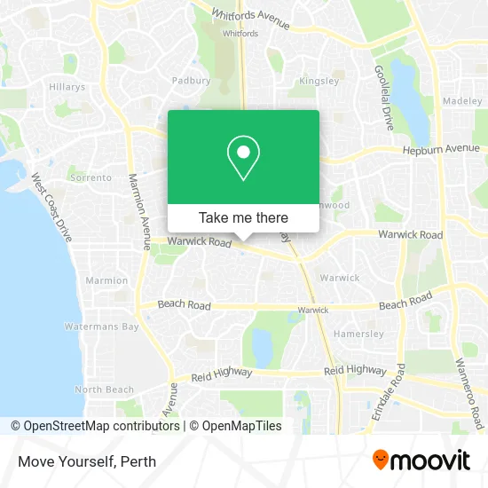
See Move Yourself, Duncraig, on the map
Public Transit to Move Yourself in Duncraig
Wondering how to get to Move Yourself in Duncraig? Moovit helps you find the best way to get to Move Yourself with step-by-step directions from the nearest public transit station.
Moovit provides free maps and live directions to help you navigate through your city. View schedules, routes, timetables, and find out how long does it take to get to Move Yourself in real time.
Looking for the nearest stop or station to Move Yourself? Check out this list of stops closest to your destination: Warwick Rd Glengarry Shopping Centre.
Bus: 443, 444.Train: YANCHEP LINE.
Want to see if there’s another route that gets you there at an earlier time? Moovit helps you find alternative routes or times. Get directions from and directions to Move Yourself easily from the Moovit App or Website.
We make riding to Move Yourself easy, which is why over 1.5 million users, including users in Duncraig, trust Moovit as the best app for public transit. You don’t need to download an individual bus app or train app, Moovit is your all-in-one transit app that helps you find the best bus time or train time available.
For information on prices of bus and train, costs and ride fares to Move Yourself, please check the Moovit app.
Use the app to navigate to popular places including to the airport, hospital, stadium, grocery store, mall, coffee shop, school, college, and university.
Move Yourself Address: 193 Warwick Rd Duncraig WA 6023 street in Duncraig
- Noodle Box,
- Hoodburger,
- Mini Monkey Kids Hair,
- Dry Age Biltong and Jerky,
- Double Dragon Dumplings Duncraig,
- Liquorland Australia,
- Marmion Warwick Playgroup,
- Dr Mark Glaser,
- Upper Gi and Bariatric Surgeon,
- Easy Heats,
- Dr Kah-Lim Tay,
- MTM Gym Rehab Carine,
- Dr Kozak Kon,
- Hart Brad,
- McGinnity Kelly,
- Simply Women,
- Made To Move Physiotherapy,
- Dr Jonathan Foo,
- Itnls Property Group LLC,
- Newbridge & Associates
Places Near Move Yourself (Duncraig)
- Blue Boat House,
- Rac Arena, Perth,
- Sir Charles Gairdner Hospital, Nedlands,
- Pelicaan Investment Ho, Bellevue,
- Watertown, Perth,
- Yankee Mart, Baldivis,
- Scitech, West Perth,
- Fiona Stanley Hospital, Murdoch,
- Perth Convention Exhibition Centre, Perth,
- Westfield Carousel, Cannington,
- Aqwa Aquarium, Hillarys,
- IKEA, Innaloo,
- Optus Stadium, Burswood,
- Langley Park, Perth,
- Royal Perth Hospital, Perth,
- Mount Hospital, Perth,
- DFO, Perth Airport,
- Karrinyup Shopping Centre, Karrinyup,
- McCallum Park, Victoria Park,
- Crown Perth Casino, Burswood
How to get to popular places in Perth with public transport
Get around Duncraig by public transport!
Travelling around Duncraig has never been so easy. See step by step directions as you travel to any attraction, street or major public transport station. View bus and train timetables, arrival times, service alerts and detailed routes on a map, so you know exactly how to get to anywhere in Duncraig.
When travelling to any destination around Duncraig use Moovit's Live Directions with Get Off Notifications to know exactly where and how far to walk, how long to wait for your line , and how many stops are left. Moovit will alert you when it’s time to get off — no need to constantly re-check whether yours is the next stop.
Wondering how to use public transport in Duncraig or how to pay for public transport in Duncraig? Moovit public transport app can help you navigate your way with public transport easily, and at minimum cost. It includes public transport fees, ticket prices, and costs. Looking for a map of Duncraig public transport lines? Moovit public transport app shows all public transport maps in Duncraig with all Bus, Train and Ferry routes and stops on an interactive map.
Perth has 3 transport type(s), including: Bus, Train and Ferry, operated by several transport agencies, including Transperth Rail, Transwa, Transperth Ferry, Transperth, TransBusselton, TransAlbany, TransGoldfields, TransEsperance, TransGeraldton, TransCarnarvon, TransHedland, TransKarratha, TransBunbury, Mandurah Bus Charter and TransBroome