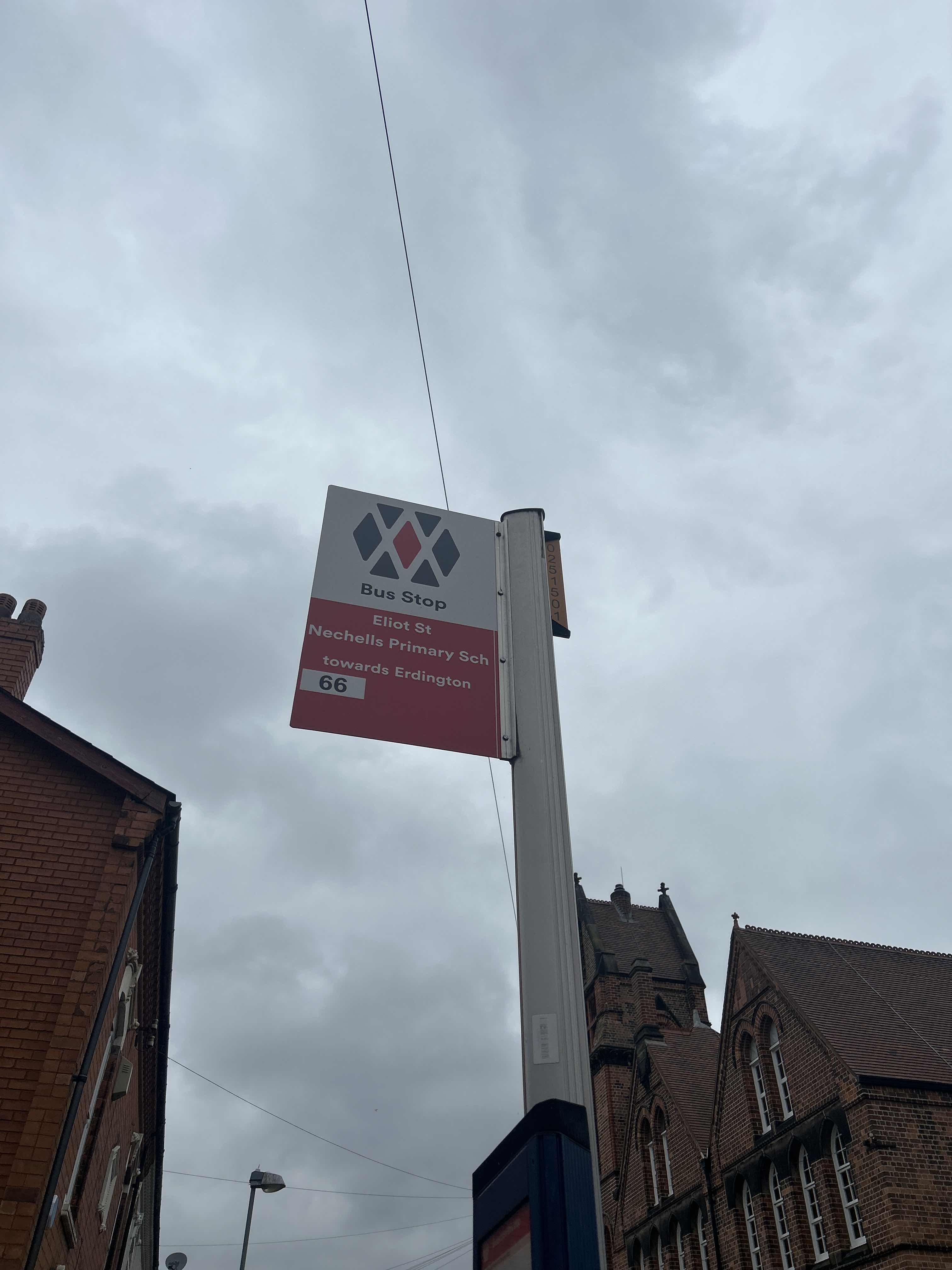
Nechells Primary School stop - Saturday schedule
| Line | Direction | Time |
|---|---|---|
| 66 | Star City Terminus | 05:44 |
| 66 | Star City Terminus | 05:44 |
| 66 | Wilton Rd | 06:29 |
| 66 | Wilton Rd | 06:29 |
| 66 | Wilton Rd | 07:01 |
| 66 | Wilton Rd | 07:01 |
| 66 | Wilton Rd | 07:31 |
| 66 | Wilton Rd | 07:31 |
| 66 | Gracechurch Centre | 08:01 |
| 66 | Gracechurch Centre | 08:01 |
| 66 | Gracechurch Centre | 08:31 |
| 66 | Gracechurch Centre | 08:31 |
| 66 | Gracechurch Centre | 09:02 |
| 66 | Gracechurch Centre | 09:02 |
| 66 | Gracechurch Centre | 09:31 |
| 66 | Gracechurch Centre | 09:31 |
| 64 | Amazon Warehouse | 09:46 |
| 64 | Amazon Warehouse | 09:46 |
| 66 | Gracechurch Centre | 09:56 |
| 66 | Gracechurch Centre | 09:56 |
| 66 | Star City Terminus | 10:11 |
| 66 | Star City Terminus | 10:11 |
| 66 | Gracechurch Centre | 10:26 |
| 66 | Gracechurch Centre | 10:26 |
| 66 | Star City Terminus | 10:44 |
Directions to Nechells Primary School stop with public transport
The following transport lines have routes that pass near Nechells Primary School
 Bus: 66, 64, X64, 65, 67.
- Train: WEST MIDLANDS RAILWAY, CHILTERN RAILWAYS.
How to get to Nechells Primary School stop by bus?
Click on the bus route to see step by step directions with maps, line arrival times and updated time schedules.
How to get to Nechells Primary School stop by train?
Click on the train route to see step by step directions with maps, line arrival times and updated time schedules.
Bus stops near Nechells Primary School stop
- Long Acre, 1 min walk,
- Salford Stadium, 5 min walk,
- Cuckoo Wharf, 5 min walk,
- Star City Terminus, 8 min walk,
Light Rail stations near Nechells Primary School station
- Millennium Point (West Midlands Metro), 33 min walk,
Train stations near Nechells Primary School station
- Birmingham Snow Hill, 40 min walk,
Bus lines to Nechells Primary School stop
- 64, Amazon Warehouse,
- 66, Wilton Rd,
- X64, Dale End,
- 65, Perry Common - Ladywood,
- 67, Ladywood - Pype Hayes,
- 68, Ladywood - Sutton Walmley & Minworth,
- 815, John Willmott School,
- FD, Fort Dunlop,
What are the nearest stations to Nechells Primary School?
The nearest stations to Nechells Primary School are:
- Long Acre is 69 meters away, 1 min walk.
- Salford Stadium is 381 meters away, 5 min walk.
- Cuckoo Wharf is 387 meters away, 5 min walk.
- Star City Terminus is 581 meters away, 8 min walk.
- Millennium Point (West Midlands Metro) is 2589 meters away, 33 min walk.
- Birmingham Snow Hill is 3062 meters away, 40 min walk.
Which bus line stops near Nechells Primary School?
66 (Gracechurch Centre)
Which train line stops near Nechells Primary School?
WEST MIDLANDS RAILWAY (Four Oaks)
What’s the nearest bus station to Nechells Primary School?
The nearest bus station to Nechells Primary School is Long Acre. It’s a 1 min walk away.
What time is the first light rail to Nechells Primary School?
The METRO is the first light rail that goes to Nechells Primary School. It stops nearby at 04:53.
What time is the last light rail to Nechells Primary School?
The METRO is the last light rail that goes to Nechells Primary School. It stops nearby at 00:46.
What time is the first train to Nechells Primary School?
The WEST MIDLANDS RAILWAY is the first train that goes to Nechells Primary School. It stops nearby at 05:51.
What time is the last train to Nechells Primary School?
The WEST MIDLANDS RAILWAY is the last train that goes to Nechells Primary School. It stops nearby at 00:10.
What time is the first bus to Nechells Primary School?
The 67 is the first bus that goes to Nechells Primary School. It stops nearby at 04:48.
What time is the last bus to Nechells Primary School?
The 67 is the last bus that goes to Nechells Primary School. It stops nearby at 01:11.
Nechells Primary School station
 Taken by Anonymous
See Nechells Primary School stop on the map
Public transport to Nechells Primary School stop (ID: nwmgdwtp)
Looking for directions to Nechells Primary School in Nechells, United Kingdom?
Download the Moovit App to find the current schedule and step-by-step directions for Bus or Train routes that pass through Nechells Primary School.
Looking for the nearest stops closest to Nechells Primary School ? Check out this list of closest stops to your destination: Long Acre; Salford Stadium; Cuckoo Wharf; Star City Terminus; Millennium Point (West Midlands Metro); Birmingham Snow Hill.
Bus: 66, 64, X64, 65, 67, 68, 815, FD.Train: WEST MIDLANDS RAILWAY, CHILTERN RAILWAYS.
We make riding on public transit to Nechells Primary School easy, which is why over 1.5 million users, including users in Nechells trust Moovit as the best app for public transit.
Use the app to navigate to popular places including to the airport, hospital, stadium, grocery store, mall, coffee shop, school, college, and university.
Nechells Primary School stop’s code is nwmgdwtp
The first line to this stop is 66, at 05:44, and the last line is 66 at 23:41.
1 Brockley Place, Birmingham, England, United Kingdom
This stop serves National Express West Midlands’s lines
- Long Acre,
- Salford Stadium,
- Cuckoo Wharf,
- Star City Terminus
Bus stops near Nechells Primary School stop
- Millennium Point (West Midlands Metro)
Light Rail station near Nechells Primary School station
- Birmingham Snow Hill
Train station near Nechells Primary School station
- Northumberland Road,
- Bilston College,
- Pensnett High St,
- Church Centre,
- Union Rd,
- Leicester Square,
- Churchill Rd,
- Bishop Perowne School,
- Queen Mary's Grammar School,
- Top Barn Farm,
- Merton Hotel,
- Heartlands Hospital,
- Witton Station,
- Witton (West Midlands),
- Derby St,
- Castle Gate Island,
- Lichfield Trent Valley,
- Leopold St,
- Warwick Hospital,
- Burrington Road
Popular public transport stations in Nechells
Get around Nechells by public transport!
Travelling around Nechells has never been so easy. See step by step directions as you travel to any attraction, street or major public transport station. View bus and train timetables, arrival times, service alerts and detailed routes on a map, so you know exactly how to get to anywhere in Nechells.
When travelling to any destination around Nechells use Moovit's Live Directions with Get Off Notifications to know exactly where and how far to walk, how long to wait for your line , and how many stops are left. Moovit will alert you when it’s time to get off — no need to constantly re-check whether yours is the next stop.
Wondering how to use public transport in Nechells or how to pay for public transport in Nechells? Moovit public transport app can help you navigate your way with public transport easily, and at minimum cost. It includes public transport fees, ticket prices, and costs. Looking for a map of Nechells public transport lines? Moovit public transport app shows all public transport maps in Nechells with all Bus, Train and Light rail routes and stops on an interactive map.
West Midlands has 3 transport type(s), including: Bus, Train and Light rail, operated by several transport agencies, including National Express West Midlands, National Express Coventry, National Express, Diamond Bus, Arriva Midlands, Stagecoach Midlands, West Midlands Metro, Stagecoach West, Stagecoach South Wales, First Potteries, First Worcestershire, LandFlight, trentbarton, D & G Bus and Flexibus