Directions to Neometric (Perth) with public transport
The following transport lines have routes that pass near Neometric
 Bus: 179, 24, 27, 72, 73.
- Train: AIRPORT LINE, ARMADALE LINE, MANDURAH LINE, YANCHEP LINE, ELLENBROOK LINE.
- Ferry: FERRY ROUTE ELIZABETH QUAY JETTY - FERRY ROUTE MENDS ST JETTY.
How to get to Neometric by bus?
Click on the bus route to see step by step directions with maps, line arrival times and updated time schedules.
From Osborne Park, Osborne Park
64 minFrom Raafa Air Force Memorial Estate, Bull Creek
68 minFrom Mirrabooka Softball Complex, Mirrabooka
56 minFrom Niggaland, Mirrabooka
65 minFrom Bentley Health Service, Bentley
41 minFrom 2 Tassels Place Car Park, Innaloo
65 minFrom Belmont Forum Shopping Centre, Cloverdale
36 minFrom Campbell Barracks, Swanbourne
66 minFrom Woolworths PRDC, Perth Airport
47 minFrom Perth Central Caravan Park, Ascot
40 min
How to get to Neometric by train?
Click on the train route to see step by step directions with maps, line arrival times and updated time schedules.
Bus stops near Neometric in Perth
Train stations near Neometric in Perth
Ferry station near Neometric in Perth
- Ferry Route Elizabeth Quay Jetty, 17 min walk,VIEW
Bus lines to Neometric in Perth
- PERTH RED CAT, Hale St / Waca,VIEW
- 24, East Perth,VIEW
- 27, East Perth,VIEW
- 32, Como,VIEW
- 33, Curtin Central Bus Stn,VIEW
- 72, Wilson,VIEW
- 73, Ranford Road Stn,VIEW
- 111, East Perth,VIEW
- 160, East Perth,VIEW
- 176, Oats Street Stn,VIEW
- 177, Bentley,VIEW
- 178, Bull Creek Stn,VIEW
- 179, Bull Creek Stn,VIEW
- 910, Fremantle Stn,VIEW
- 930, Thornlie Stn,VIEW
- 930X, Thornlie Stn,VIEW
- 39, Redcliffe Stn,VIEW
- 270, High Wycombe Stn,VIEW
- 935, Redcliffe Stn,VIEW
- 940, Redcliffe Stn,VIEW
What are the nearest stations to Neometric?
The nearest stations to Neometric are:
- Hay St Victoria Avenue Cat Id 84 is 147 meters away, 3 min walk.
- St Georges Tce Before Victoria Av Eastbound is 156 meters away, 3 min walk.
- Adelaide Tce After Hill St is 196 meters away, 3 min walk.
- Wellington St Hill Street Cat Id 55 is 527 meters away, 8 min walk.
- Wellington St Royal Perth Hospital Cat Id 56 is 592 meters away, 9 min walk.
- Mciver Stn is 716 meters away, 10 min walk.
- Ferry Route Elizabeth Quay Jetty is 1275 meters away, 17 min walk.
- Perth Stn is 2853 meters away, 37 min walk.
- Perth Underground Stn is 2853 meters away, 37 min walk.
Which bus lines stop near Neometric?
These bus lines stop near Neometric: 179, 24, 27, 72, 73, 910, 930X, 935, 940, 960.
Which train lines stop near Neometric?
These train lines stop near Neometric: AIRPORT LINE, ARMADALE LINE, MANDURAH LINE, YANCHEP LINE.
What’s the nearest train station to Neometric in Perth?
The nearest train station to Neometric in Perth is Mciver Stn. It’s a 10 min walk away.
What’s the nearest bus station to Neometric in Perth?
The nearest bus stations to Neometric in Perth are Hay St Victoria Avenue Cat Id 84, St Georges Tce Before Victoria Av Eastbound and Adelaide Tce After Hill St. The closest one is a 3 min walk away.
What’s the nearest ferry station to Neometric in Perth?
The nearest ferry station to Neometric in Perth is Ferry Route Elizabeth Quay Jetty. It’s a 17 min walk away.
What time is the first train to Neometric in Perth?
The ARMADALE LINE is the first train that goes to Neometric in Perth. It stops nearby at 05:03.
What time is the last train to Neometric in Perth?
The FREMANTLE LINE is the last train that goes to Neometric in Perth. It stops nearby at 00:38.
What time is the first bus to Neometric in Perth?
The 935 is the first bus that goes to Neometric in Perth. It stops nearby at 04:47.
What time is the last bus to Neometric in Perth?
The 935 is the last bus that goes to Neometric in Perth. It stops nearby at 00:38.
What time is the first ferry to Neometric in Perth?
The FERRY ROUTE ELIZABETH QUAY JETTY - FERRY ROUTE MENDS ST JETTY is the first ferry that goes to Neometric in Perth. It stops nearby at 06:30.
What time is the last ferry to Neometric in Perth?
The FERRY ROUTE ELIZABETH QUAY JETTY - FERRY ROUTE MENDS ST JETTY is the last ferry that goes to Neometric in Perth. It stops nearby at 22:25.
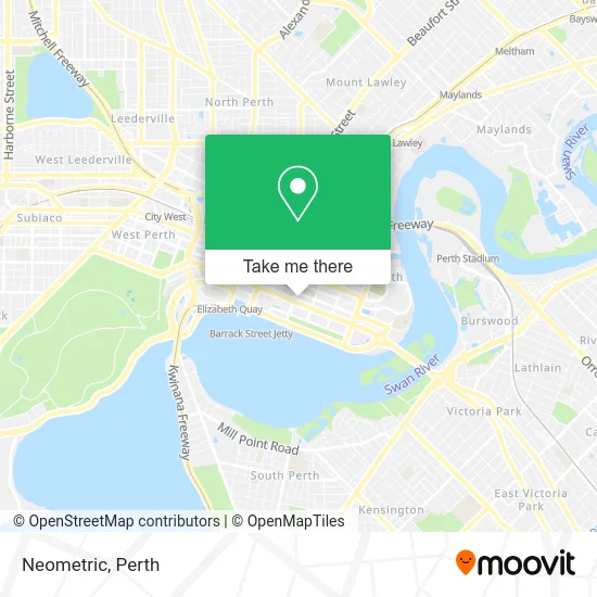
See Neometric, Perth, on the map
Public Transit to Neometric in Perth
Wondering how to get to Neometric in Perth? Moovit helps you find the best way to get to Neometric with step-by-step directions from the nearest public transit station.
Moovit provides free maps and live directions to help you navigate through your city. View schedules, routes, timetables, and find out how long does it take to get to Neometric in real time.
Looking for the nearest stop or station to Neometric? Check out this list of stops closest to your destination: Hay St Victoria Avenue Cat Id 84; St Georges Tce Before Victoria Av Eastbound; Adelaide Tce After Hill St; Wellington St Hill Street Cat Id 55; Wellington St Royal Perth Hospital Cat Id 56; Mciver Stn; Ferry Route Elizabeth Quay Jetty; Perth Stn; Perth Underground Stn.
Bus: 179, 24, 27, 72, 73, 910, 930X, 935, 940, 960, PERTH RED CAT, 32, 33.Train: AIRPORT LINE, ARMADALE LINE, MANDURAH LINE, YANCHEP LINE, ELLENBROOK LINE, MIDLAND LINE, THORNLIE-COCKBURN LINE, FREMANTLE LINE.Ferry: FERRY ROUTE ELIZABETH QUAY JETTY - FERRY ROUTE MENDS ST JETTY.
Want to see if there’s another route that gets you there at an earlier time? Moovit helps you find alternative routes or times. Get directions from and directions to Neometric easily from the Moovit App or Website.
We make riding to Neometric easy, which is why over 1.5 million users, including users in Perth, trust Moovit as the best app for public transit. You don’t need to download an individual bus app or train app, Moovit is your all-in-one transit app that helps you find the best bus time or train time available.
For information on prices of bus and train, costs and ride fares to Neometric, please check the Moovit app.
Use the app to navigate to popular places including to the airport, hospital, stadium, grocery store, mall, coffee shop, school, college, and university.
Neometric Address: 256 Adelaide Ter Perth WA 6000 street in Perth
- Befriend,
- RQR,
- Invicta Agency,
- Minnovo,
- Housing First,
- Impact Seed,
- Cits V Service Austral,
- Jensen Hughes,
- Eagles City Mission,
- Cloud A2k,
- Purpose Studio,
- Minnovare,
- McConnell Dowell Creative Construction,
- Cohesion Co,
- Twenty Seven Co. Limited,
- Built Environs,
- Goodline,
- Locations,
- Warringtonfire,
- Hewlett Packard Enterprise Hpe
Places Near Neometric (Perth)
- Langley Park, Perth,
- Pelicaan Investment Ho, Bellevue,
- Royal Perth Hospital, Perth,
- Aqwa Aquarium, Hillarys,
- Watertown, Perth,
- Karrinyup Shopping Centre, Karrinyup,
- Blue Boat House,
- DFO, Perth Airport,
- IKEA, Innaloo,
- Crown Perth Casino, Burswood,
- Mount Hospital, Perth,
- Westfield Carousel, Cannington,
- Rac Arena, Perth,
- Perth Convention Exhibition Centre, Perth,
- Yankee Mart, Baldivis,
- Sir Charles Gairdner Hospital, Nedlands,
- McCallum Park, Victoria Park,
- Fiona Stanley Hospital, Murdoch,
- Optus Stadium, Burswood,
- Scitech, West Perth
How to get to popular places in Perth with public transport
Get around Perth by public transport!
Travelling around Perth has never been so easy. See step by step directions as you travel to any attraction, street or major public transport station. View bus and train timetables, arrival times, service alerts and detailed routes on a map, so you know exactly how to get to anywhere in Perth.
When travelling to any destination around Perth use Moovit's Live Directions with Get Off Notifications to know exactly where and how far to walk, how long to wait for your line , and how many stops are left. Moovit will alert you when it’s time to get off — no need to constantly re-check whether yours is the next stop.
Wondering how to use public transport in Perth or how to pay for public transport in Perth? Moovit public transport app can help you navigate your way with public transport easily, and at minimum cost. It includes public transport fees, ticket prices, and costs. Looking for a map of Perth public transport lines? Moovit public transport app shows all public transport maps in Perth with all Bus, Train and Ferry routes and stops on an interactive map.
Perth has 3 transport type(s), including: Bus, Train and Ferry, operated by several transport agencies, including Transperth Rail, Transwa, Transperth Ferry, Transperth, TransBusselton, TransAlbany, TransGoldfields, TransEsperance, TransGeraldton, TransCarnarvon, TransHedland, TransKarratha, TransBunbury, Mandurah Bus Charter and TransBroome