Directions to O2 Academy Birmingham (Ladywood) with public transport
The following transport lines have routes that pass near O2 Academy Birmingham
 Bus: 23, 61, 63, 87, X2.
- Train: AVANTI WEST COAST, WEST MIDLANDS RAILWAY, CROSSCOUNTRY, TRANSPORT FOR WALES.
How to get to O2 Academy Birmingham by bus?
Click on the bus route to see step by step directions with maps, line arrival times and updated time schedules.
How to get to O2 Academy Birmingham by train?
Click on the train route to see step by step directions with maps, line arrival times and updated time schedules.
Bus stops near O2 Academy Birmingham in Ladywood
- Smallbrook Queensway, 2 min walk,
- Old Repertory Theatre, 3 min walk,
Light Rail stations near O2 Academy Birmingham in Ladywood
- Town Hall (West Midlands Metro), 5 min walk,
Train station near O2 Academy Birmingham in Ladywood
- Birmingham New Street, 32 min walk,
Bus lines to O2 Academy Birmingham in Ladywood
- 35, King's Norton South - Nechells,
- 45, Rubery & Rednal - Ladywood,
- 47, Ladywood - Rubery & Rednal,
- X20, The Square Peg,
- X21, Bartley Green War Memorial,
- X22, Bartley Green War Memorial,
- 23, Bus Mall,
- 24, Bus Mall,
- 61, Arden Rd Terminus,
- 63, Moor St Queensway,
- 82, Colmore Row,
- 87, Colmore Row,
- 822, Bus Mall,
- 16, Markets,
- 16A, Birmingham, Markets,
- 80, Markets,
What are the nearest stations to O2 Academy Birmingham?
The nearest stations to O2 Academy Birmingham are:
- Old Repertory Theatre is 85 meters away, 4 min walk.
- Smallbrook Queensway is 129 meters away, 2 min walk.
- Town Hall (West Midlands Metro) is 348 meters away, 5 min walk.
- Birmingham New Street is 2431 meters away, 32 min walk.
Which bus lines stop near O2 Academy Birmingham?
These bus lines stop near O2 Academy Birmingham: 23, 61, 63, 87, X2, X21, X22.
Which train lines stop near O2 Academy Birmingham?
These train lines stop near O2 Academy Birmingham: AVANTI WEST COAST, WEST MIDLANDS RAILWAY.
What’s the nearest light rail station to O2 Academy Birmingham in Ladywood?
The nearest light rail station to O2 Academy Birmingham in Ladywood is Town Hall (West Midlands Metro). It’s a 5 min walk away.
What’s the nearest bus station to O2 Academy Birmingham in Ladywood?
The nearest bus station to O2 Academy Birmingham in Ladywood is Old Repertory Theatre. It’s a 4 min walk away.
What time is the first light rail to O2 Academy Birmingham in Ladywood?
The METRO is the first light rail that goes to O2 Academy Birmingham in Ladywood. It stops nearby at 07:49.
What time is the last light rail to O2 Academy Birmingham in Ladywood?
The METRO is the last light rail that goes to O2 Academy Birmingham in Ladywood. It stops nearby at 00:20.
What time is the first train to O2 Academy Birmingham in Ladywood?
The WEST MIDLANDS RAILWAY is the first train that goes to O2 Academy Birmingham in Ladywood. It stops nearby at 08:25.
What time is the last train to O2 Academy Birmingham in Ladywood?
The AVANTI WEST COAST is the last train that goes to O2 Academy Birmingham in Ladywood. It stops nearby at 01:23.
What time is the first bus to O2 Academy Birmingham in Ladywood?
The 63 is the first bus that goes to O2 Academy Birmingham in Ladywood. It stops nearby at 03:00.
What time is the last bus to O2 Academy Birmingham in Ladywood?
The 63 is the last bus that goes to O2 Academy Birmingham in Ladywood. It stops nearby at 03:01.
See O2 Academy Birmingham, Ladywood, on the map
Public Transit to O2 Academy Birmingham in Ladywood
Wondering how to get to O2 Academy Birmingham in Ladywood? Moovit helps you find the best way to get to O2 Academy Birmingham with step-by-step directions from the nearest public transit station.
Moovit provides free maps and live directions to help you navigate through your city. View schedules, routes, timetables, and find out how long does it take to get to O2 Academy Birmingham in real time.
Looking for the nearest stop or station to O2 Academy Birmingham? Check out this list of stops closest to your destination: Old Repertory Theatre; Smallbrook Queensway; Town Hall (West Midlands Metro); Birmingham New Street.
Bus: 23, 61, 63, 87, X2, X21, X22, X20, 24, 16, 16A, 80, 35, 45, 47.Train: AVANTI WEST COAST, WEST MIDLANDS RAILWAY, CROSSCOUNTRY, TRANSPORT FOR WALES.
Want to see if there’s another route that gets you there at an earlier time? Moovit helps you find alternative routes or times. Get directions from and directions to O2 Academy Birmingham easily from the Moovit App or Website.
We make riding to O2 Academy Birmingham easy, which is why over 1.5 million users, including users in Ladywood, trust Moovit as the best app for public transit. You don’t need to download an individual bus app or train app, Moovit is your all-in-one transit app that helps you find the best bus time or train time available.
For information on prices of bus and train, costs and ride fares to O2 Academy Birmingham, please check the Moovit app.
Use the app to navigate to popular places including to the airport, hospital, stadium, grocery store, mall, coffee shop, school, college, and university.
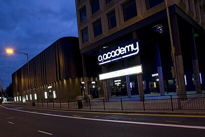
O2 Academy Birmingham Address: 16-18 Horsefair street in Ladywood
O2 Academy Birmingham is a music venue located in Birmingham, West Midlands, England.Wiki
- B1 1DB,
- 17 Bow Street,
- Horsefair Car Park,
- Birmingham Royal Ballet,
- B5 7aa,
- A38,
- Queen Elizabeth,
- Windmill Hill/ the Axium Apartments,
- St Catherine of Siena Church, Birmingham,
- Scala House,
- Riley's Pool & Snooker Club,
- pentahotel Birmingham,
- A38 Bromsgrove,
- Bromsgrove Street Bristol,
- Holloway Head Service Station,
- Birmingham Hippodrome Theatre,
- Hotel ibis Birmingham Centre Irving Street,
- Birmingham LGBT Health & Wellbeing Centre,
- Hotel ibis budget Birmingham Centre,
- Radisson Blu Hotel, Birmingham
Places Near O2 Academy Birmingham (Ladywood)
- Moseley, Moseley,
- Fort Shopping Centre, Birmingham, Pype Hayes,
- Stratford Road, Sparkhill,
- Boundary Mill Stores, Bentley And Darlaston North,
- Lilleshall Hall National Sports Centre, Telford,
- Birmingham And Midland Eye Centre, Soho & Jewellery Quarter,
- Royal Orthopaedic Hospital, Northfield,
- Travelodge Birmingham Airport Hotel Birmingham, Bickenhill,
- The Merry Hill Centre, Brierley Hill,
- Crown Wharf Retail Park, St. Matthew's,
- Waseley Hills Crematorium, Frankley Great Park,
- Bournville Staff Shop (Cadbury World), Bournville & Cotteridge,
- Birmingham Dental Hospital, Edgbaston,
- One Stop Shopping Centre, Perry Barr,
- IKEA Wednesbury, Oldbury,
- Bickerstaff Endoscopy Unit (PRH), Apley Castle,
- Sandwell General Hospital, West Bromwich Central,
- Heritage Building (Queen Elizabeth Hospital), Edgbaston,
- Tally Ho Police Training, Birmingham, Edgbaston,
- Sandwell General Hospital, West Bromwich Central
How to get to popular places in West Midlands with public transport
Get around Ladywood by public transport!
Travelling around Ladywood has never been so easy. See step by step directions as you travel to any attraction, street or major public transport station. View bus and train timetables, arrival times, service alerts and detailed routes on a map, so you know exactly how to get to anywhere in Ladywood.
When travelling to any destination around Ladywood use Moovit's Live Directions with Get Off Notifications to know exactly where and how far to walk, how long to wait for your line , and how many stops are left. Moovit will alert you when it’s time to get off — no need to constantly re-check whether yours is the next stop.
Wondering how to use public transport in Ladywood or how to pay for public transport in Ladywood? Moovit public transport app can help you navigate your way with public transport easily, and at minimum cost. It includes public transport fees, ticket prices, and costs. Looking for a map of Ladywood public transport lines? Moovit public transport app shows all public transport maps in Ladywood with all Bus, Train and Light rail routes and stops on an interactive map.
West Midlands has 3 transport type(s), including: Bus, Train and Light rail, operated by several transport agencies, including National Express West Midlands, National Express Coventry, National Express, Diamond Bus, Arriva Midlands, Stagecoach Midlands, West Midlands Metro, Stagecoach West, Stagecoach South Wales, First Potteries, First Worcestershire, LandFlight, trentbarton, D & G Bus and Flexibus